
All destinations
Verified sources only — we never invent entries to fill gaps.
Barishal (বরিশাল)
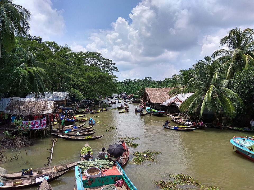 Bhimruli Floating Guava MarketNature & forests · Jhalokati, Barishal
In the monsoon, this canal-side wholesale guava market fills with boats - farmers arrive by dinghy with guavas and buyers from Dhaka and Chattogram trade directly from the water. Around 5,000 visitors come daily in season, and floating hotels serve local fish and duck dishes. The season runs roughly July to September; noon is the peak trading time.
Directly confirmed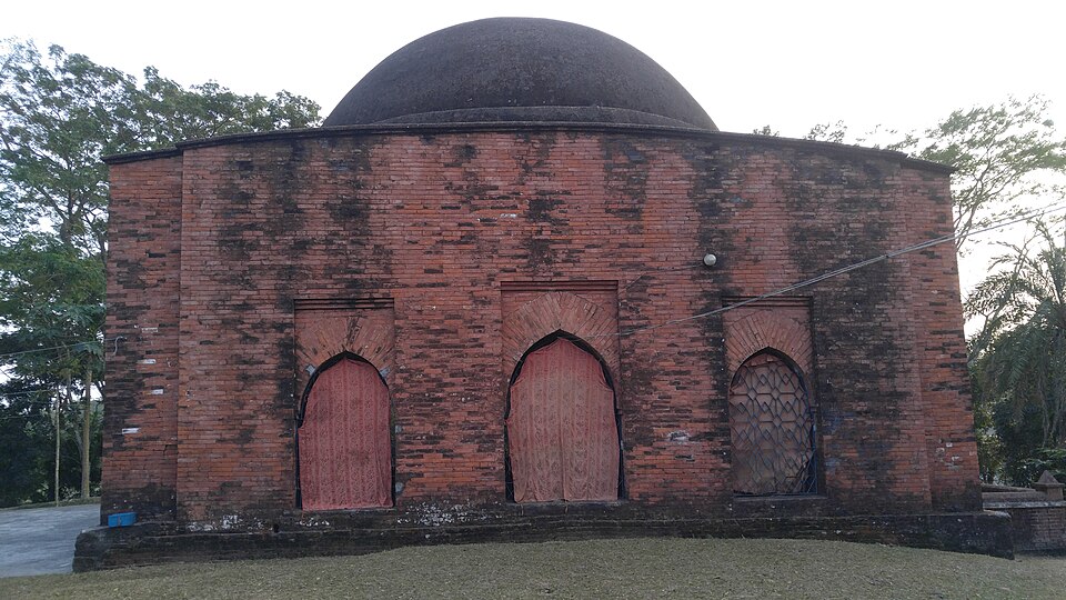 Bibichini Shahi MosqueHistoric · Barguna, Barishal
A single-domed Mughal-style mosque from the 17th century in Bibi Chini village, Betagi Upazila. Measuring 33 by 33 feet with walls about 6 feet thick, it was listed as a protected archaeological site in 1992 and renovated by the Directorate of Archaeology. The mosque and village are said to be named after Bibi Chini, daughter of Shah Neyamatullah. It remains an active mosque - be respectful at prayer times.
Directly confirmed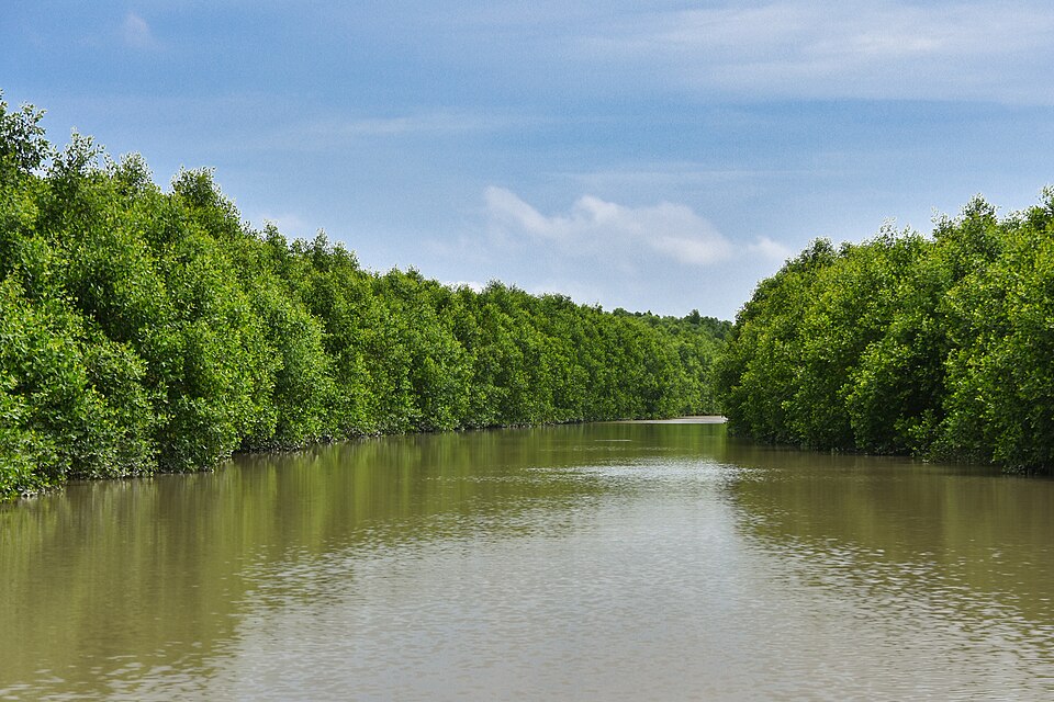 Char Kukri Mukri Wildlife SanctuaryNature & forests · Bhola, Barishal
A 40-hectare sanctuary declared in 1981 on a char island at the mouth of the Meghna in the Bay of Bengal, at the southern tip of Bhola. It mixes mangroves, tidal forest and a long sandy shoreline, with shorebirds and waterbirds peaking during the winter migration. There is no formal accommodation on the island, so most visitors come on a day trip; arrange a boat and local guide in advance.
Directly confirmed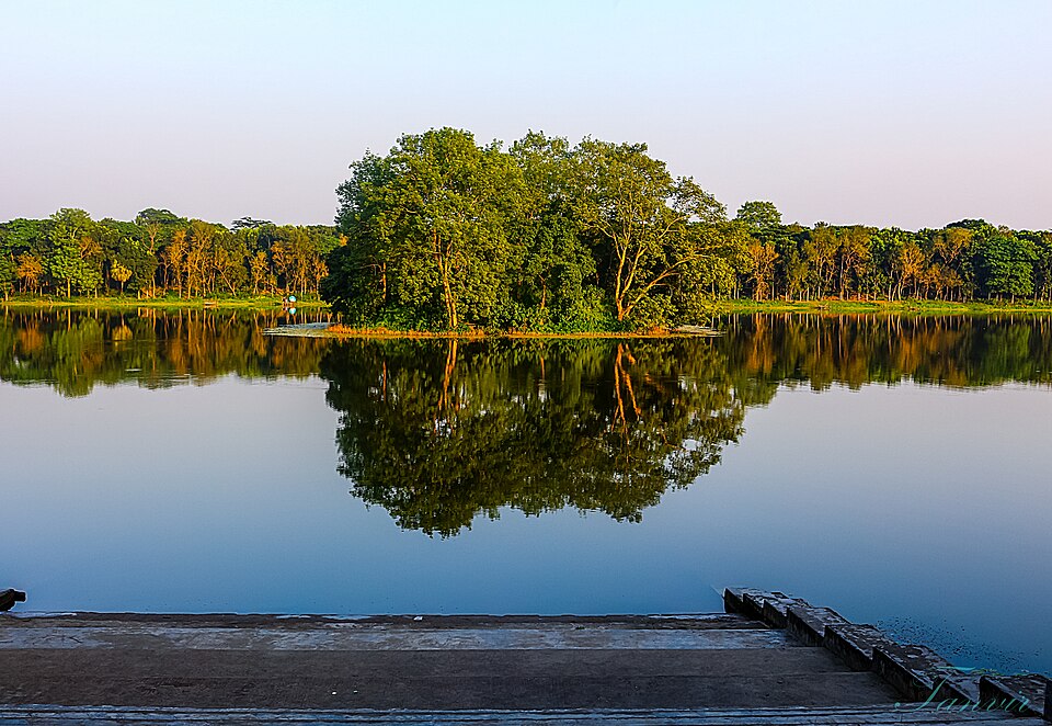 Durga SagorNature & forests · Barishal, Barishal
The largest dighi (excavated lake) in southern Bangladesh, at Madhabpasha in Babuganj about 11 km from Barishal city. It was excavated in 1780 by Rani Durgabati, mother of Raja Joy Narayan, and covers about 25 hectares. A small artificial island sits in the lake and migratory birds gather here in winter. It is close to Guthia Mosque, so the two can be combined in one trip.
Community-reported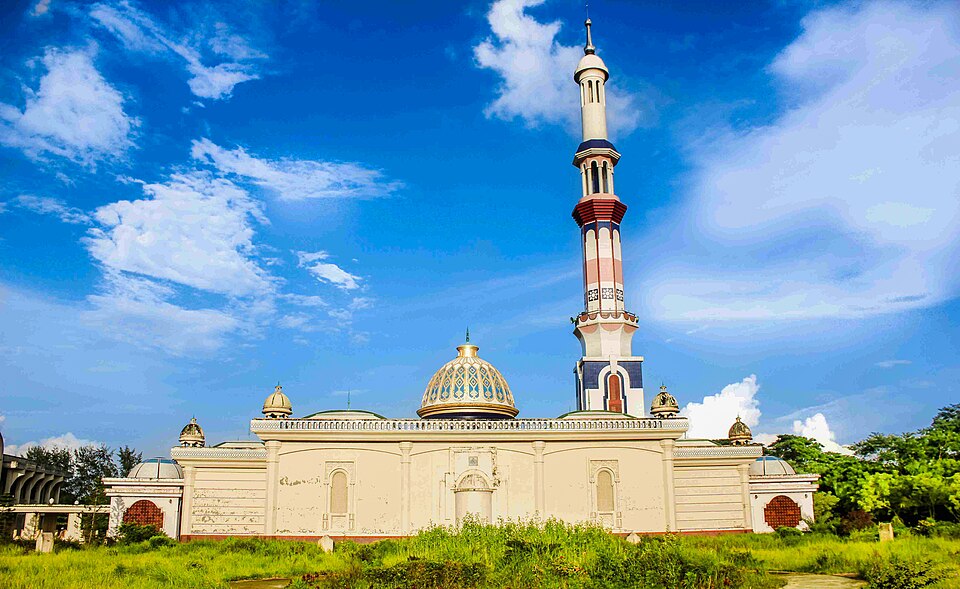 Guthia Mosque (Baitul Aman Jame Masjid)Historic · Barishal, Barishal
A 14-acre modern mosque complex begun in 2003, containing a mosque, a large Eidgah, three lakes, a madrasa and an orphanage. Its 58-metre minaret of white marble is described as the tallest in the country. The lakes reflect the mosque from several angles, and evening floodlighting is the best time to visit. It pairs well with Durga Sagor on a day trip from Barishal city.
Directly confirmed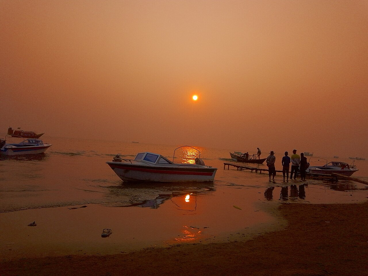 Kuakata BeachBeaches · Patuakhali, Barishal
An roughly 18-km-long sea beach at Kalapara in Patuakhali district, southern Bangladesh. Known as the 'Daughter of the Sea' (Sagorkanya) because both sunrise and sunset can be seen from the same spot.
Community-reported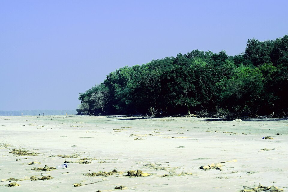 Lebur CharBeaches · Patuakhali, Barishal
A natural char of about 1,000 acres lying 5 km east of Kuakata beach, covered with keora, gewa, goran, koroi and golpata trees. It works as a quieter complement to Kuakata and is easily combined with a Kuakata trip. There are no shops or accommodation on the char itself - stay in Kuakata.
Community-reported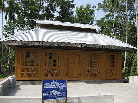 Momin MosqueHistoric · Pirojpur, Barishal
A historic wooden mosque at Burirchar in Mathbaria. Momin Uddin Akon began building it in 1913 with twenty-one artisans and it was completed in about seven years. Its nail-free woodwork uses iron wood (loha kath) and Burmese teak, with carved and painted leaves, flowers and fruit; it was designated a national heritage site in 2003, with restoration from 2008. Rare timber architecture makes it worthwhile for heritage visitors.
Community-reported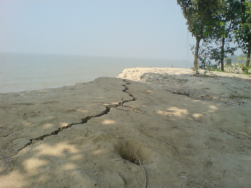 Monpura IslandNature & forests · Bhola, Barishal
An island upazila (about 373 sq km) in the Meghna estuary on Bhola's north-eastern side, made widely known by the 2009 film 'Monpura'. Main draws are the sunset from the island's southern sandy bank (Dakhin Hawa sea beach), spotted deer in the edge mangroves, and cycling along the coastal embankments. Lodging is very basic - a government dak bungalow and small guesthouses - and electricity can be inconsistent.
Directly confirmed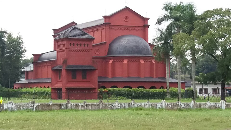 Oxford Mission Church (Epiphany Church)Historic · Barishal, Barishal
A historic red-brick church in Greek revival style, established in 1903 and among the oldest and largest churches in Bangladesh. It looks five-storeyed from outside but has a single floor with a vast prayer hall, 40 archways and long corridors. The 35-acre compound holds 13 ponds, a school and a hospital. Note it is not a fully open tourist site: entry to the church building is restricted, and most visitors view it from outside.
Directly confirmedShubho Shondha BeachBeaches · Barguna, BarishalA beach on the coast of Taltali, Barguna's southernmost upazila, mentioned in the upazila's Wikipedia article, which also notes that tourists come to the Paira-Bishkhali-Bay of Bengal confluence area. Detailed information is scarce - treat it as a remote, little-documented coastal destination and check current conditions locally.
Community-reportedShujabad Fort (historic site)Historic · Jhalokati, BarishalHistorical accounts record that Prince Shah Shuja built two forts at Shujabad in Nalchity in 1654 to counter Magh and Portuguese piracy. This is not a developed tourist site - reliable detail on surviving remains is scarce; consider it a side stop for history enthusiasts on a Jhalokati trip and check its current state locally.
Unverified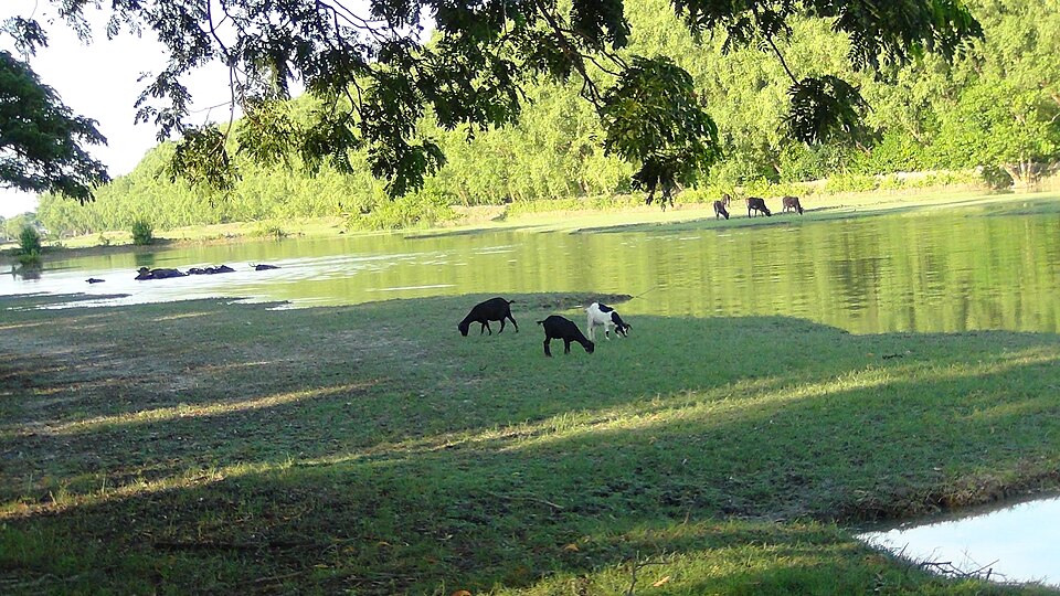 Sonar CharBeaches · Patuakhali, Barishal
A mangrove-fringed char risen in the Bay of Bengal under Char Montaz union of Rangabali Upazila, about 45 km from Patuakhali district headquarters. On its roughly 9 km beach, small red crabs can be seen at dawn; the Forest Department reports deer and monkeys in the forest, and winter brings migratory birds. There are no hotels on the island - visitors stay at the Forest Department camp or camp, which is a basic experience.
Community-reported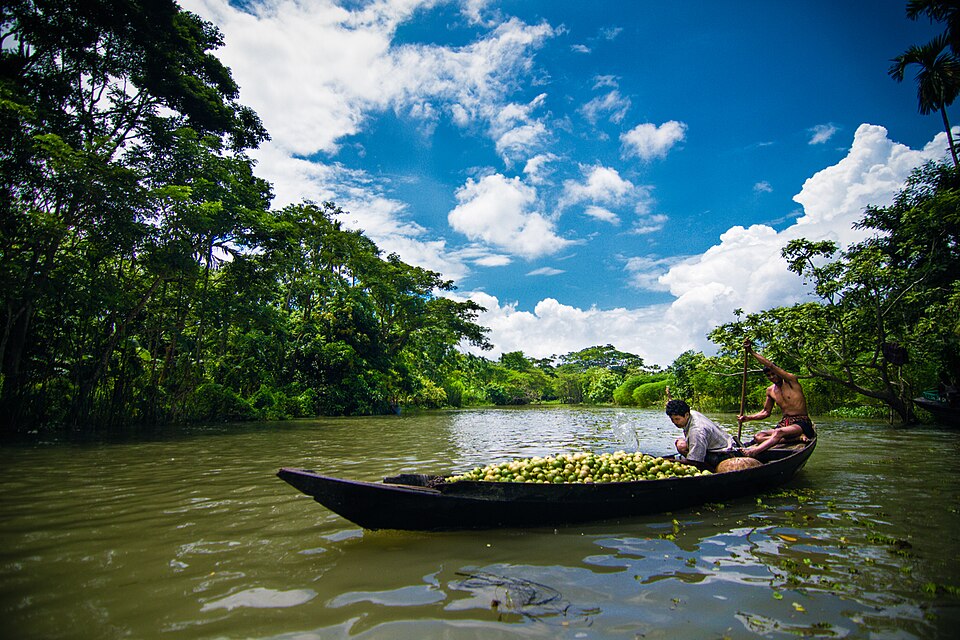 Swarupkathi Floating Guava Market (Atghor/Kuriana/Kirtipasha)Nature & forests · Pirojpur, Barishal
A floating guava market on the Kirtipasha canal in Nesarabad (Swarupkathi) upazila - the well-known Atghor and Kuriana guava markets of the Barishal region also fall in this upazila. Guavas arrive from July and the trade runs to September; visit around noon when wholesale trading peaks. It can be combined with Bhimruli on the same day.
Directly confirmed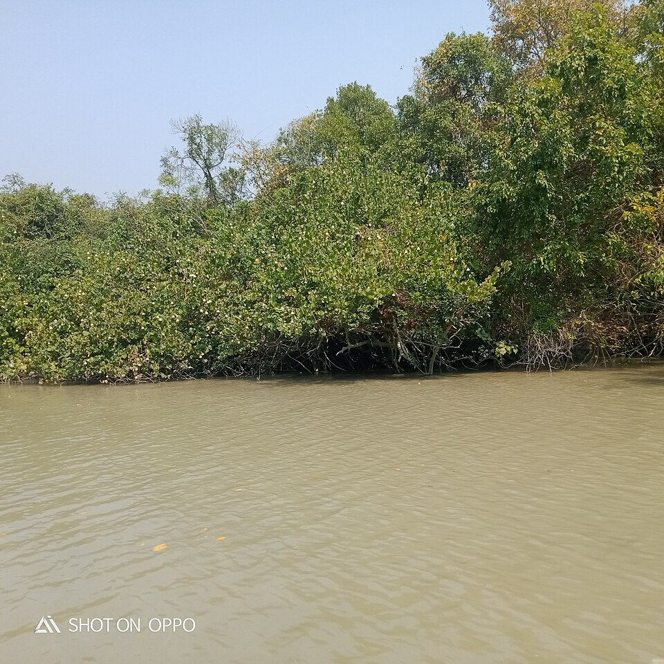 Tengragiri Wildlife Sanctuary (Fatrar Ban)Nature & forests · Barguna, Barishal
A 4,048-hectare coastal forest near Taltali, locally known as Fatrar Ban, declared a wildlife sanctuary on 24 October 2010. It combines mangrove and littoral forest beside the confluence of the Payra-Bishkhali rivers and the Bay of Bengal. Infrastructure is limited - take a local forest staff member or guide.
Community-reportedChattogram (চট্টগ্রাম)
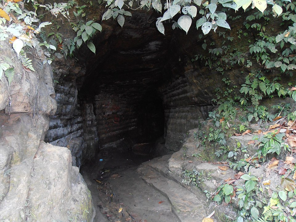 Alutila CaveNature & forests · Khagrachhari, Chattogram
A 100-metre natural cave inside the roughly 1,000-metre Alutila (Arbari) hill, with cold water flowing along its floor. It is pitch dark inside, so bring a torch; locals sell flambeaux. An easy day trip from Khagrachhari town.
Community-reportedAs-Salam Jame Masjid, RamgatiHistoric · Lakshmipur, ChattogramA two-storey, window-less modern mosque at Charporagachha union in Ramgati; per The Daily Star it is lit by natural light, letting worshippers feel monsoon rain and winter mist without getting wet or overheated. An education complex has grown around it and draws visitors from other districts.
Community-reported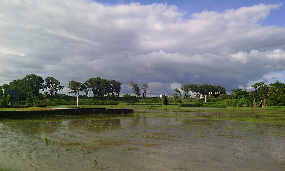 Bijoy Singh DighiHistoric · Feni, Chattogram
A 37.57-acre historic reservoir at Mahipal, about 2 km west of Feni town; Bangla Wikipedia attributes its digging to Bijoy Sen (popularly Bijoy Singh), founder of the Sen dynasty. Tree-lined high banks make it an easy town stroll.
Community-reported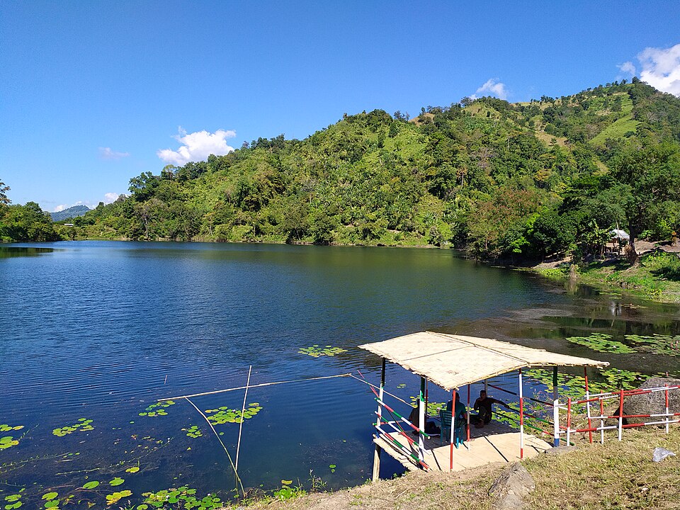 Boga LakeNature & forests · Bandarban, Chattogram
A natural deep freshwater lake among the hills of Ruma upazila at about 380 m altitude, with an average depth around 38 m. A Bawm village stands beside it and homestays are available. Legend says an earthquake collapsed a hillside to form the lake.
Community-reported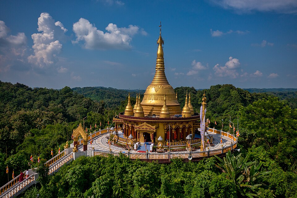 Buddha Dhatu Jadi (Golden Temple)Historic · Bandarban, Chattogram
The largest Theravada Buddhist temple in Bangladesh, completed in 2000 on a 60-metre hill. It houses Buddha relics and the second-largest Buddha statue in the country. About 10 km from Bandarban town; a strict dress code applies.
Community-reported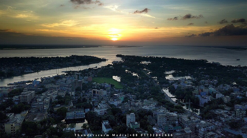 Chandpur Trimohona (Boro Station)Nature & forests · Chandpur, Chattogram
The meeting of the Padma and Meghna rivers (with the Dakatia nearby), best viewed from the Boro Station area known locally as the Molehead. Trawler rides and the fish-town experience are the draw, with late-afternoon views the best. BSS reported a trawler fare of Tk 100 per person.
Directly confirmed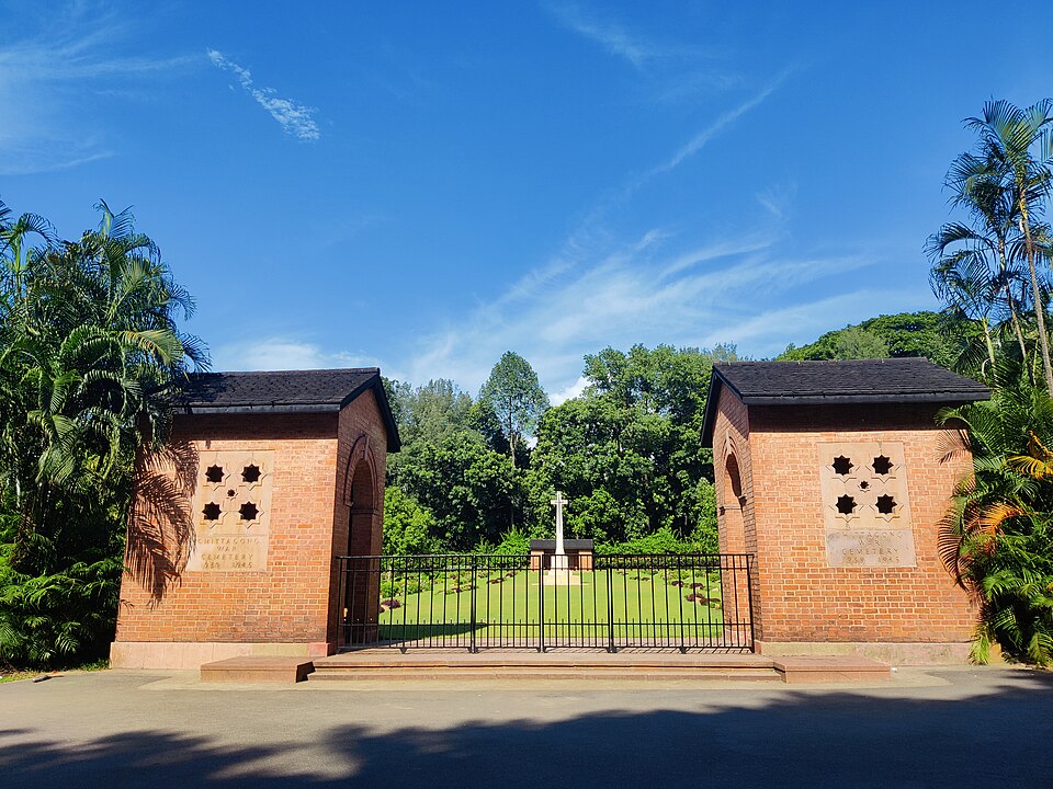 Chittagong War CemeteryHistoric · Chattogram, Chattogram
A Commonwealth War Graves Commission cemetery of the Second World War, holding 731 Commonwealth burials (17 unidentified) plus 19 Japanese soldiers. A calm, immaculately kept garden cemetery on sloping ground, and one of the city most significant historical sites.
Community-reported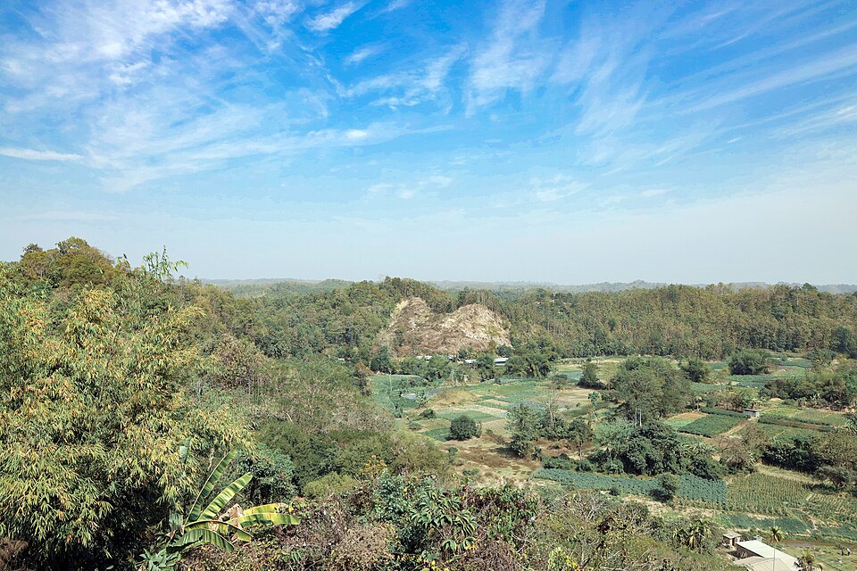 Chimbuk HillHills · Bandarban, Chattogram
Described on Bangla Wikipedia as the third-highest hill in Bandarban district, rising about 2,500 feet above sea level. It sits about 26 km from Bandarban town on the Thanchi road. The surrounding hill villages and views make the drive worthwhile.
Community-reported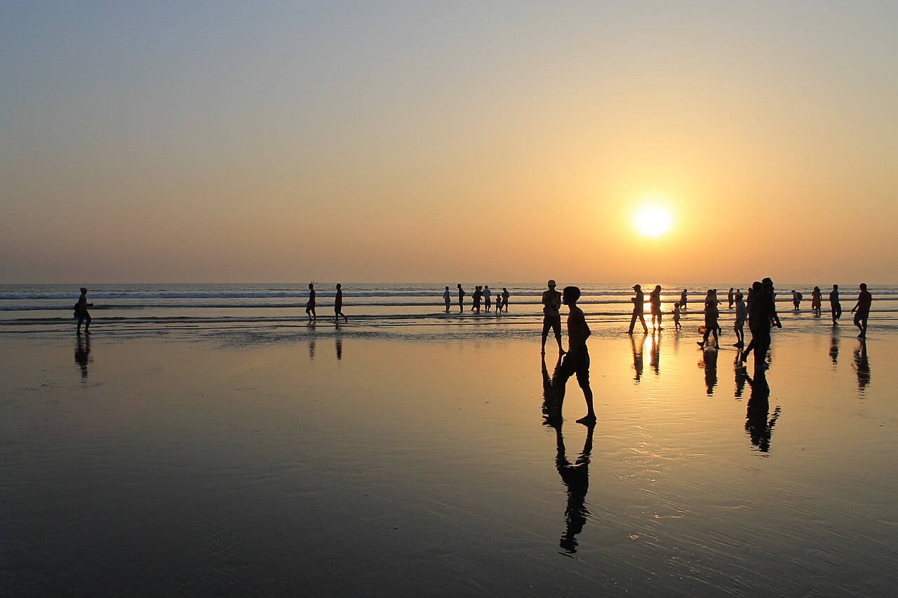 Cox's Bazar BeachBeaches · Cox's Bazar, Chattogram
One of the world's longest natural sandy sea beaches — stretching roughly 120 km. Laboni, Inani and Sugandha points are the most popular. Famous for sunrise and sunset views.
Community-reported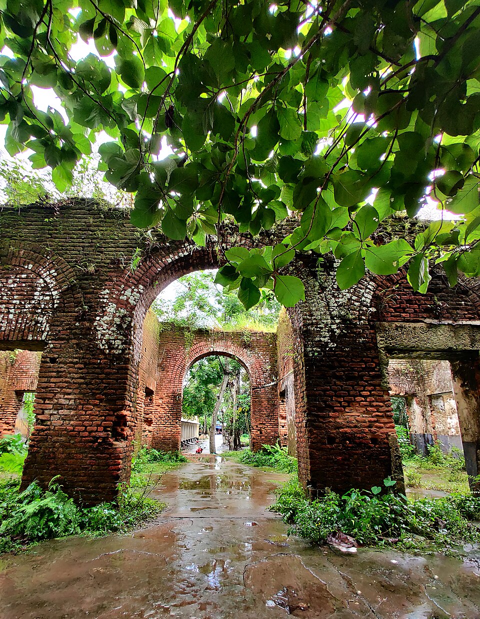 Dalal Bazar Zamindar BariHistoric · Lakshmipur, Chattogram
A roughly 300-year-old zamindar house beside the Dhaka-Raipur road, about 5 km from the district headquarters. Local belief holds that Lakshmipur district was first named after the landlord Lakshmi Narayan. Worthwhile for those interested in the area naming and history.
Community-reported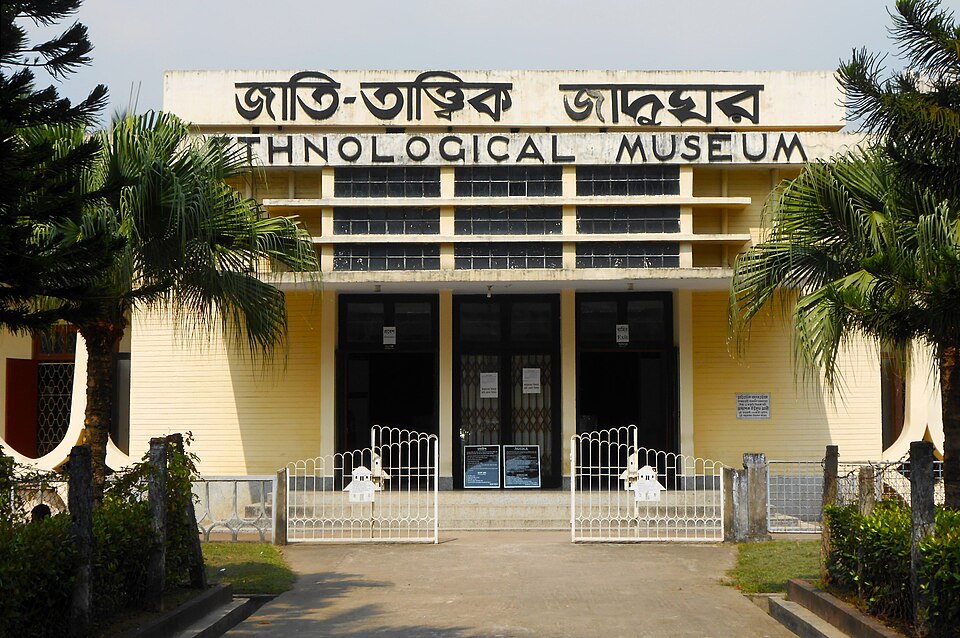 Ethnological MuseumUrban / day trips · Chattogram, Chattogram
The only ethnological museum in Bangladesh, established in 1965 at Agrabad. Its galleries present the history, dwellings, dress and culture of the country indigenous communities — valuable context before or after a trip to the hill districts.
Community-reported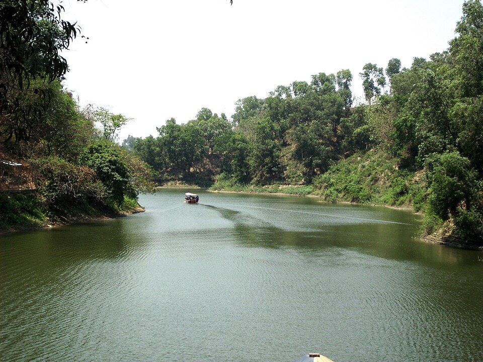 Foy's LakeUrban / day trips · Chattogram, Chattogram
An artificial lake created in 1924 by damming a hill stream to supply water to the railway colony at Pahartali. A lakeside amusement park (run by Concord) and hill scenery now surround it. One of the city main recreation spots.
Community-reportedGandhi Ashram, JayagHistoric · Noakhali, ChattogramAn ashram commemorating the Gandhi peace mission in Noakhali after the 1946 riots; he arrived at Jayag on 29 January 1947. It houses a Gandhi Memorial Museum and a charkha/khadi centre, and today the Gandhi Ashram Trust runs development programmes.
Community-reported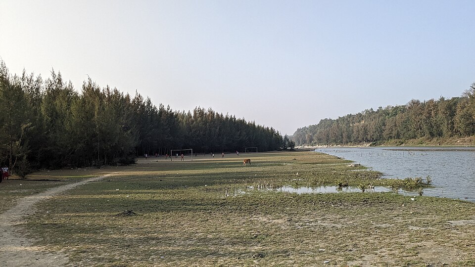 Himchari National ParkNature & forests · Cox's Bazar, Chattogram
A 1,729-hectare mixed evergreen forest along the coast beside Cox's Bazar town, declared a national park in 1980. It is visited for its broken hills, seasonal waterfall and row of Christmas trees, and shelters 286 bird species plus Asian elephants. Easy to combine with a beach trip.
Community-reported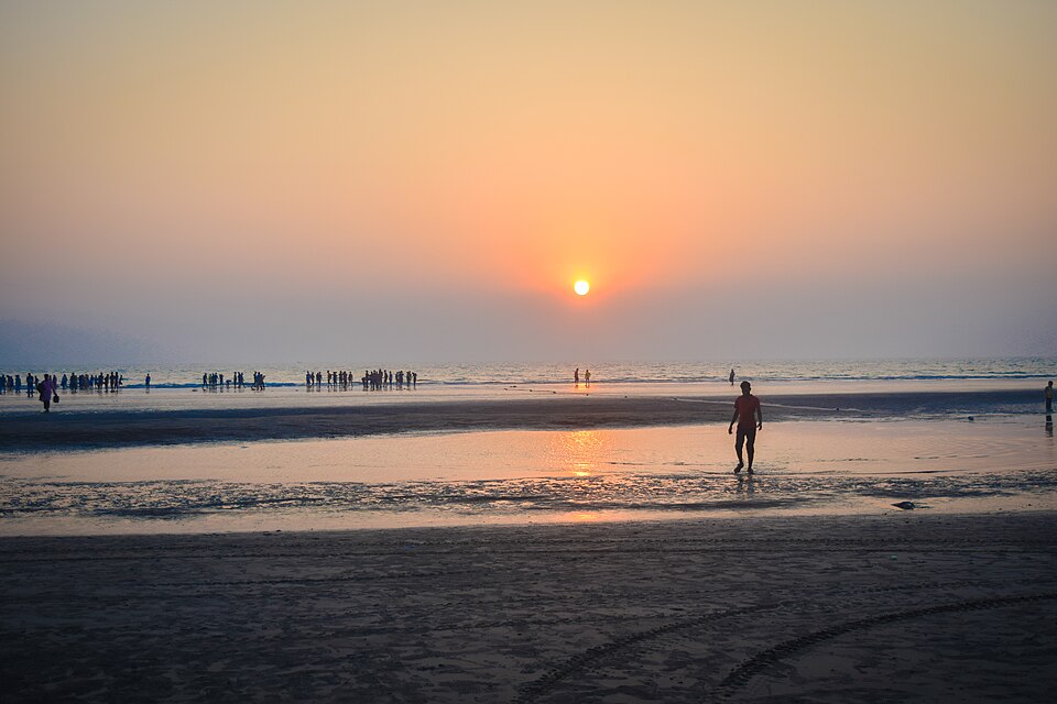 Inani BeachBeaches · Cox's Bazar, Chattogram
An 18 km stretch of the Cox's Bazar shoreline in Ukhia upazila, distinct for its scattered rocks. Black and green coral stones appear on and under the water in summer and the rainy season. A popular day trip via the Marine Drive road.
Community-reported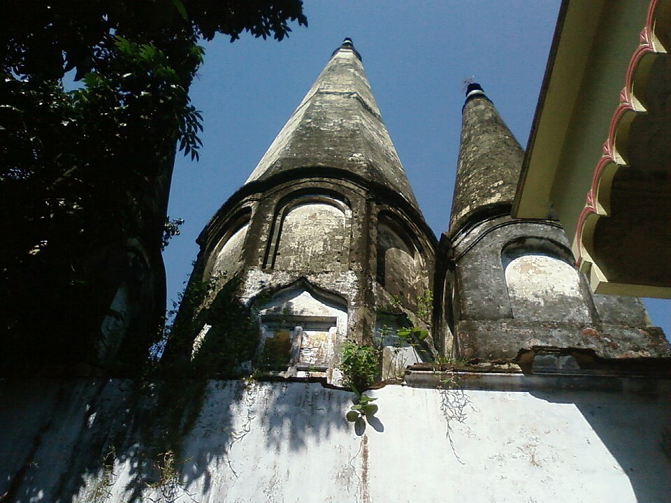 Kal Bhairab TempleHistoric · Brahmanbaria, Chattogram
A Shiva (Kal Bhairab) temple at Medda near the Titas river, famed for a 28-foot Shiva statue/linga believed to be the largest in the world. The current 24-foot stone statue was rebuilt after the original was destroyed in 1971. Major Shaivite festivals draw large crowds.
Community-reported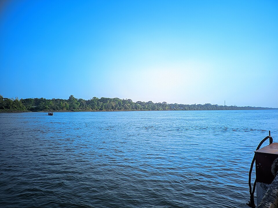 Kaptai LakeNature & forests · Rangamati, Chattogram
The largest man-made lake in Bangladesh (about 688 sq km), created in the 1960s by damming the Karnaphuli river. Boat trips, island visits and the famous hanging bridge at Rangamati town all centre on this water. The dam displaced about 100,000 people, a defining part of local history.
Community-reported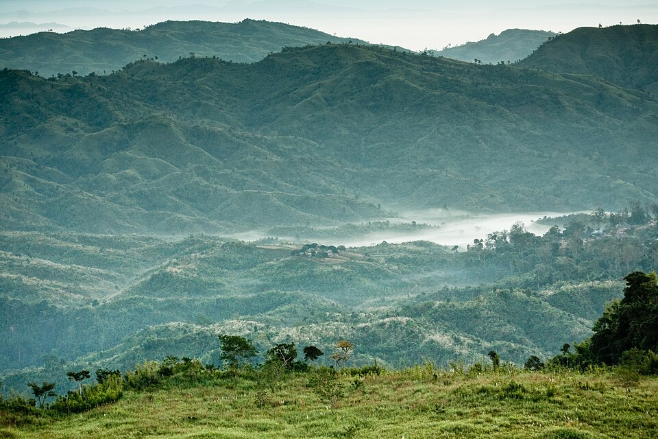 KeokradongHills · Bandarban, Chattogram
A popular summit in Ruma upazila measured by GPS at roughly 986 m. It is typically reached on foot from Boga Lake. Wikipedia is explicit that this is not the highest point of Bangladesh: that is Saka Haphong.
Community-reported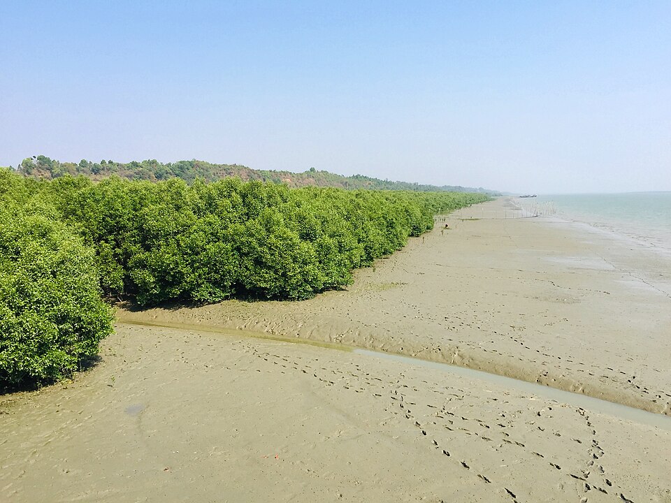 Maheshkhali IslandNature & forests · Cox's Bazar, Chattogram
The only hilly island in Bangladesh, home to roughly 400,000 people. Known for the Adinath Hindu temple on its hill, betel-leaf farms and the sun-dried fish (shutki) trade. An easy boat day trip from Cox's Bazar.
Community-reported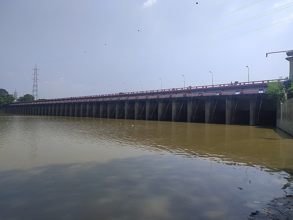 Muhuri Dam (Irrigation Project)Nature & forests · Feni, Chattogram
The closure dam of Bangladesh second-largest irrigation project, at the confluence of the Feni, Muhuri and Kalidas-Pahaliya rivers, roughly 18 km from Feni town. In winter the closed dam forms a reservoir behind it, a popular picnic and boating spot; the Forest Department keeps deer and monkeys nearby.
Community-reported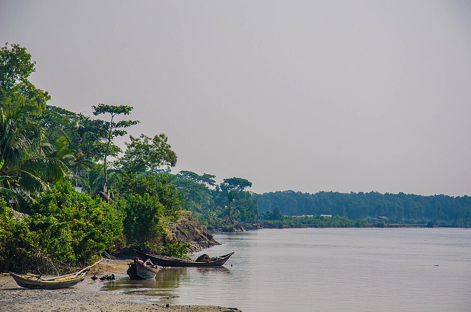 Nijhum DwipNature & forests · Noakhali, Chattogram
An island that grew from remote chars in the Meghna estuary; the government-planted mangrove holds a herd of about 5,000 chital spotted deer, and the area became a national park in 2001. Migratory birds crowd in winter. Access is by boat with basic infrastructure, so plan ahead.
Directly confirmed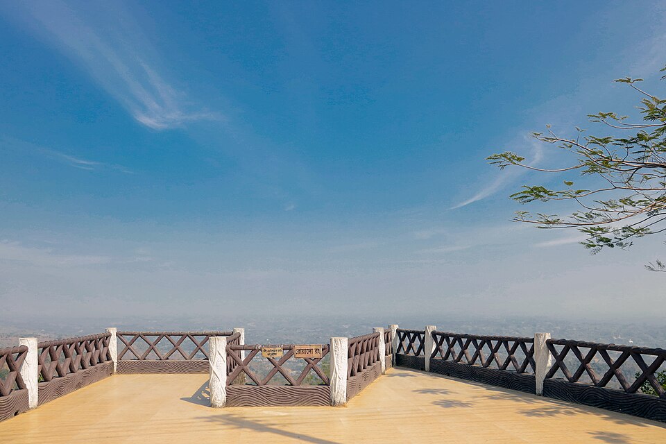 NilachalHills · Bandarban, Chattogram
A hilltop tourist centre close to Bandarban town, at approximately 2,460 feet elevation according to the government tourism portal. The summit offers broad views of surrounding hills and valleys; arriving before dusk also rewards you with the town lights below.
Official source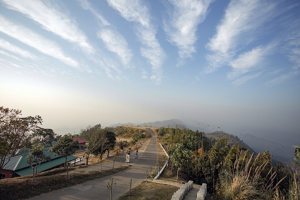 Nilgiri Hill ResortHills · Bandarban, Chattogram
A hilltop tourist centre on the Bandarban–Thanchi road at roughly 2,350 feet above sea level. It is known for sunrise and sunset above cloud cover and sweeping views of the surrounding hills. Winters turn genuinely cold, so carry a warm jacket.
Official source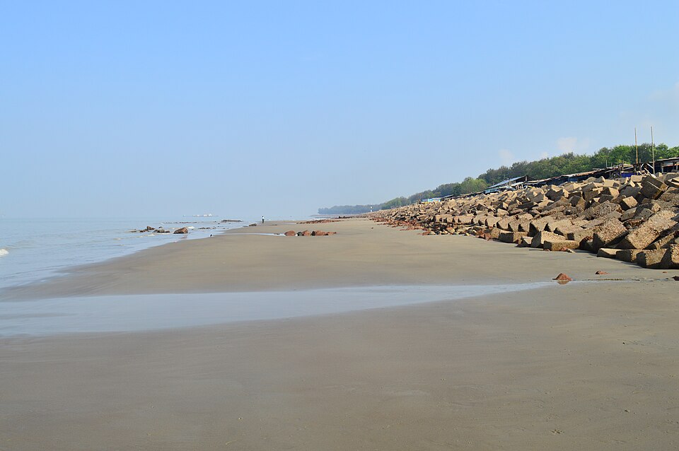 Patenga BeachBeaches · Chattogram, Chattogram
A Bay of Bengal beach near the mouth of the Karnaphuli river, about 14 km south of Chattogram city, beside the airport and Naval Academy. Popular for sunsets and patrolled by the Bangladesh Navy.
Community-reported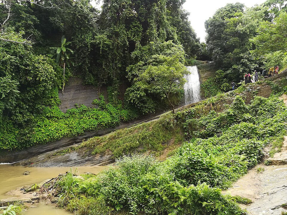 Risang WaterfallNature & forests · Khagrachhari, Chattogram
A roughly 100-foot hill waterfall at Sapmara village, about 10-11 km from Khagrachhari town, reached by descending 235 steps. Wikipedia notes a small entry fee is charged from tourists.
Community-reported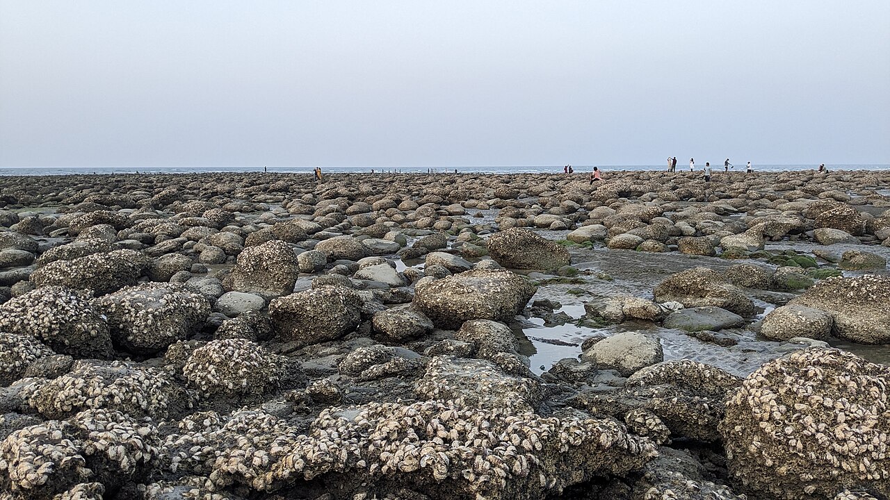 Saint Martin's IslandBeaches · Cox's Bazar, Chattogram
Bangladesh's only coral island, about 9 km south of the mainland. Known for Narikel Jinjira (Coconut Beach), Chera Dwip and clear sea water.
Community-reported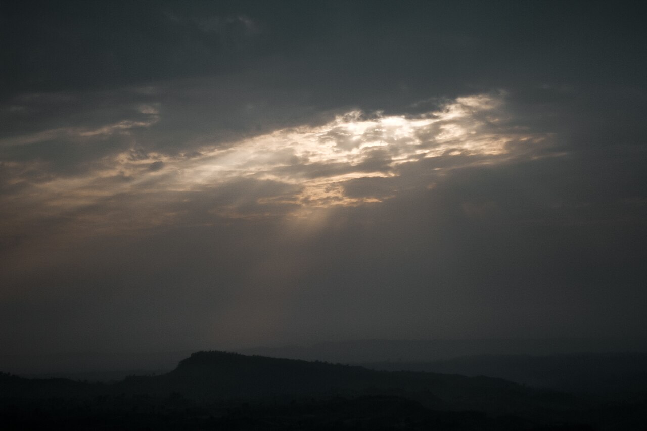 Sajek ValleyHills · Rangamati, Chattogram
A tourist village at about 1,800 feet in the Kaptai hill area of Baghaichhari upazila, Rangamati. Famous for cloud-covered hill roads and sunsets.
Community-reported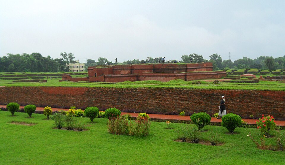 Shalvan Vihara (Mainamati)Historic · Cumilla, Chattogram
Ruins of a Buddhist monastery of the 7th-12th centuries in the Mainamati-Lalmai hill range, with 115 monastic cells around a cruciform temple. The Mainamati museum beside it holds bronzes, coins and copper plates; Kutila Mura and Charpatra Mura lie nearby. About 8 km west of Comilla town.
Directly confirmed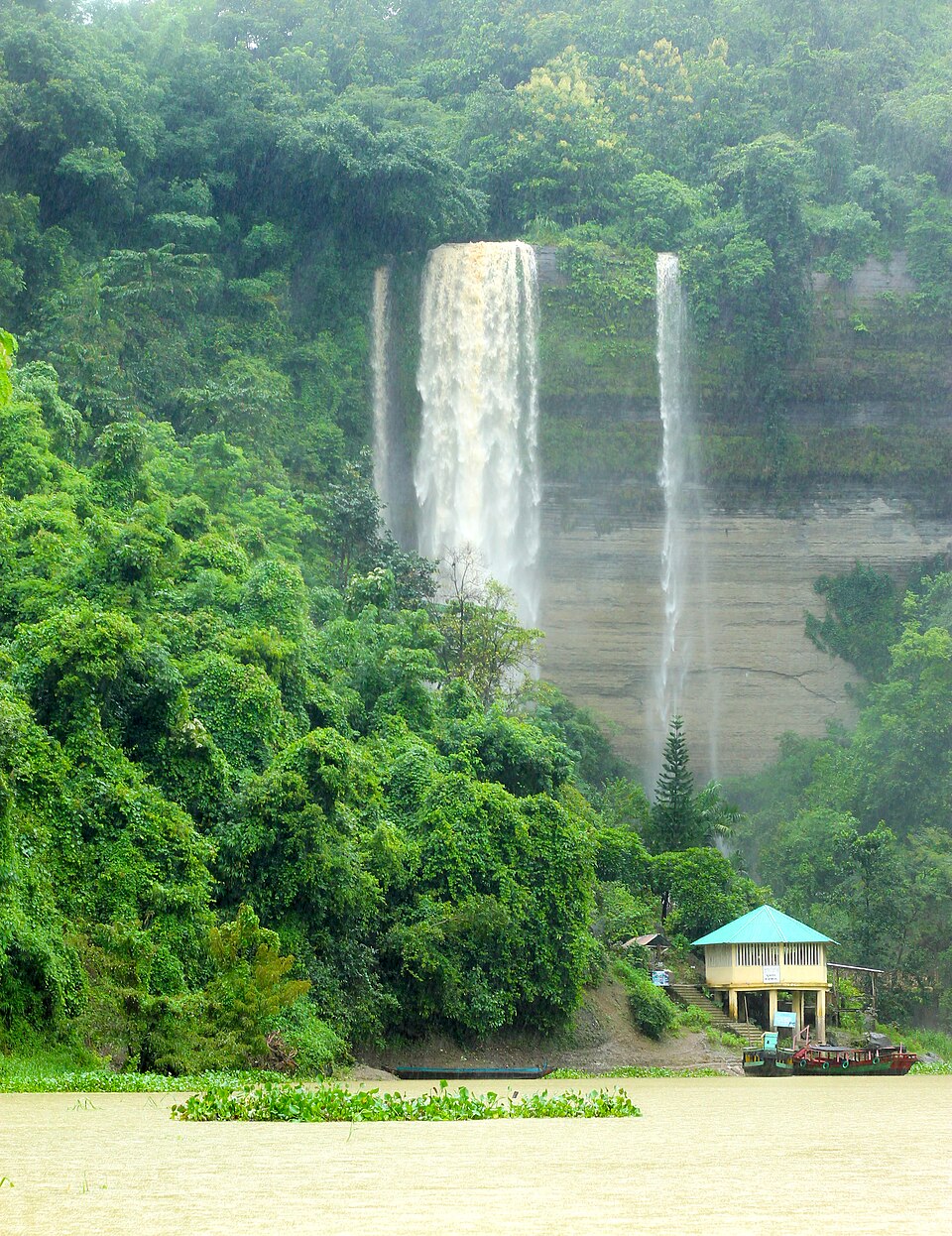 Shuvolong WaterfallNature & forests · Rangamati, Chattogram
A tall hill waterfall on the shore of Kaptai Lake in Barkal upazila; ringed by steep forested hills, it is reachable only by water (about 25 km by boat from Rangamati town). Flow is best from late monsoon into early winter.
Community-reported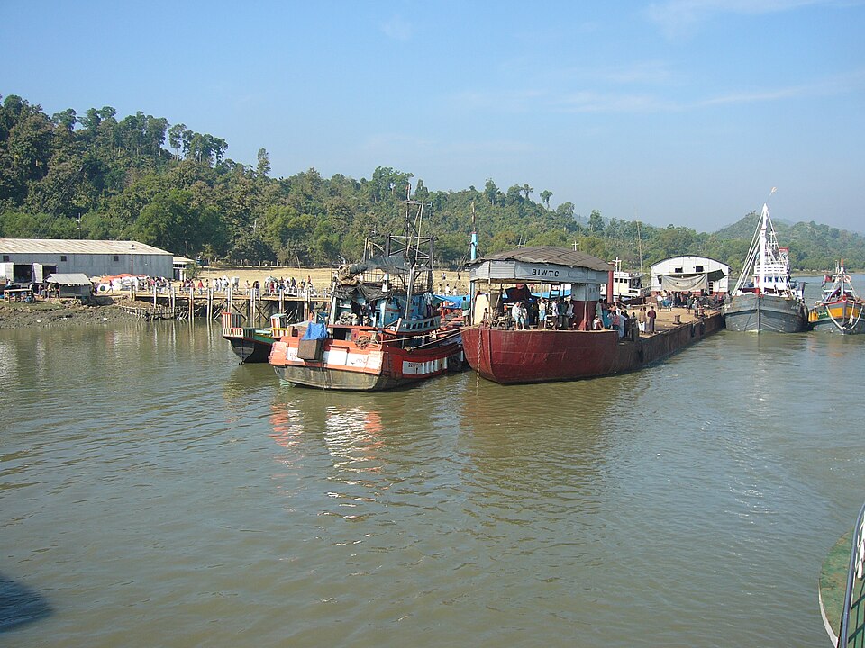 TeknafNature & forests · Cox's Bazar, Chattogram
The southernmost tip of the Bangladeshi mainland, beside the Naf river which forms the boundary between Bangladesh and Myanmar. Known for river views and coastal life. Any attempt to cross the Naf is strictly off-limits on security and legal grounds.
Community-reportedDhaka (ঢাকা)
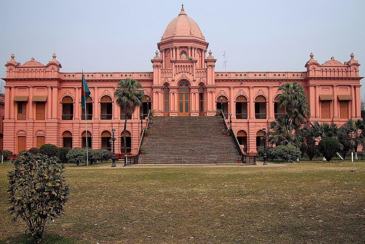 Ahsan ManzilUrban / day trips · Dhaka, Dhaka
The riverfront residence of the Nawabs of Dhaka on the Buriganga river; now a museum. Also known as the 'Pink Palace' for its colour.
Community-reported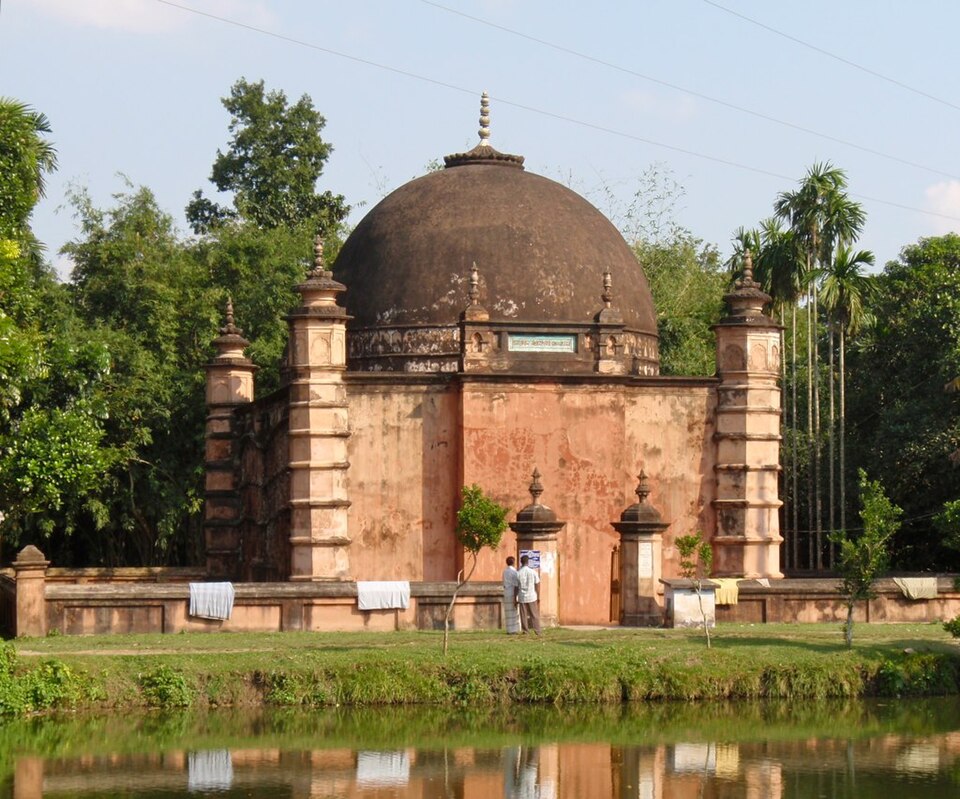 Atia MosqueHistoric · Tangail, Dhaka
A four-domed historic mosque built around 1610-1611 CE during Mughal emperor Jahangir's reign and protected by the Department of Archaeology. It stands about 6 km south of Tangail city on the eastern bank of the Louhajang River. Its terracotta ornamentation and quiet riverside setting make it a rewarding half-day trip.
Community-reported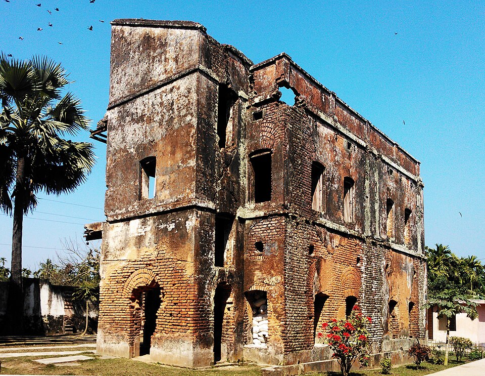 Baliati PalaceHistoric · Manikganj, Dhaka
A 19th-century zamindar's palace complex of seven buildings spread over about 5.88 acres, enclosed within a moat and perimeter wall and containing roughly 200 rooms. The estate was founded by the family of Gobinda Ram Shaha, a salt merchant. It has been managed by Bangladesh's Department of Archaeology since 1987, with a large pond behind the palaces.
Community-reported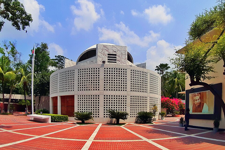 Mausoleum of Bangabandhu Sheikh Mujibur Rahman, TungiparaHistoric · Gopalganj, Dhaka
The birthplace and mausoleum complex of Bangladesh's founding president Sheikh Mujibur Rahman; built 1998-2001, it includes the tomb, a library, a museum, his ancestral home and a family mosque. Crowds come to pay respects on national days; it is quiet at other times.
Community-reportedBeel Route CanalNature & forests · Gopalganj, DhakaA straight man-made canal connecting the Arial Khan river at Tekerhat with the Madhumati at Gopalganj, running directly beside the historic Arpara Munshi Bari; locals also call it the Madaripur Beel Route because many wetlands feed into it. It is known for its tranquil straight stretch of water and riverside village scenery; the source notes native shushuk dolphins occur in its waters.
Community-reported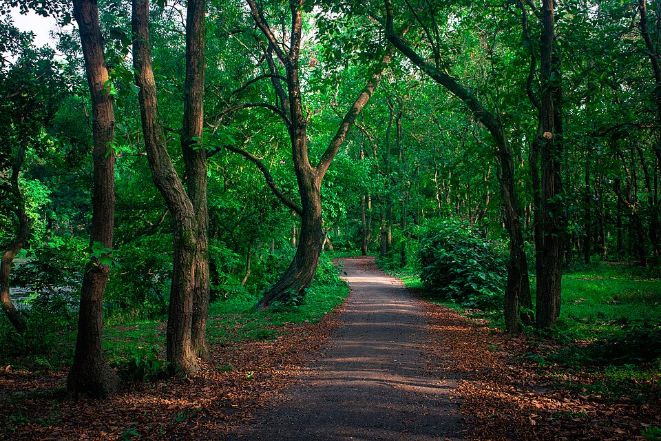 Bhawal National ParkNature & forests · Gazipur, Dhaka
A national park with a 940-hectare core area within the Bhawal sal forest, about 40 km north of Dhaka, surrounded by 5,022 hectares of forest. It holds 345 plant species, and the Forest Department has introduced peacocks, spotted deer and pythons. It is the closest picnic and weekend forest spot to Dhaka and gets very crowded on weekends.
Community-reported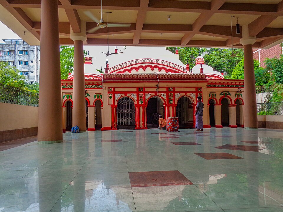 Dhakeshwari National TempleUrban / day trips · Dhaka, Dhaka
A temple to the goddess Dhakeshwari — the 'goddess of Dhaka' — traditionally founded in the 12th century under Sena king Ballal Sen; state-owned, it holds the distinction of being Bangladesh's 'National Temple'. It is counted among the shakta pithas and, since the destruction of Ramna Kali Mandir in 1971, is the country's most important and largest Hindu place of worship. The national flag is raised daily outside its main premises.
Community-reported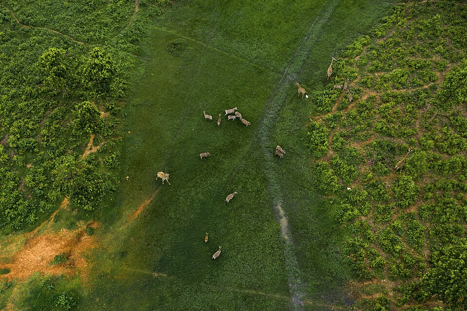 Gazipur Safari ParkNature & forests · Gazipur, Dhaka
Established in 2013 across about 3,810 acres of sal forest, this is one of Asia's largest safari parks with around 3,000 animals of 47 species. In the Core Safari zone tigers, lions, elephants and other animals can be seen in open enclosures, toured by park bus or permitted vehicles. It reopened to visitors under its new name on 15 November 2024.
Community-reported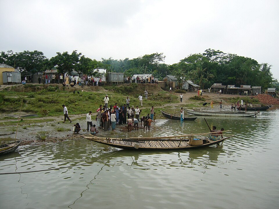 Goalundo GhatUrban / day trips · Rajbari, Dhaka
A historic river port on the south bank of the Padma; after the Kolkata-Goalundo railway opened in 1871 it was the main water-and-rail hub for travellers to eastern Bengal, Assam and Burma. A 1913 colonial account noted that Goalundo occupied a very strong strategic position in the waterways of Bengal. Today the draws are the wide Padma views and the busy Daulatdia-Paturia ferry operations next door.
Community-reported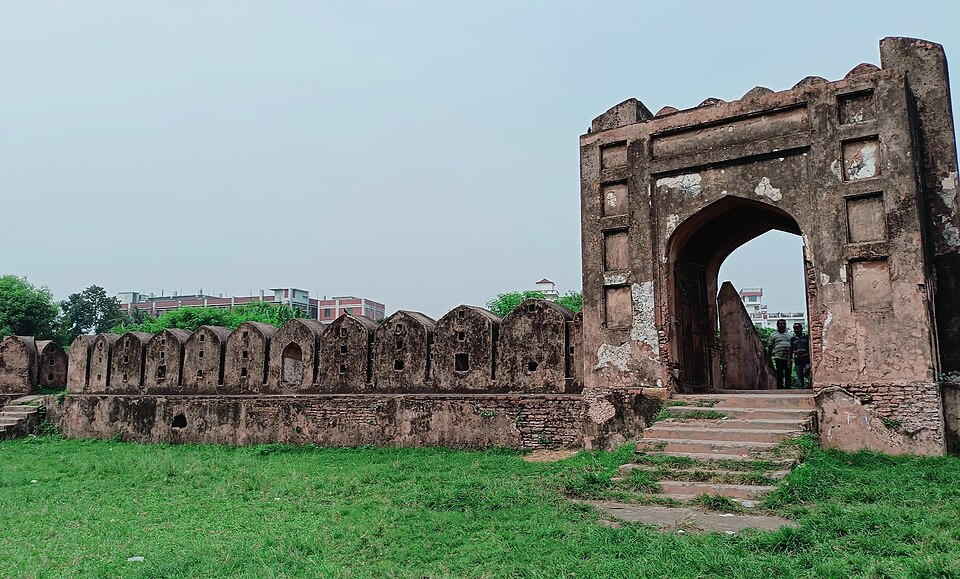 Hajiganj FortHistoric · Narayanganj, Dhaka
A Mughal river fort on the western bank of the Shitalakshya River, likely built soon after Islam Khan made Dhaka the Mughal capital to guard against Magh and Portuguese raiders. It is a protected Department of Archaeology site open to the public; the walls, gateway and corner bastions survive, though the watch tower is ruined.
Community-reported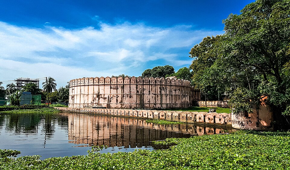 Idrakpur FortHistoric · Munshiganj, Dhaka
A river fort built around 1660 AD by the Mughal Subahdar Mir Jumla as part of a triangular defence with the Hajiganj and Sonakanda forts against Portuguese and Magh pirates. Its features include a circular drum tower 32.5 m in diameter and a staircase to a hidden underground magazine. It is managed by the Department of Archaeology and open to the public.
Community-reported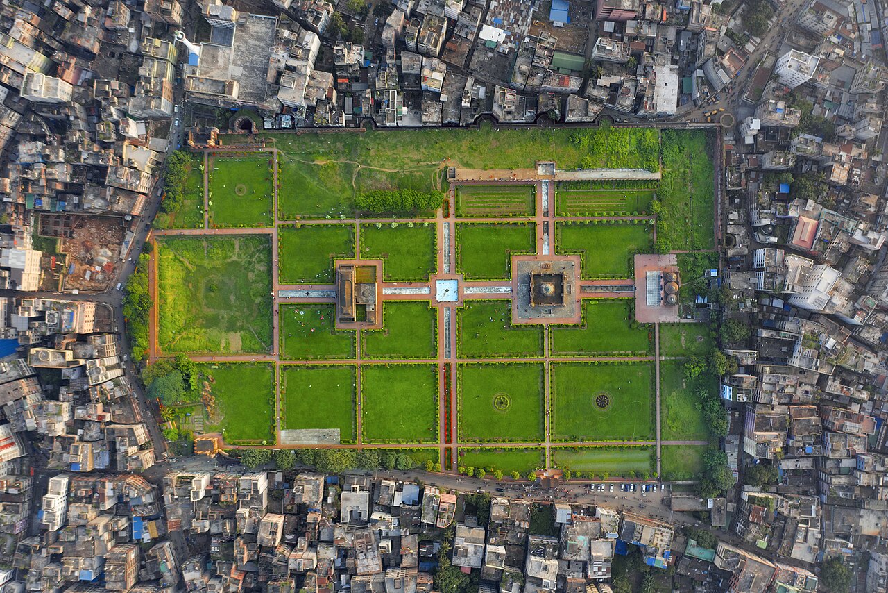 Lalbagh FortUrban / day trips · Dhaka, Dhaka
An incomplete Mughal fort begun in the 17th century by Prince Azam Shah. Known for the tomb of Pari Bibi, the audience hall and Mughal-era water tanks.
Community-reported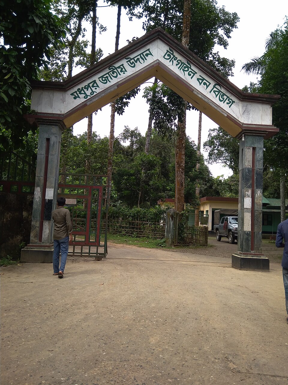 Madhupur National ParkNature & forests · Tangail, Dhaka
A national park declared in 1982 covering 8,436 hectares, part of one of Bangladesh's finest sal forests with about 40% sal-tree cover. Some 176 plant species and 190 faunal species have been recorded, and Garo indigenous communities live in the area. It is about 125 km from Dhaka, making it feasible as a day trip.
Community-reported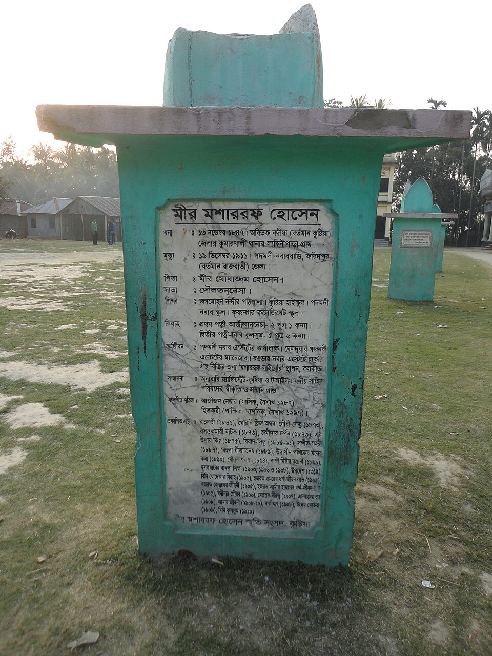 Mir Mosharraf Hossain Memorial CentreHistoric · Rajbari, Dhaka
A memorial to the writer Mir Mosharraf Hossain, author of Bishad Sindhu, in the Padamdi Nawab Estate area where he spent much of his life. The centre holds collections on his life and literary work. It is a special stop for literature lovers on the Dhaka-Faridpur/Rajbari route.
Community-reported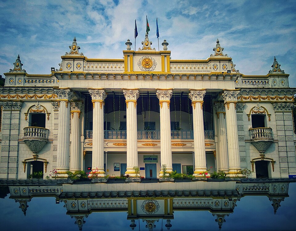 Mohera Zamindar BariHistoric · Tangail, Dhaka
A 19th-century zamindari palace built in 1890 by brothers Kali Charan Saha and Anand Saha, originally from Calcutta, spread over roughly eight acres. It is considered one of the best-maintained zamindari estates in Bangladesh. A police training centre operates in the building today, so parts of the complex may have restricted access.
Community-reportedNateshwar Deul (Buddhist Archaeological Site)Historic · Munshiganj, DhakaA roughly thousand-year-old Buddhist site in the ancient Vikrampur region, occupied in two phases (c. 780-950 and 950-1223 CE), where excavations have uncovered sixteen stupas — including Bangladesh's only complete pyramid-shaped stupa — monasteries and brick-paved roads. Systematic digging has continued since 2012-13 and an archaeological park is planned here. It is significant for visitors interested in the Vikrampur connection of Atish Dipankar Srijnan.
Community-reported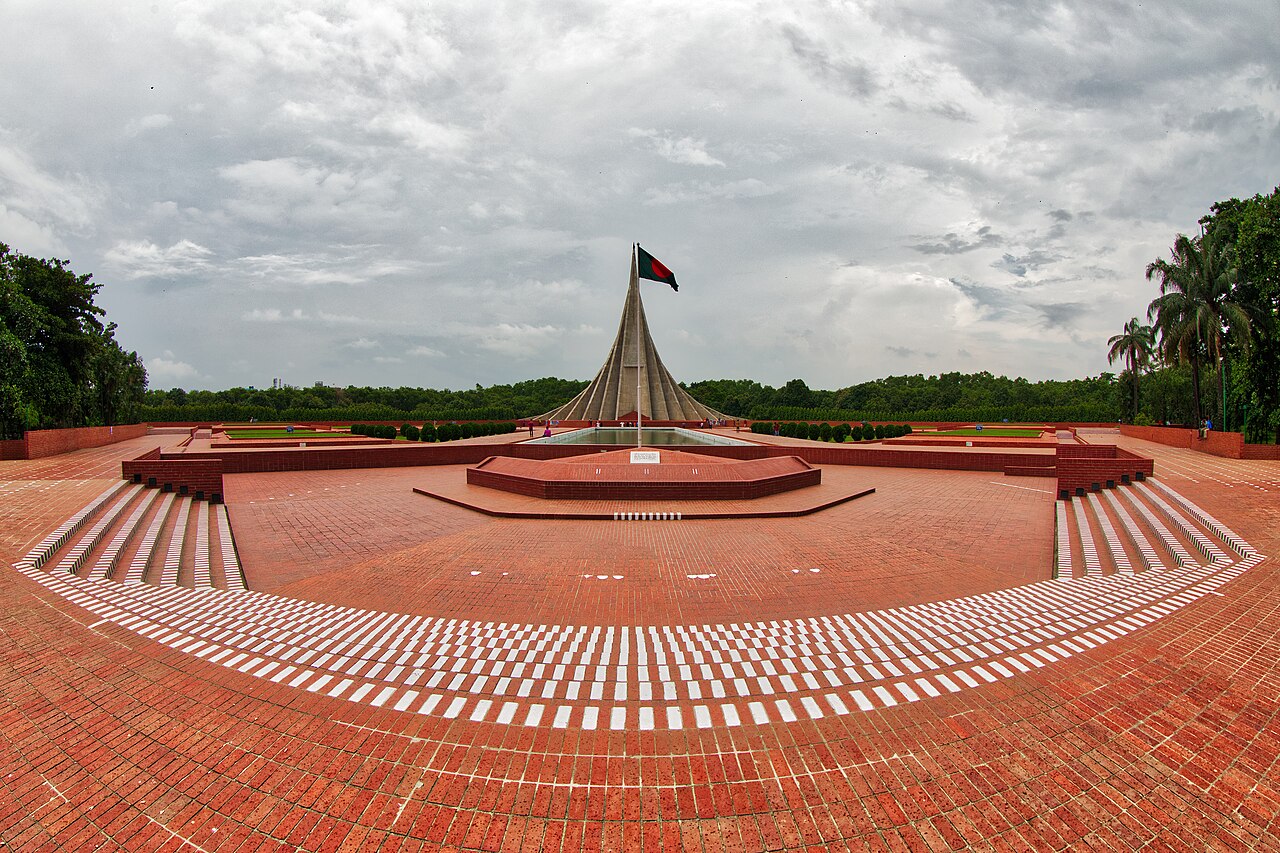 National Martyrs' MemorialUrban / day trips · Dhaka, Dhaka
The national memorial at Savar honouring those martyred in the Liberation War; its seven red-and-green-tinted concrete towers form the iconic silhouette.
Community-reported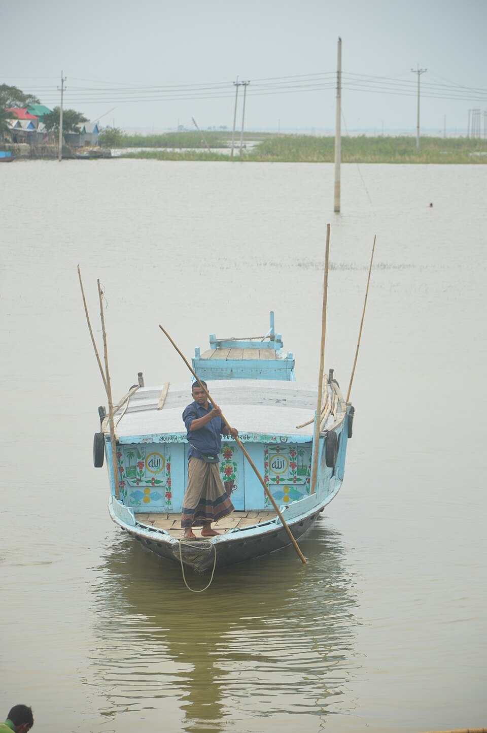 Nikli HaorNature & forests · Kishoreganj, Dhaka
One of Bangladesh's largest freshwater wetlands, spanning Nikli, Mithamain, Austagram and Itna upazilas; in the monsoon the whole area becomes a vast inland lake dotted with small island villages. Boating, sunset watching, birdwatching and observing fishing communities are the real draws, and walking the Nikli embankment is also popular.
Official source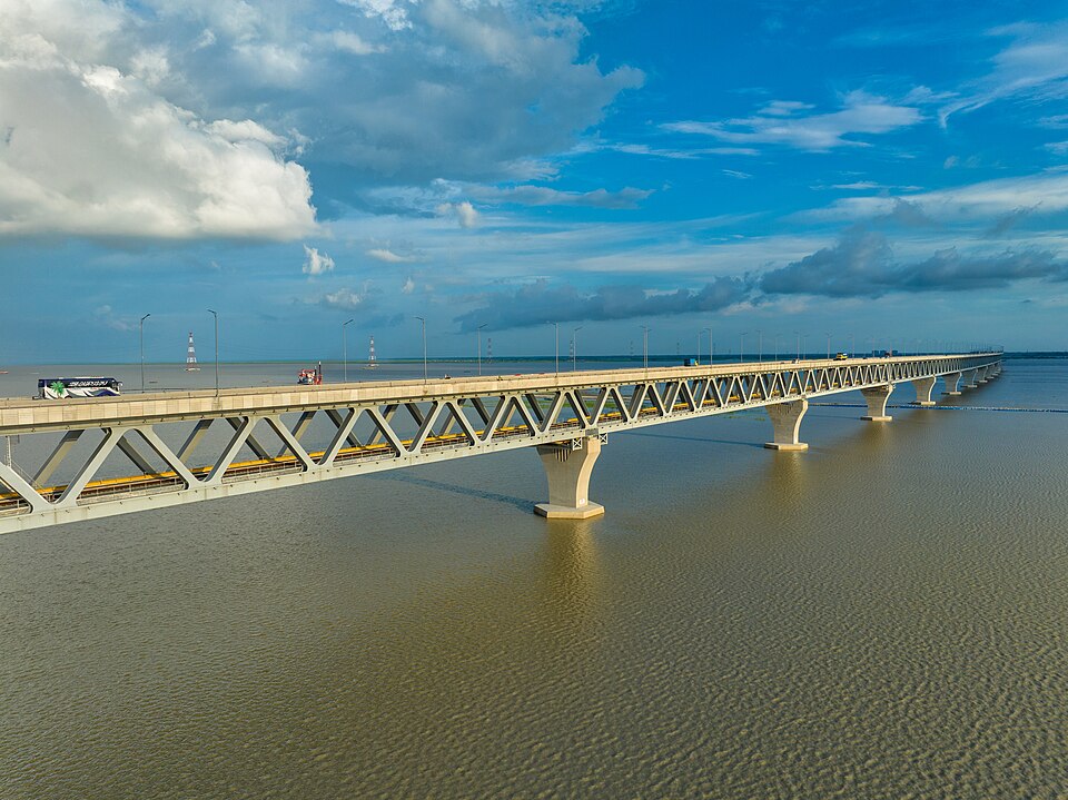 Padma Bridge (Zajira end)Urban / day trips · Shariatpur, Dhaka
A 6.15 km two-level bridge (four-lane highway above, single-track rail below), inaugurated on 25 June 2022, connecting Louhajang Upazila in Munshiganj with Zajira in Shariatpur and part of Shibchar in Madaripur. From the southern Zajira-Shibchar bank you get sweeping Padma views and the lively bridge-head market.
Community-reported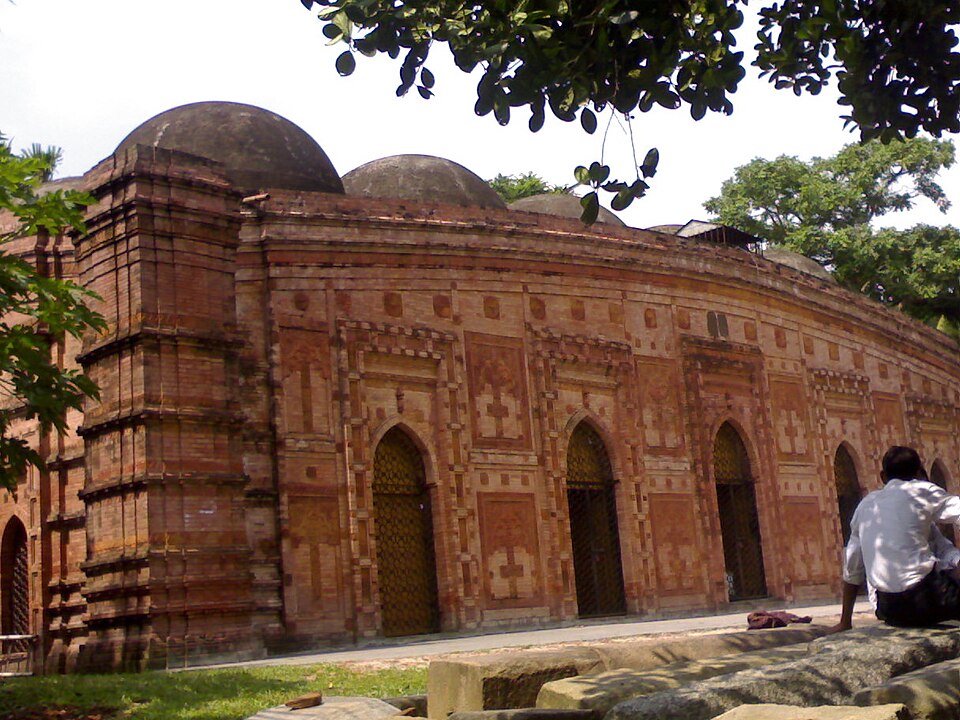 Pathrail MosqueHistoric · Faridpur, Dhaka
A Bengal Sultanate-era mosque built during the reign of Sultan Ghiyasuddin Azam Shah (15th century), rectangular in plan with ten equal domes, four octagonal corner towers, five eastern doorways and five mihrabs, decorated with floral-scroll and rosette terracotta. It is administered by the Department of Archaeology and remains an active mosque.
Community-reported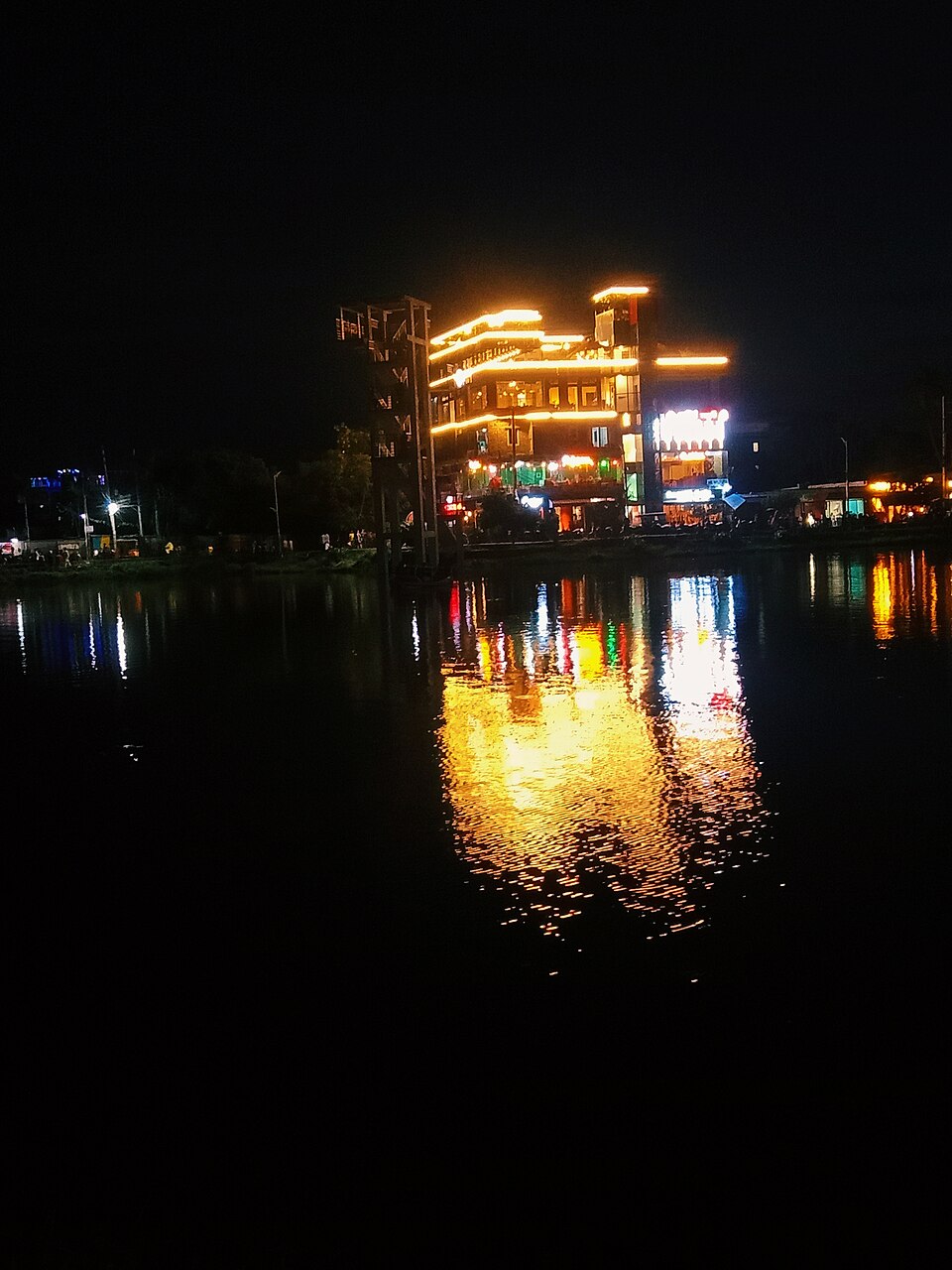 Shakuni LakeUrban / day trips · Madaripur, Dhaka
A popular lake and open recreation area in the heart of Madaripur town, 5-8 km from the district headquarters, filling up with locals in the evenings. It is known for its scenic lake views, birdwatching and photography opportunities. It works as an evening stop for travellers arriving over the Padma Bridge.
Community-reported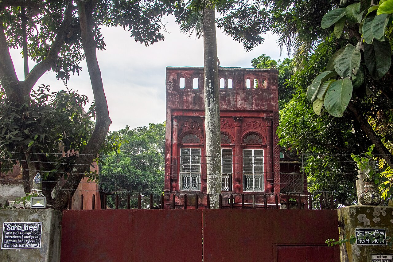 SonargaonHistoric · Narayanganj, Dhaka
An ancient capital of Bengal and a trade centre in the Muslim and pre-Mughal eras. Today the Folk Art and Craft Museum, Panam City and Goaldi Mosque are the highlights.
Community-reported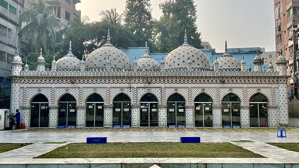 Star MosqueUrban / day trips · Dhaka, Dhaka
A mosque built in the first half of the 19th century by Mirza Golam Pir and redecorated in 1926 by Ali Jan Bepari with blue star-motif Chinitikri tiles; two more domes were added in 1987. With its five domes set in a narrow Old Dhaka lane it is one of the most photogenic religious buildings in Dhaka and has appeared on the Bangladeshi 100-taka note.
Community-reported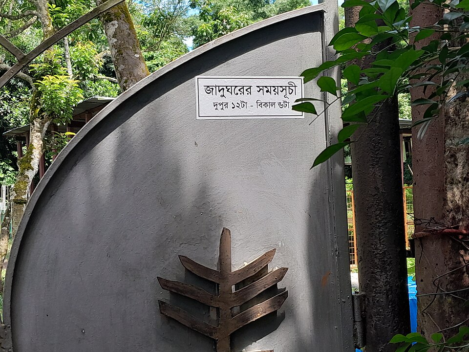 Wari-Bateshwar RuinsHistoric · Narsingdi, Dhaka
One of the oldest urban settlements in Bangladesh, occupied mainly in the Iron Age (400-100 BCE), with a 600 x 600 m moated citadel and about 6 km of outer fortification. An ancient paved road, punch-marked silver coins and evidence of Southeast Asian and Roman trade underline its importance; some researchers identify it with Ptolemy's 'Sounagora' emporium (a hypothesis). The features lie dispersed across farmland, so walking village paths is the real way to experience the site.
Community-reportedKhulna (খুলনা)
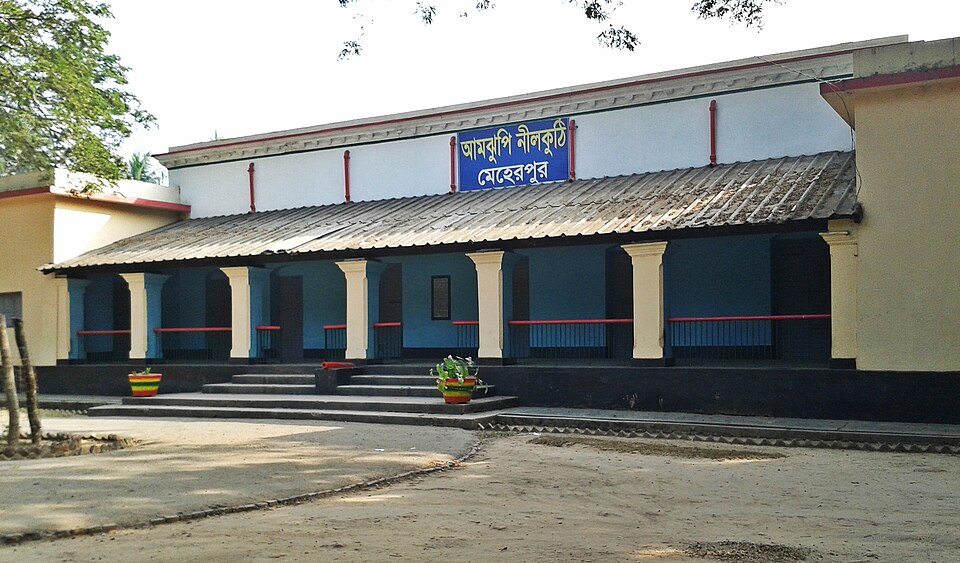 Amjhupi NilkuthiHistoric · Meherpur, Khulna
A British-era indigo warehouse about 6 km east of Meherpur town beside the Kajla/Bhairab river, a witness to the exploitative history of indigo cultivation. It is known as an archaeology-administered monument and has been considered a tourist centre since 1978. The two-storey kuthi building, adjacent tank and grounds are worth seeing, though the structures are somewhat neglected.
Directly confirmed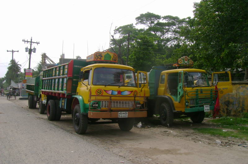 Benapole Border TownUrban / day trips · Jashore, Khulna
Bangladesh's busiest land port, directly opposite India's Petrapole checkpoint. The zero point draws border watchers and it is a hub for cross-border train and bus services. Hotels and food are available around Benapole/Sharsha; follow border rules when photographing.
Community-reportedBhatervitaNature & forests · Magura, KhulnaA rural riverside spot on the north bank of the Fatki river at the southern edge of Magura Sadar, per the source description. Locals come for the calm village-river ambience. Tourist facilities are minimal; visit in daylight.
Community-reported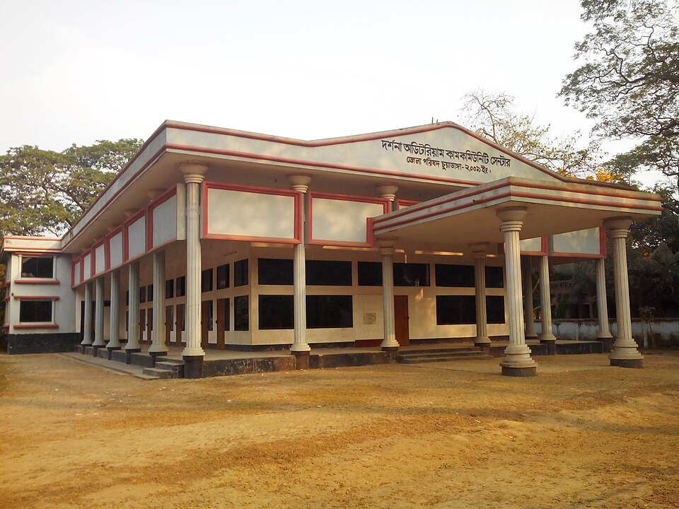 DarshanaUrban / day trips · Chuadanga, Khulna
A small industrial town and municipality in Chuadanga, home to Carew & Co, described as the biggest sugar mill in Bangladesh and established in the British period, and to the land port where trains first entered for Calcutta. Visitors come for the railway heritage and border-town atmosphere. Its station dates to 1871 on the Calcutta-Goalundo line.
Community-reportedGunjanath TempleHistoric · Jhenaidah, KhulnaA 17th-century temple at Boro Bazar in Kaliganj, one of Jhenaidah's better-known antiquities. Old mosques and the Naldanga temple complex nearby make it easy to visit several sites together. It lies roughly 20 km from Jhenaidah town.
Community-reported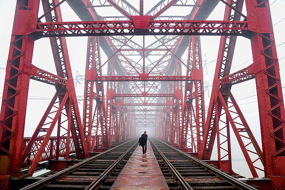 Hardinge BridgeHistoric · Kushtia, Khulna
A roughly 1.8 km steel railway truss bridge over the Padma, built in 1912 between Ishwardi (Pabna) and Bheramara (Kushtia). Damaged in the 1971 war and reopened to public passage on 12 October 1972. A popular photo stop for the bridge and Padma river views.
Directly confirmed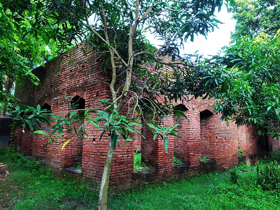 Jahajghata Fort Site, ShyamnagarHistoric · Satkhira, Khulna
Site of the historic Jahajghata naval fort in Shyamnagar, listed by Banglapedia among Satkhira district tourist spots. It mattered historically as an old gateway on the water routes into the Sundarbans. The surrounding area offers mangrove scenery and fishing villages.
Community-reportedJess Garden ParkUrban / day trips · Jashore, KhulnaAn urban garden in Jashore Sadar that Banglapedia lists among the district's tourist spots. A relaxed local park for an afternoon outing with family. Easy to combine with other sights on a Jashore town day trip.
Community-reported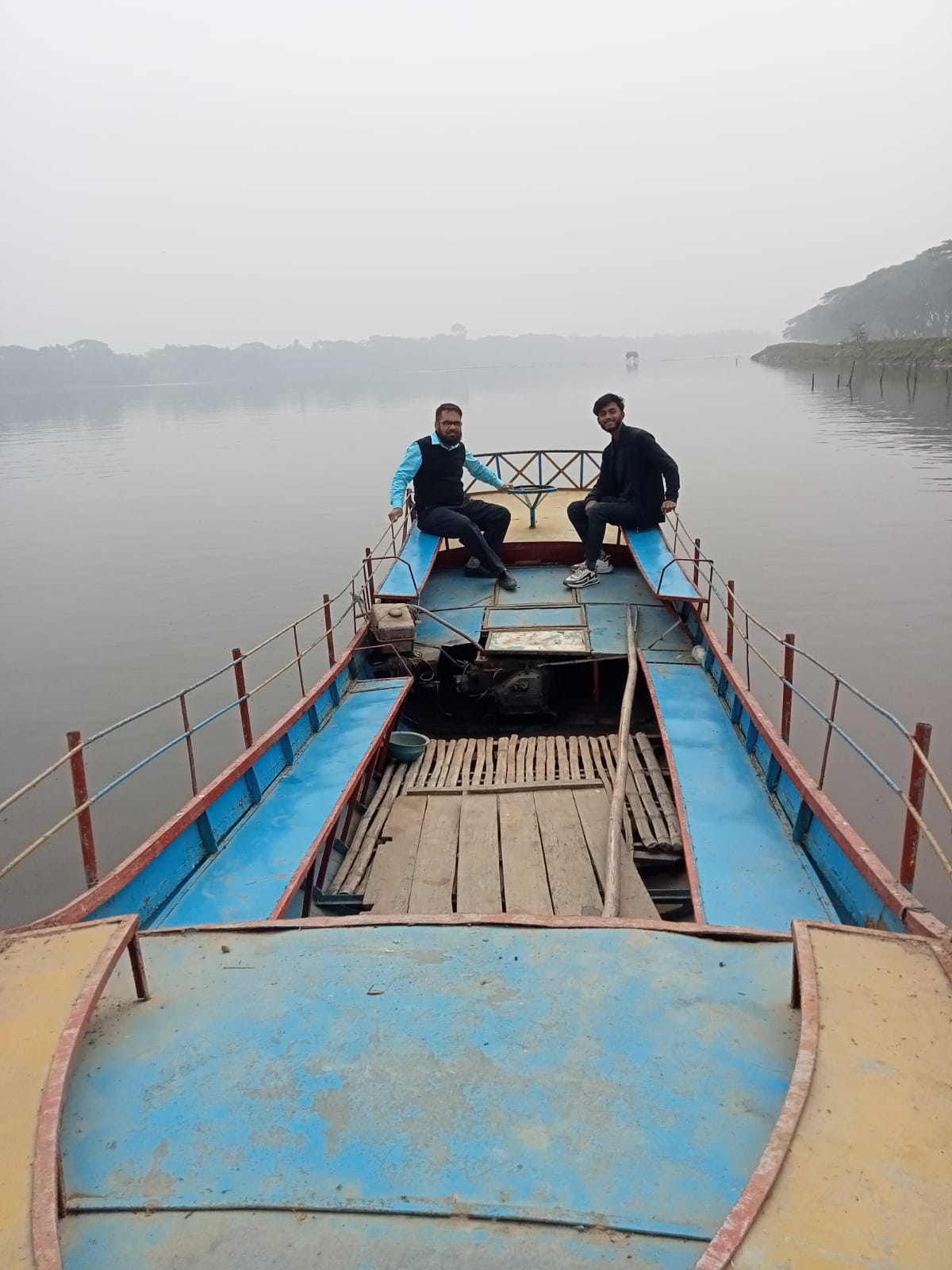 Jhapa Baor Floating BridgeNature & forests · Jashore, Khulna
A floating bridge about 1,300 feet long across Jhapa Baor near Rajganj in Monirampur upazila — known as the first and longest floating bridge in Bangladesh. Listed in the district administration’s tourist-spot directory. Boat trips on the baor, its calm wetland scenery and winter migratory birds are the main draws.
Community-reported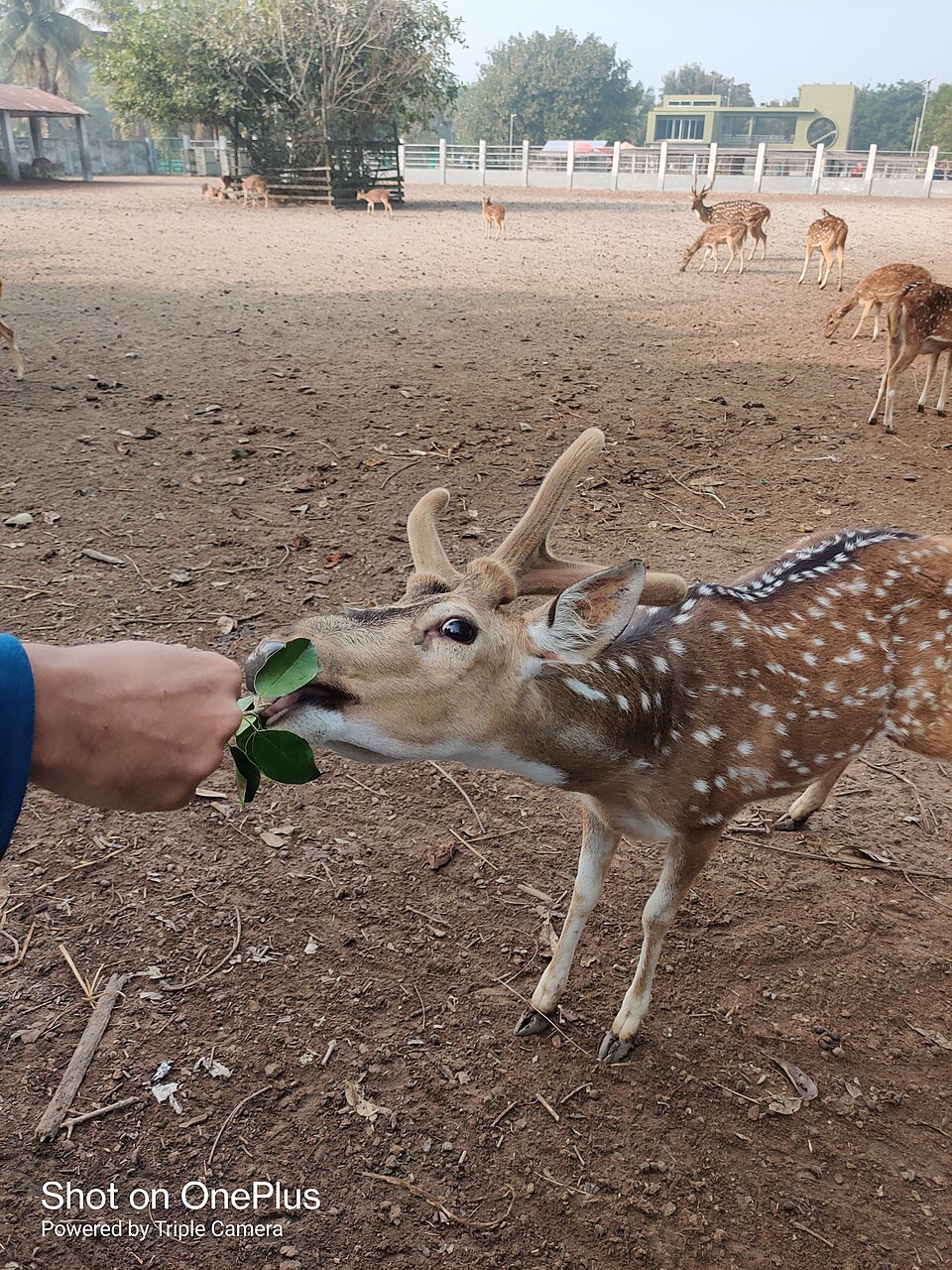 Karamjal Ecotourism CenterNature & forests · Bagerhat, Khulna
The most accessible ecotourism centre on the edge of the Sundarbans, a short boat ride from Mongla. It has a captive breeding centre with deer, crocodiles, monkeys and northern river terrapins, elevated wooden and concrete walkways and observation towers. A good half-day option for experiencing the mangroves without a deep-forest expedition.
Official sourceKarpasdanga NeelkuthiHistoric · Chuadanga, KhulnaA colonial-era indigo warehouse at Karpasdanga, Alamdanga, listed by Banglapedia among Chuadanga's archaeological heritage. A witness to the history of indigo cultivation, of interest to those exploring the district's nilkuthi heritage. Ask locally about its current condition.
Community-reported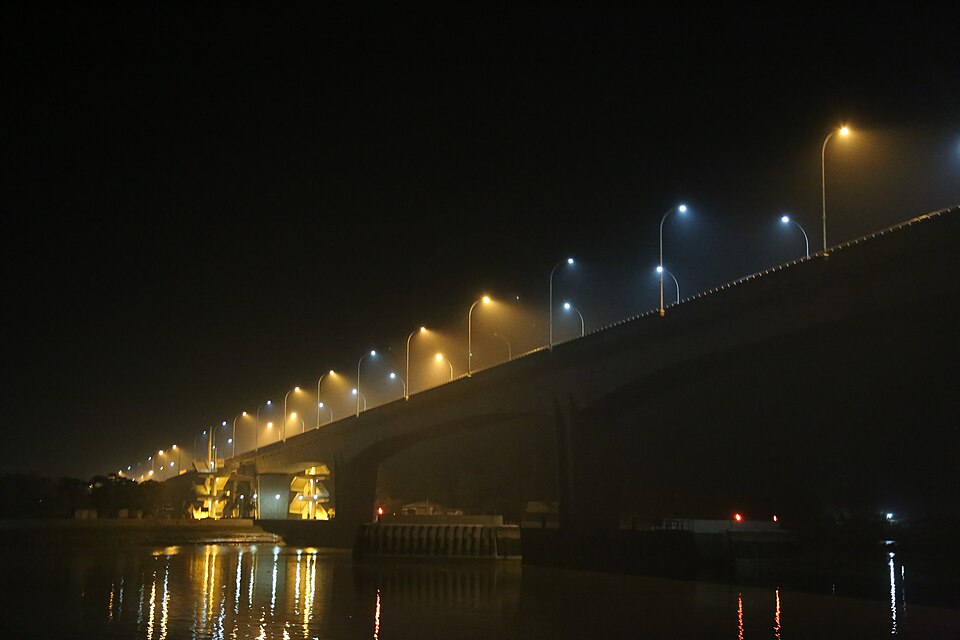 Khan Jahan Ali Bridge (Rupsa Bridge)Urban / day trips · Khulna, Khulna
A 1.6 km bridge over the Rupsa River opened in 2005, known as the gateway of Khulna. The bridge ends and river ghats are a popular spot for evening views. It lies on the route toward Mongla and the Sundarbans.
Directly confirmed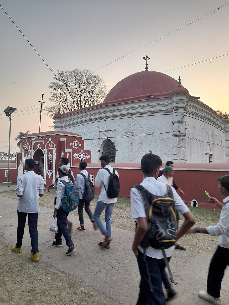 Mazar of Khan Jahan AliHistoric · Bagerhat, Khulna
Mausoleum of the 15th-century Sufi saint-ruler Khan Jahan Ali, founder of the Mosque City of Bagerhat. The tomb stands on the bank of one of his historic water tanks and remains a major pilgrimage site. It is within walking distance of the Sixty Dome Mosque, with local stalls around the shrine.
Directly confirmed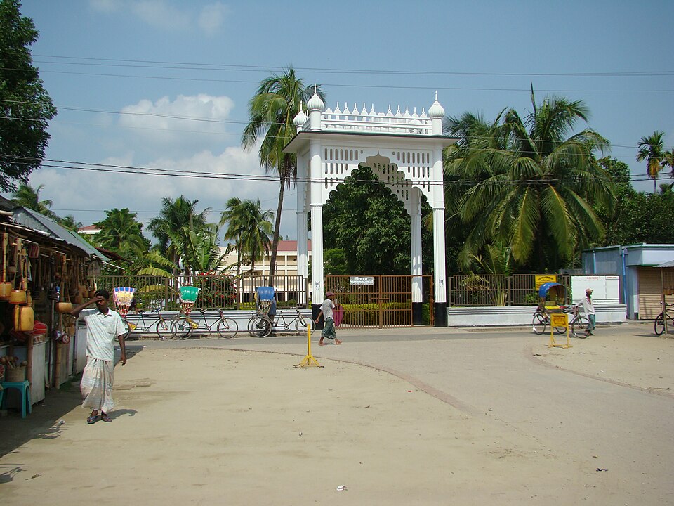 Lalon Akhra (Shrine)Historic · Kushtia, Khulna
The akhra and tomb of the Baul master Fakir Lalon, about 2 km from Kushtia railway station. He was buried at the centre of his own akhra, and a mausoleum with a research centre was built there in 1963. Twice-yearly festivals (Dol Purnima and his October death anniversary) draw thousands of devotees and Baul singers.
Directly confirmed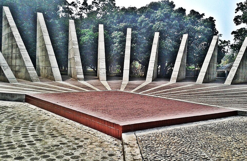 Mujibnagar Memorial ComplexHistoric · Meherpur, Khulna
The site where Bangladesh's first provisional government was sworn in on 17 April 1971, with Baidyanathtala renamed Mujibnagar. A memorial complex of about 20 acres includes 23 pillars representing the 23 years of Pakistani rule and a red-brick square marking the oath spot. The central destination for Liberation War heritage visits.
Directly confirmed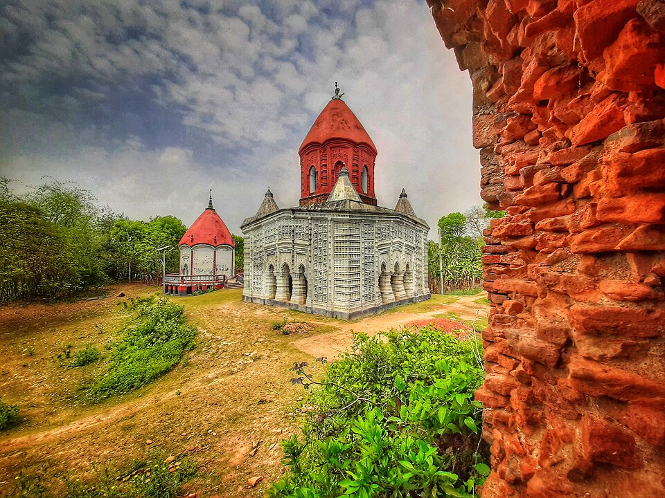 Naldanga RajbariHistoric · Jhenaidah, Khulna
The residence and temple complex of the Naldanga raj family in Kaliganj upazila, a reminder of medieval Bengali temple architecture and listed among the district places of interest. Some structures survive through government restoration; others are ruins.
Community-reported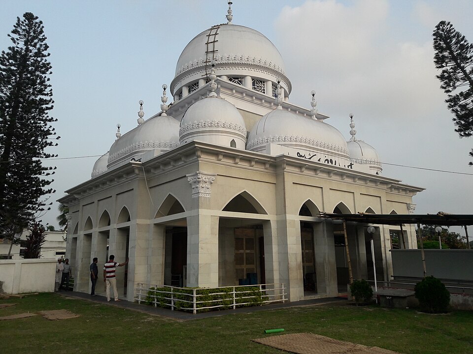 Nalta SharifHistoric · Satkhira, Khulna
Nalta Sharif in Kaliganj, Satkhira is the birthplace and memorial centre of Khan Bahadur Ahsanullah (r), an educationist and religious reformer of undivided Bengal. A large complex has grown around his shrine with a mosque, madrasa, schools, a college and health-service facilities. It is a well-known pilgrimage destination in the region.
Community-reportedNij Nanduali Shiv TempleHistoric · Magura, KhulnaAn old Shiva temple in Nijnanduali village, Magura, described by the source as a distinctive monument of heritage, history and architecture. Reachable as a day trip from Magura town. Check the temple's current condition locally before going.
Community-reported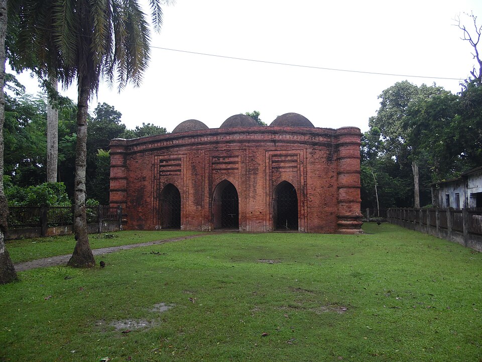 Nine Dome MosqueHistoric · Bagerhat, Khulna
A 15th-century mosque built under Khan Jahan Ali's governorship, with one large central dome ringed by eight smaller domes. Terracotta floral scrolls decorate the mihrab wall. It falls naturally on a half-day heritage route with the Sixty Dome Mosque and the mazar.
Directly confirmed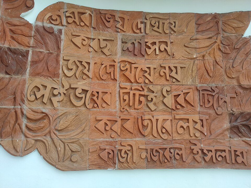 Tomb of Pagla KanaiHistoric · Jhenaidah, Khulna
The tomb of Pagla Kanai, the 19th-century folk (Baul-style) singer and lyricist, in Jhenaidah Sadar. Local visitors treat it as the district's cultural memorial. Being inside town, access is easy.
Community-reported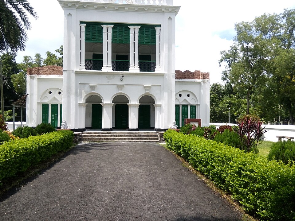 Rabindra Complex, DakkhindihiHistoric · Khulna, Khulna
The former residence of Beni Madhab Roy Chowdhury, Rabindranath Tagore's father-in-law, which the poet visited; the Department of Archaeology later declared it a protected site and converted it into a museum. A quiet heritage stop that works as a half-day trip from Khulna city.
Community-reported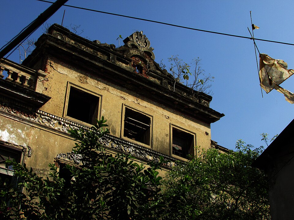 Radha Raman Smriti Tirtha Mandir, DebbhogHistoric · Narail, Khulna
The temple at Debbhog founded by Shri Tribhanga Brahmachary, described in the district record as a prominent place to visit. It is known locally as a religious pilgrimage spot. An easy half-day outing from Narail town.
Community-reported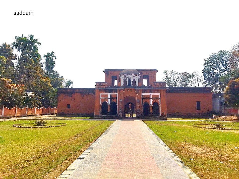 Raja Sitaram Ray's HomesteadHistoric · Magura, Khulna
Ruins of the homestead of the zamindar Raja Sitaram Ray on the Madhumati riverbank, about 25 km southeast of Magura town per the source description. Combines riverine scenery with local history. The site is not well maintained, so ask locally for the way.
Community-reported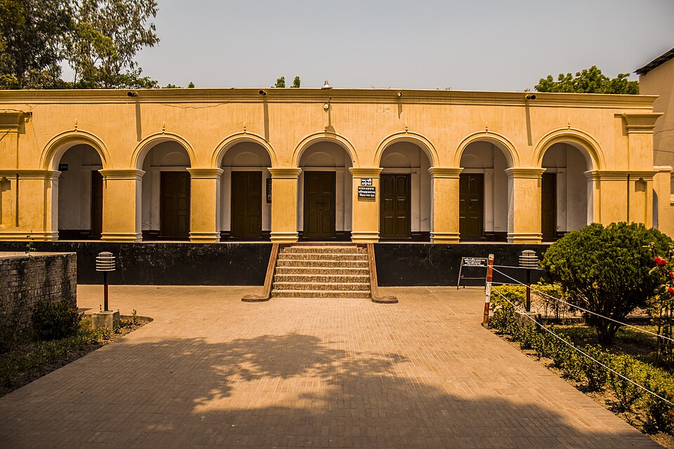 Sagardari and Madhu PalliHistoric · Jashore, Khulna
Birthplace of the epic poet Michael Madhusudan Dutt, on the Kopotaksho river in Keshabpur upazila. His ancestral house, Modhu Palli, is preserved there, and an annual fair organised by the district council is held on his birthday. A literary-historic stop combined with rural riverside scenery.
Community-reported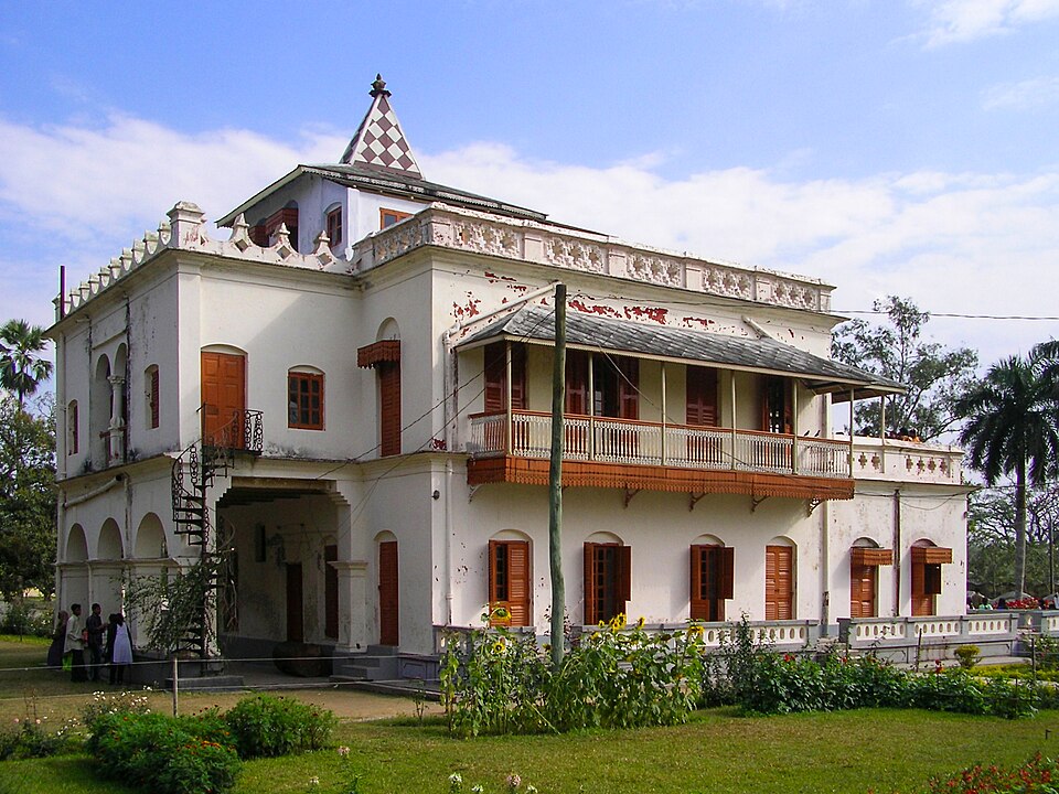 Shilaidaha KuthibariHistoric · Kushtia, Khulna
The Tagore family's estate country house where Rabindranath Tagore spent part of his life, wrote many memorable poems and in 1912 began translating Gitanjali into English, work that earned him the Nobel Prize. The restored Kuthi Bari now operates as the Tagore Memorial Museum under the Department of Archaeology. One of the main draws of a Kushtia trip.
Directly confirmed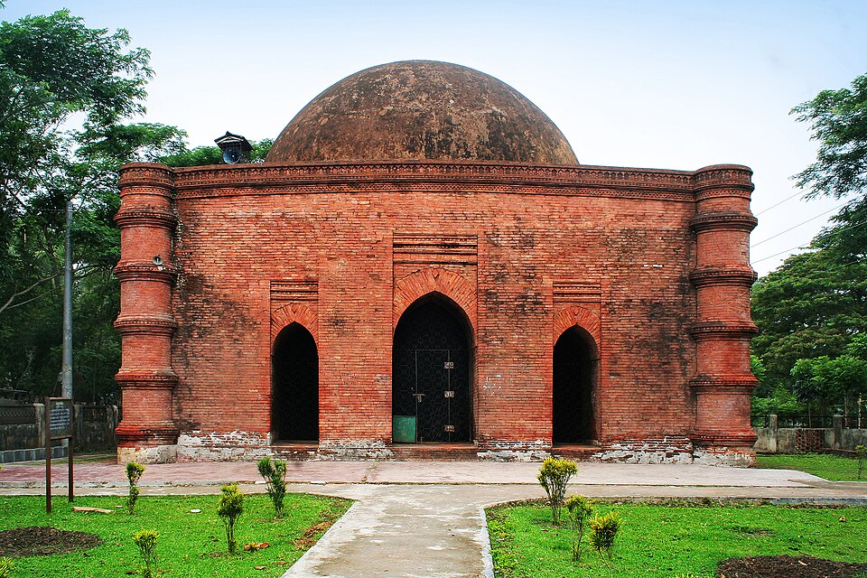 Singair MosqueHistoric · Bagerhat, Khulna
A square, single-domed 15th-century brick mosque about 200 m southeast of the Sixty Dome Mosque. Thick 2.1 m walls, a curved cornice and terracotta ornamentation are its hallmarks. Easy to add to any Mosque City visit.
Directly confirmed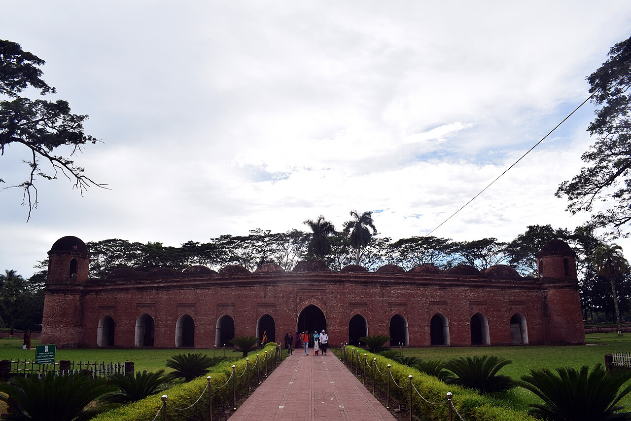 Sixty Dome MosqueHistoric · Bagerhat, Khulna
The most famous Sultanate-era mosque of Bengal, built in the 15th century by Khan Jahan Ali; part of the UNESCO World Heritage Site 'Mosque City of Bagerhat' since 1985.
Community-reportedS.M. Sultan Memorial MuseumHistoric · Narail, KhulnaMemorial museum of the painter S.M. Sultan, born in what is now Narail district, holding his works; his paintings are also kept in major collections including the Bangladesh National Museum and the National Art Gallery. Sultan's farmer-centred imagery draws directly on Narail's river and village landscape. The district's main attraction for art lovers.
Community-reported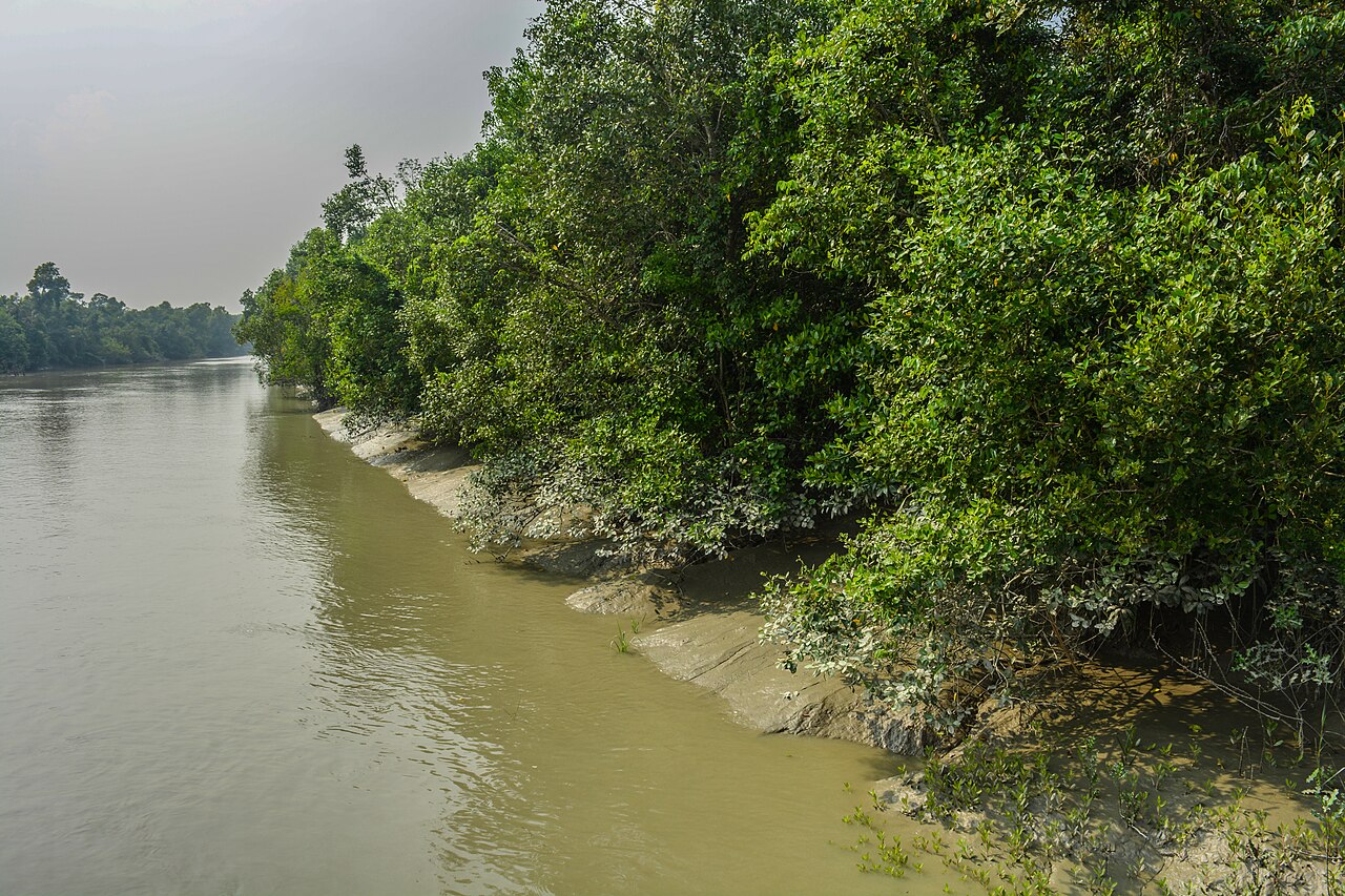 SundarbansNature & forests · Khulna, Khulna
The world's largest mangrove forest; home of the Royal Bengal Tiger and a UNESCO World Heritage Site. Explored by boat through a network of creeks and channels.
Community-reported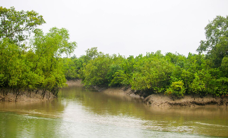 Sundarbans West Wildlife SanctuaryNature & forests · Satkhira, Khulna
The westernmost of the three core wildlife sanctuaries making up the Sundarbans UNESCO World Heritage property; habitat to tiger, spotted deer, fishing cat and estuarine crocodile among roughly 40 mammal, 260 bird and 35 reptile species. Leisure visitors reach it via licensed boat tours operating from the Shyamnagar/Burigoalini side. Core-area access rules change over time - check current Forest Department rules before planning.
Directly confirmedMymensingh (ময়মনসিংহ)
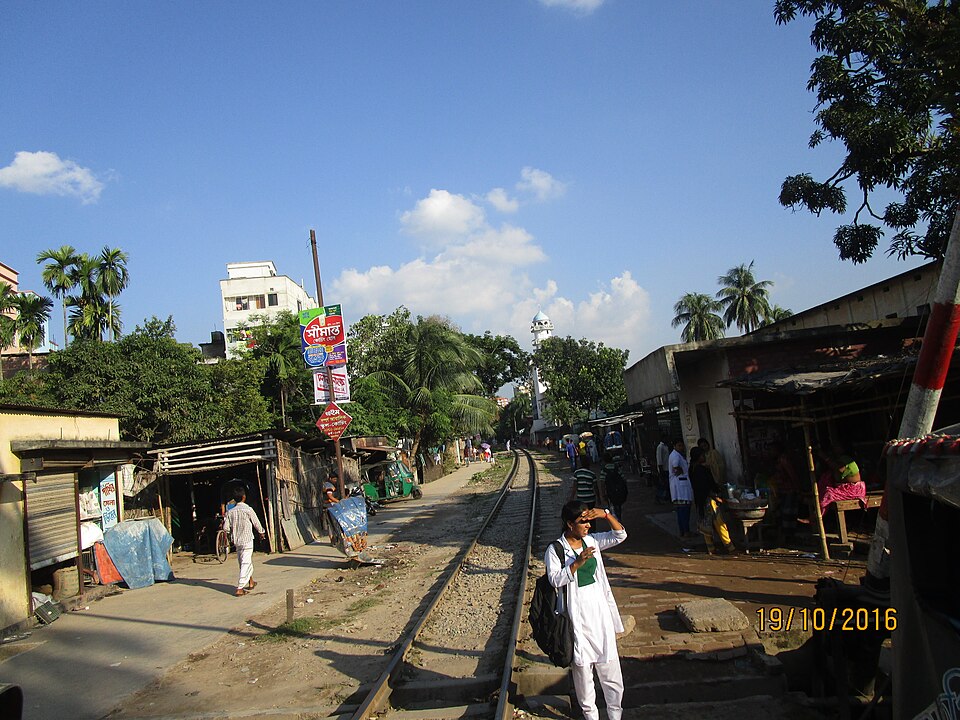 Bahadurabad GhatHistoric · Jamalpur, Mymensingh
A historic rail-ferry terminal on the Jamuna River: in 1912 the railway line was extended from Jamalpur to Bahadurabad Ghat, from where rail ferries crossed to Tistamukh Ghat. The station on the Narayanganj-Bahadurabad Ghat line is now defunct, but the riverside setting and railway heritage still draw history-minded visitors. It is listed among the notable historical sites of Jamalpur district.
Directly confirmed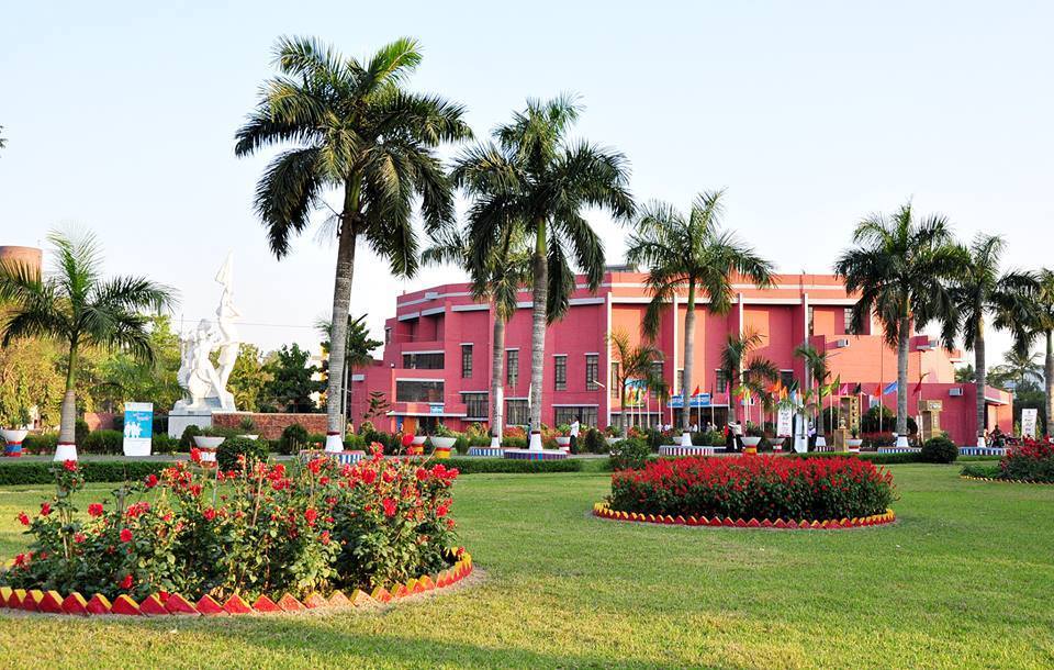 Bangladesh Agricultural University campus and Fish MuseumNature & forests · Mymensingh, Mymensingh
The 1,200-acre riverside campus of Bangladesh Agricultural University, founded on 18 August 1961 on the west bank of the Old Brahmaputra about 5 km southeast of the city centre. Its tree-lined roads, open fields and river bank make it a popular walking and cycling escape for townspeople. The campus also hosts the Fish Museum & Biodiversity Center (FMBC), a small but worthwhile stop.
Directly confirmed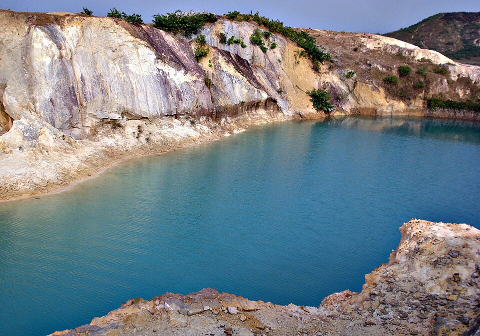 Bijoypur China Clay Hills and Blue LakeNature & forests · Netrokona, Mymensingh
Bangladesh's main china clay deposit, identified by geological survey in 1957, where hills of layered black, reddish, brown and bluish clay and a lake formed by mining have become a popular tourist destination. Extraction was halted by court order in 2016 on environmental grounds, but visits to the hills and blue lakes continue. On the way, the ornately carved Kullagora temple is worth a look.
Directly confirmed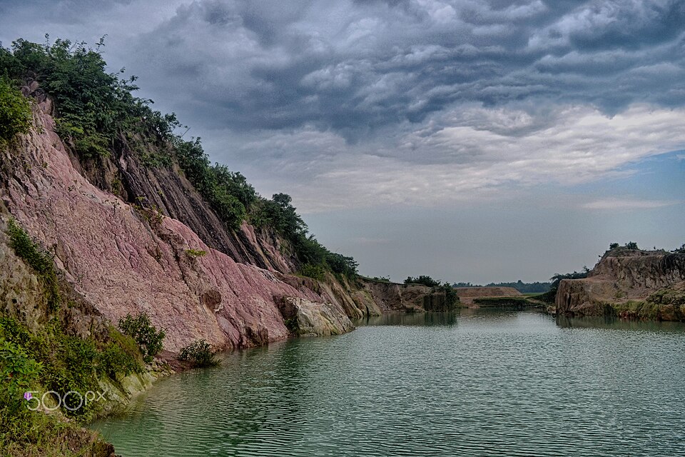 Birishiri and the China Clay HillsHills · Netrokona, Mymensingh
The village of Birishiri on the Someshwari River at the foot of the Garo Hills, with the striking white and multi-coloured china clay hills, is the most popular tourist attraction of Netrokona district. One trip can combine the clay cliffs and clear winter-blue river with the Birishiri Tribal Cultural Academy, Sagar Dighi (Kamala Rani's pond), Durgapur Rajbari and a boat crossing to Ranikong Mission. Much of the local population is Garo and Hajong indigenous, giving the area a distinct cultural character.
Directly confirmed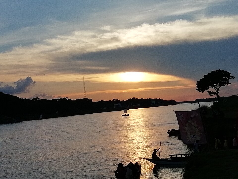 Chorpara Moor and the Old Brahmaputra riverfrontUrban / day trips · Mymensingh, Mymensingh
The stretch of the Old Brahmaputra River along the northern edge of Mymensingh town, centred on the busy Chorpara Moor crossing. The riverbank is the city's classic evening promenade and lies close to Ganginarpar Road, Town Hall Moor and Zero Point. Bipin Park, a small park near Boro Bazaar, gives direct access to the river, and the Bangladesh Agricultural University campus is visible across the water.
Community-reported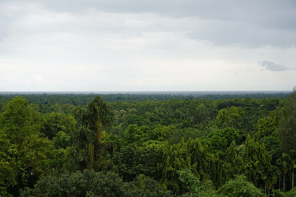 Gajni Recreation CentreNature & forests · Sherpur, Mymensingh
A recreation centre of about 90 acres built in 1993 by the Sherpur district administration at the foot of the Garo Hills, with India's Meghalaya to the north. Sal, teak and gajari forest, hill paths and picnic grounds are its attractions, and it appears in the district's list of points of interest.
Directly confirmedGandhi Ashram, JamalpurHistoric · Jamalpur, MymensinghThe historic Gandhi Ashram, founded in 1934, stands on the bank of the Jhenai River about 15 km from Jamalpur town, carrying the memory of Gandhi-inspired rural reconstruction and social work of that era. The calm riverside setting is its main draw today. Check the current condition of the buildings locally before planning a dedicated visit.
Community-reportedLauchapara Recreation CentreNature & forests · Jamalpur, MymensinghA popular picnic and recreation spot in Baksiganj Upazila, 50 km north of Jamalpur Sadar, set among hills, forest and a lake. The hill-forest-lake scenery of Lauchapara makes it a known getaway for visitors from within the district. It is busiest during the winter picnic season.
Community-reported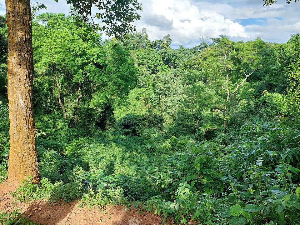 Madhutila Eco ParkNature & forests · Sherpur, Mymensingh
A 380-acre deep green forest and eco park established in 1999 at the foot of the Garo Hills, close to the Bangladesh-India border. Hill trails, birdwatching and the view from the watchtower are the main draws, with picnics popular on winter days. It is one of the best-known natural attractions of Sherpur district, listed in the district's official heritage records.
Directly confirmed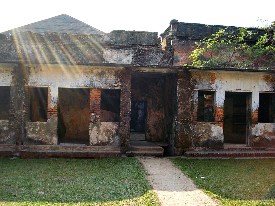 Muktagachha Zamindar BariHistoric · Mymensingh, Mymensingh
The Rajbari of the Brahmin zamindar family of Muktagachha, roughly 20-25 km west of Mymensingh town, now partly used as Shahid Smrity College and falling into ruin for lack of care. A 200-year-old twin Shiva Temple stands just outside the zamindar house, where Durga Puja is still celebrated. The town is also famous for its traditional sweetmeat, Monda, which makes an easy half-day trip combined with the palace.
Directly confirmed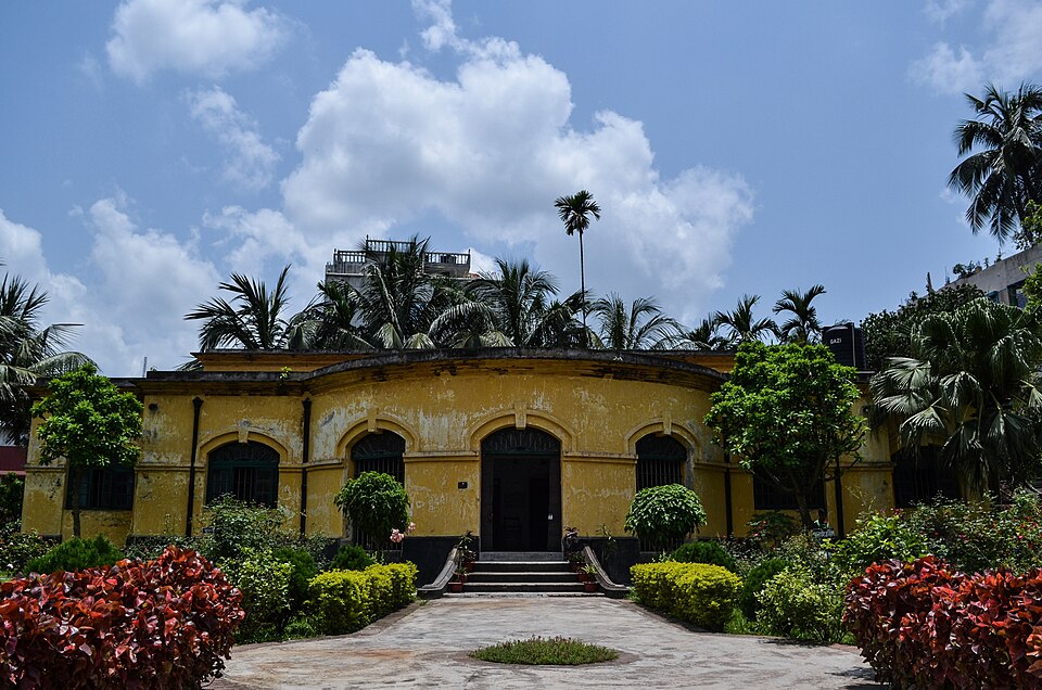 Mymensingh MuseumUrban / day trips · Mymensingh, Mymensingh
One of Bangladesh's older museums, established in 1969 at the initiative of the then Deputy Commissioner and housed in the Baganbari (garden house) of zamindar Madan Babu. Its initial 214 items were collected from the palaces of Mymensingh district zamindars, including stone vases and antique clocks from Muktagacha, elephant heads and Italian statues from Gouripur, and manuscripts and coins. The museum has been noted to lack modern preservation facilities, so treat it as a short heritage stop.
Directly confirmed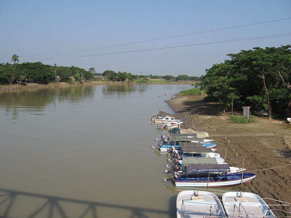 Someshwari RiverNature & forests · Netrokona, Mymensingh
A trans-boundary river originating in the Nokrek Range of Meghalaya (where it is called Simsang), flowing through Susang-Durgapur in Netrokona until it joins the Kangsha River; it is the longest river of the Garo Hills region. In winter its water turns clear and blue, and the river running past the china clay hills forms the classic Birishiri view. Local boats ferry visitors across to Bijoypur and Ranikong.
Directly confirmed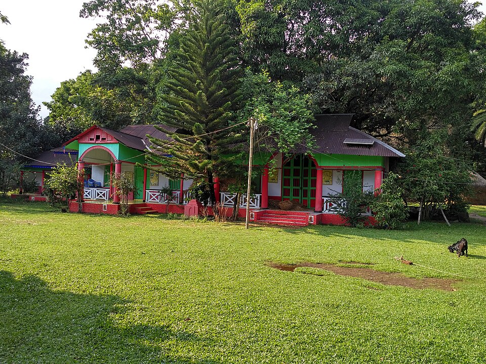 Susang Durgapur Rajbari and Sagar DighiHistoric · Netrokona, Mymensingh
In the old riverside town of Susang Durgapur stand the Durgapur Rajbari — known as the residence of the last Pal king — and Sagar Dighi, also called Kamala Rani's pond, whose south-western bank still survives. Mattagorh and the Tribal Cultural Academy can be visited on the same walk. These sights are why Durgapur has earned a solid reputation among tourists.
Directly confirmed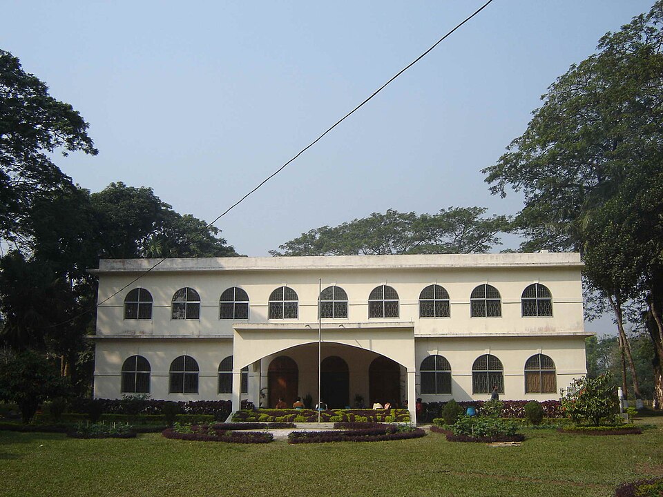 Zainul Abedin SangrahashalaUrban / day trips · Mymensingh, Mymensingh
An art museum established on 15 April 1975 as a branch of the Bangladesh National Museum, holding the collection of artist Shilpacharya Zainul Abedin (1914-1976), a pioneer of modern art in Bangladesh. Displays include 53 oil paintings, replicas, photographs of his life, and personal mementos such as brushes and his spectacles; much of the work depicts rural Bengal and the 1943 Bengal famine. The riverside grounds include an art school, an Art Cottage for visiting artists, and an open-air stage, with an anniversary programme held every December.
Directly confirmedRajshahi (রাজশাহী)
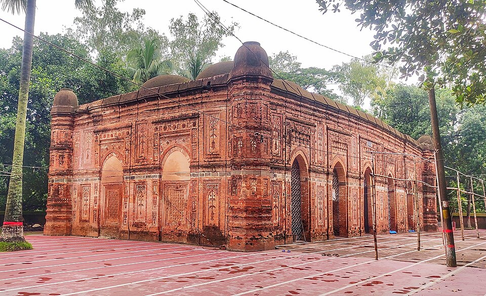 Bagha MosqueHistoric · Rajshahi, Rajshahi
One of the finest surviving Bengal Sultanate mosques, built in 930 AH (1523/24 CE) by Sultan Nasiruddin Nasrat Shah. Walls inside and out carry terracotta floral and fruit motifs; the mosque has ten domes beside an old lake, rebuilt after the 1897 earthquake destroyed the originals. It is still used for worship.
Community-reported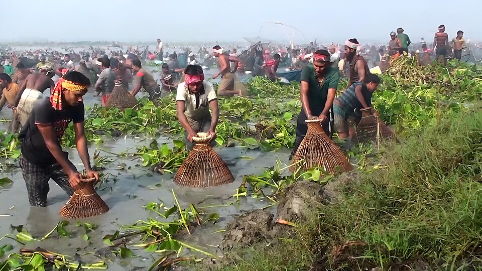 Chalan BeelNature & forests · Natore, Rajshahi
The largest wetland of northwest Bangladesh — about 40% in Natore, 35% in Sirajganj and 25% in Pabna. Winter brings migratory birds and the monsoon brings open water for country-boat trips; forty-seven rivers and waterways feed the beel, the Atrai being the main inflow. It is a region, not a single site — visit from Singra/Gurudaspur (Natore), Tarash (Sirajganj) or Bhangura (Pabna) with a locally hired boat.
Community-reportedChapainawabganj Mango OrchardsNature & forests · Chapainawabganj, RajshahiChapainawabganj is Bangladesh's mango heartland, with vast orchards of Himsagar, Langra, Fazli and Gopalbhog across the district. Between May and August — peaking around June — visitors walk the orchards, meet growers and eat mangoes straight off the tree. Orchards around the district town and Kansat are the easiest to reach.
Community-reported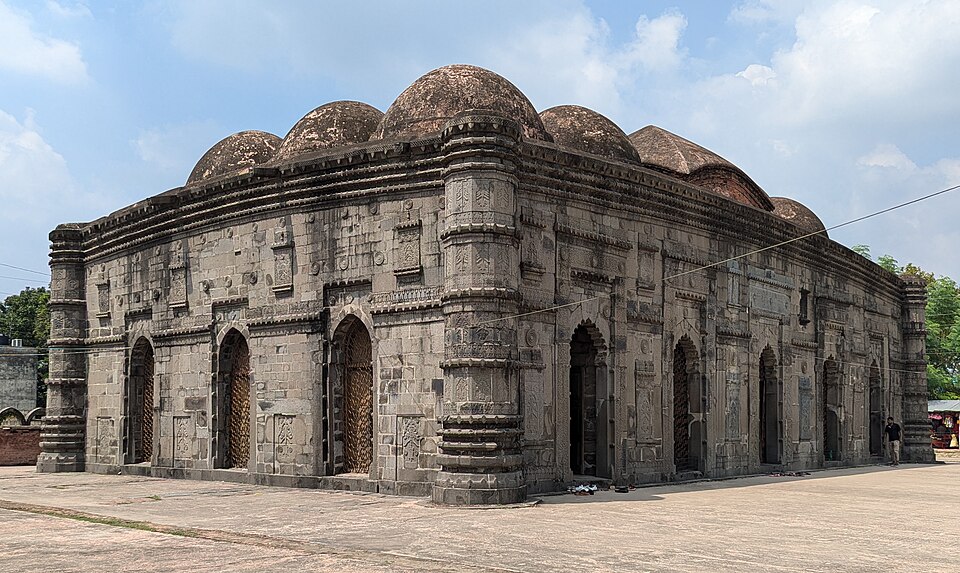 Choto Sona MosqueHistoric · Chapainawabganj, Rajshahi
Built under Sultan Alauddin Husain Shah (1493–1519), this is among the finest pre-Mughal monuments of Bengal. Its brick-and-stone structure takes its 'golden' name from domes once gilded; visitors see carved stonework, glazed tiles and fifteen original dome positions. It is the anchor sight of a Gaur-area day trip from Chapainawabganj town.
Community-reported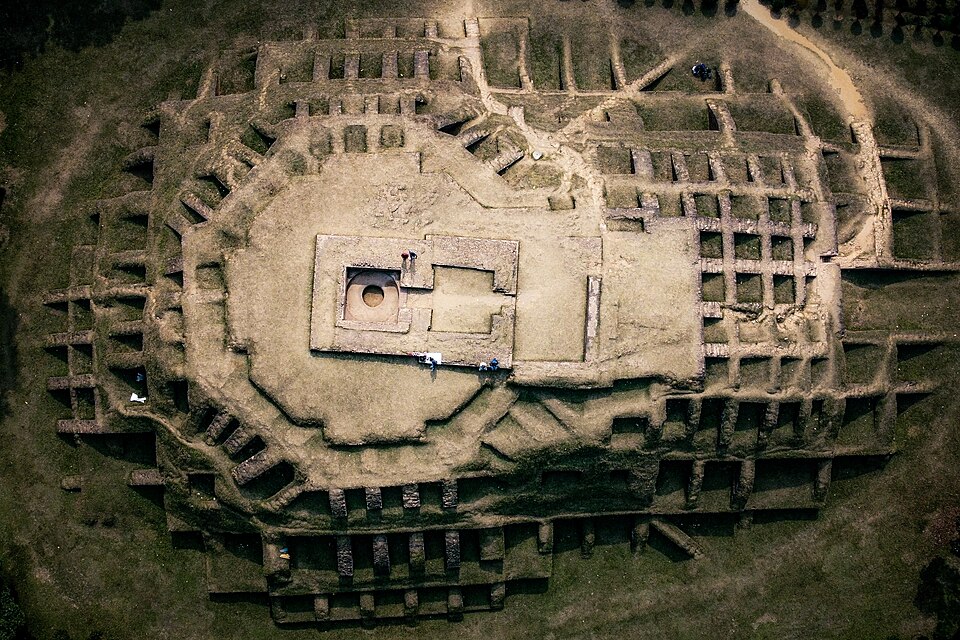 Gokul Medh (Behular Basor Ghar)Historic · Bogura, Rajshahi
An excavated stupa base about 2 km southwest of the Mahasthangarh citadel, known in folklore as Behula's bridal chamber. Excavation in 1934–36 revealed a terraced base of 172 blind cells rising in tiers, with later temple remains on top. Include it in the same half-day loop as Mahasthangarh.
Community-reported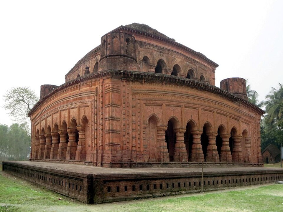 Hatikumrul Navaratna TempleHistoric · Sirajganj, Rajshahi
The largest of the navaratna (nine-spired) temples discovered in Bangladesh — a three-storeyed brick structure sheathed in terracotta, named for the nine crowns on its roof. Locally called 'Dolmancha', it is a Department of Archaeology protected site with three more old temples nearby. A half-day trip via Ullapara from Sirajganj or Bogura.
Community-reported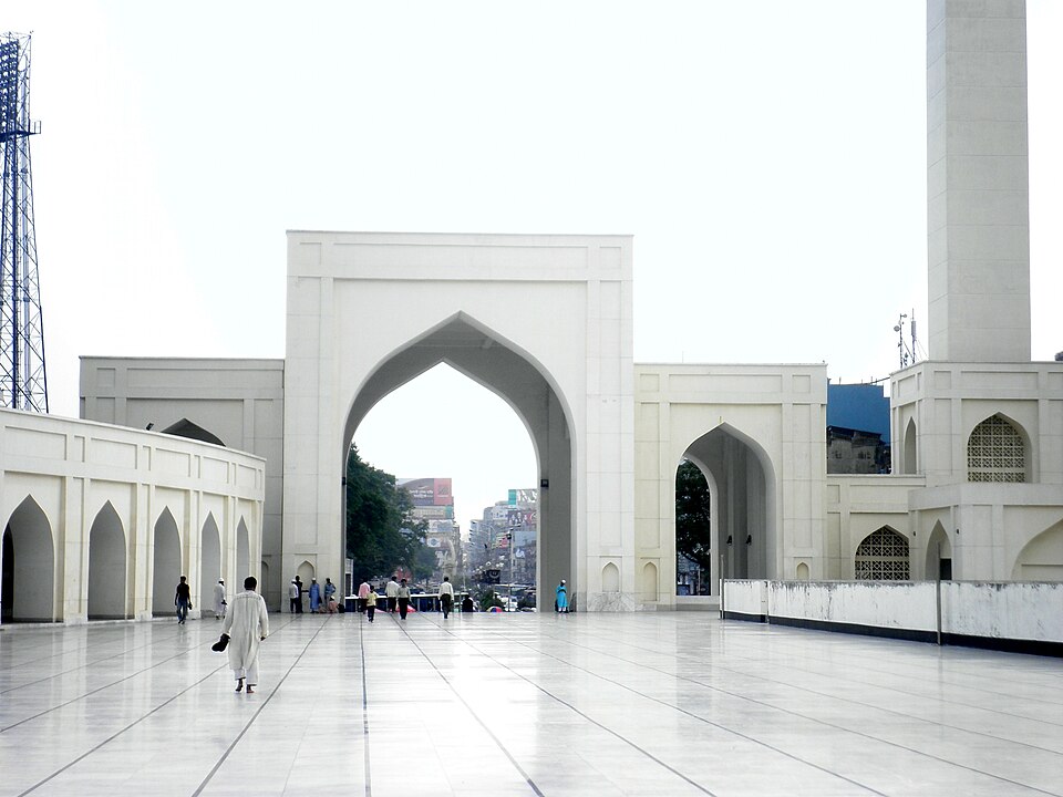 Hinda-Kosba Shahi MosqueHistoric · Joypurhat, Rajshahi
Joypurhat's best-known monument, built in 1958 to a design by Pir Abdul Gafur Chishti in a Mughal-inspired style — five domes, a 40-foot minaret, and walls decorated with glass, broken porcelain and mosaic. It stands about 16 km from the district town. Despite the 'Shahi' name, this is 20th-century architecture, not a Mughal-era monument.
Directly confirmed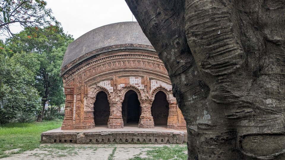 Jor Bangla Temple, PabnaHistoric · Pabna, Rajshahi
A heritage temple in the classic Jor-bangla style of Bengal, standing inside Pabna town — two hut-like curved roofs, one serving as a porch in front of the shrine. Being in the town centre, it is an easy rickshaw stop combined with the town's other sights.
Community-reported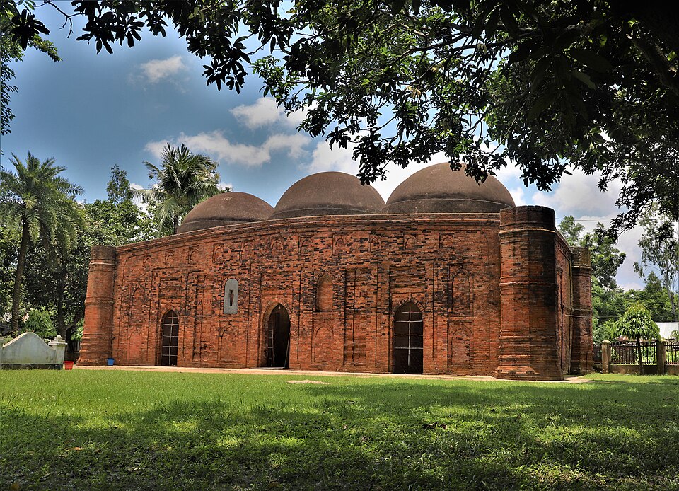 Kherua MosqueHistoric · Bogura, Rajshahi
An early Mughal-era three-domed mosque completed in 1582 AD (989 AH) by Nawab Mirza Murad Khan, still in use for daily prayers. Its brick-and-stone design is simple but elegant, and its closeness to Bogura town makes it an easy add-on to a Mahasthangarh trip.
Community-reported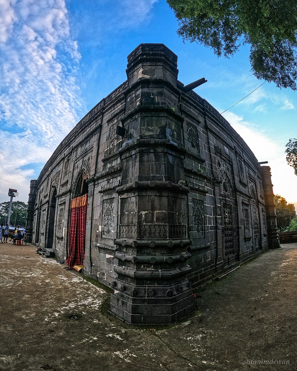 Kusumba MosqueHistoric · Naogaon, Rajshahi
A Suri-period mosque completed in 1559, nicknamed 'the Black Gem of Bangladesh' for its dark stone. Visitors come for its carved arches, mihrabs and domed prayer hall; it was damaged in the 1897 earthquake but survives as a protected national heritage site. It pairs well with a half-day trip from Naogaon town.
Community-reported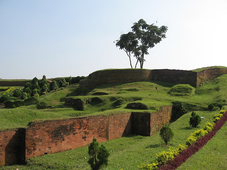 MahasthangarhHistoric · Bogura, Rajshahi
Bangladesh's earliest urban archaeological site — the fortified city of Pundranagara, inhabited from at least the 3rd century BCE. Visitors walk the long earthen ramparts, the riverside Govinda Bhita and the site museum by the Karatoya; allow several hours. It lies about 11 km north of Bogura town on the Bogura–Rangpur highway.
Community-reported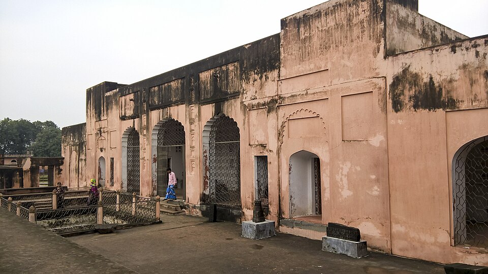 Mughal TahakhanaHistoric · Chapainawabganj, Rajshahi
A three-storied retreat built by Shah Shuja, son of Emperor Shah Jahan and Subahdar of Bengal, in honour of his spiritual mentor Shah Syed Niyamatullah — the name means 'cool palace'. The complex includes a hammam, a mosque and a tomb, and is protected by the Department of Archaeology. It lies close to Choto Sona Mosque, so the two are visited together.
Community-reported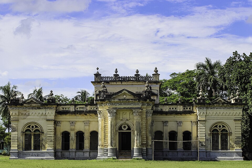 Natore RajbariHistoric · Natore, Rajshahi
The seat and residence of the Rajshahi Raj zamindar family, a set of palace blocks spread over roughly 50 acres. The celebrated Rani Bhabani managed the estate and expanded the palace from here in the mid-1700s. Damaged in the 1897 earthquake and rebuilt, the blocks are walkable in a couple of hours.
Community-reported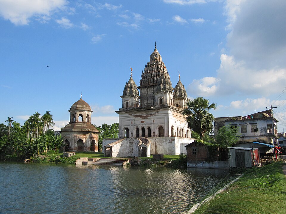 Puthia Temple ComplexHistoric · Rajshahi, Rajshahi
The largest cluster of historic Hindu temples in Bangladesh, built by the zamindars of the Puthia Raj family. The terracotta-decorated Pancha Ratna Govinda Temple, Bara Anhik, Jagannath (Rath) Temple and Bangladesh's largest Shiva temple stand around the Shyam Sagar lake, beside the 1895 Puthia Rajbari palace. It is the classic day trip from Rajshahi city.
Community-reported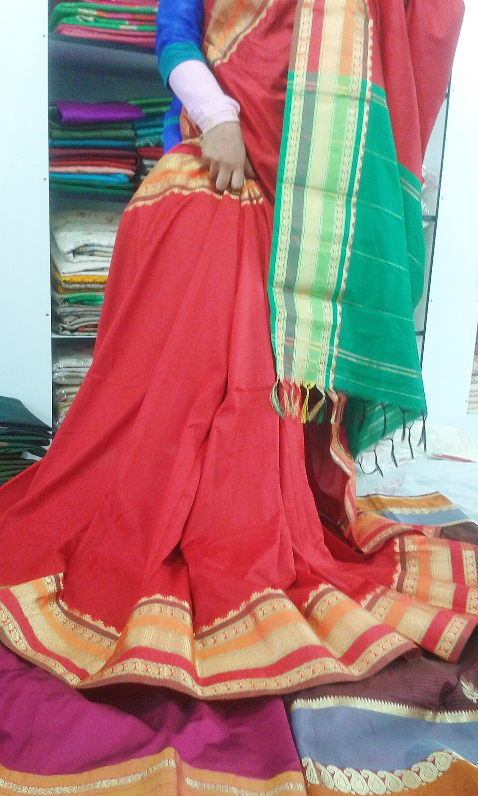 Rajshahi Silk HeritageUrban / day trips · Rajshahi, Rajshahi
Rajshahi has been a silk-weaving centre for centuries; Rajshahi silk received geographical indication (GI) status in 2021. Showrooms and handloom workshops in the city sell silk saris and three-piece sets directly to visitors. This is not a single monument but a city-wide craft tradition — allow half a day for shopping and workshop visits.
Community-reported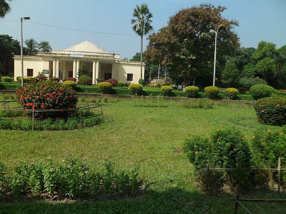 Rabindra Kachharibari, ShahjadpurHistoric · Sirajganj, Rajshahi
The revenue office of the Tagore family's estate, now the Rabindra Memorial Museum. Tagore stayed here repeatedly and wrote parts of Sonar Tori, Bishorjon and Chitra; the two-storey seven-room house displays his belongings. It is the centrepiece of a Sirajganj trip, combinable with Chalan Beel.
Community-reported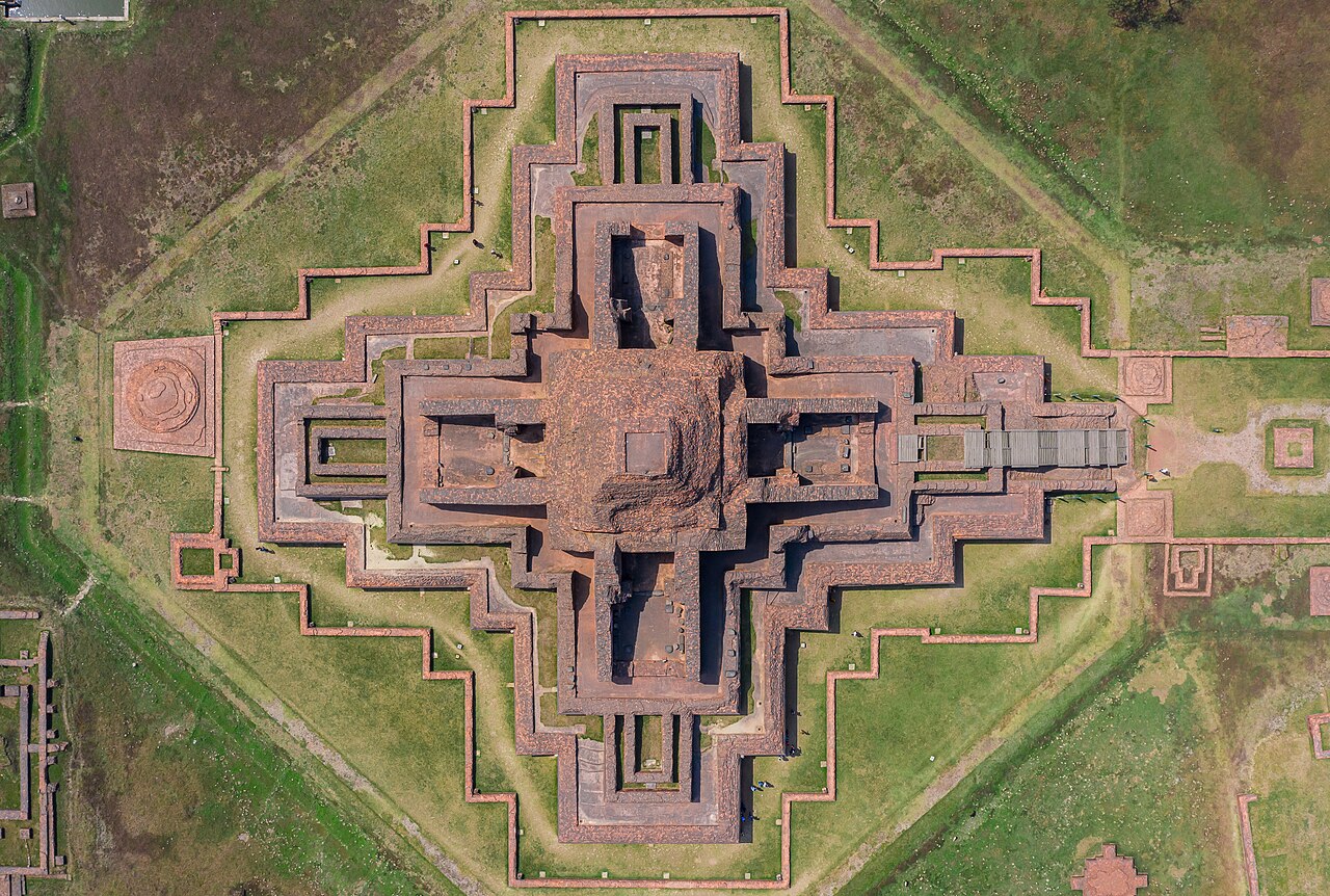 Somapura MahaviharaHistoric · Naogaon, Rajshahi
One of the largest Buddhist viharas in South Asia, built in the 8th century under the Pala dynasty; a UNESCO World Heritage Site since 1985. Famous for its remarkable terracotta plaques and central shrine.
Community-reported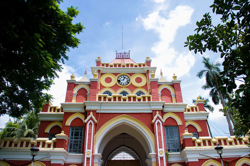 Uttara Ganabhaban (Dighapatia Palace)Historic · Natore, Rajshahi
An Indo-Saracenic royal palace built in 1734 by Raja Doyaram, Dewan of Rani Bhabani, known for its clocktower gate with an imported Italian clock and marble statues. Declared the official government residence for northern Bangladesh in 1972, a museum opened inside in 2018. Because it still serves a state function, check which parts are open to visitors before going.
Community-reported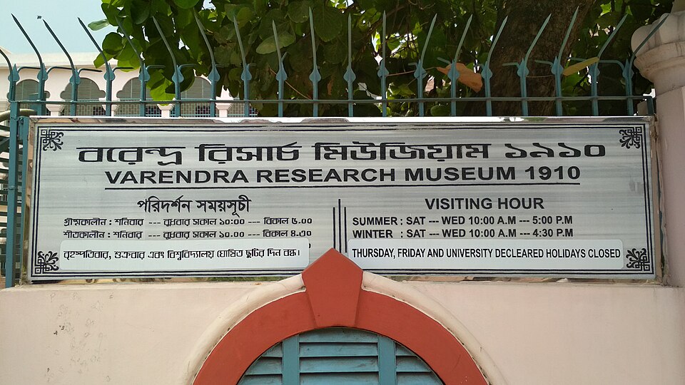 Varendra Research MuseumUrban / day trips · Rajshahi, Rajshahi
Founded in 1910, it is considered the oldest museum in Bangladesh. Its galleries hold Pala- and Sena-era Buddhist and Hindu stone sculpture from the Varendra region, inscriptions in Sanskrit, Arabic, Persian and old Bengali, and a gallery on indigenous and tribal culture. It sits inside Rajshahi city, so it fits easily into a half-day city itinerary.
Community-reportedRangpur (রংপুর)
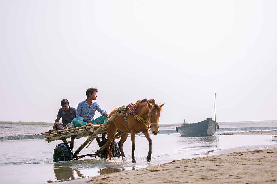 Balashi GhatNature & forests · Gaibandha, Rangpur
A historic ghat on the Brahmaputra at Kanchipara union, Fulchhari, about 8 km east of the district town, listed on the district administration's tourism page. Known for wide river views and sunsets.
Official source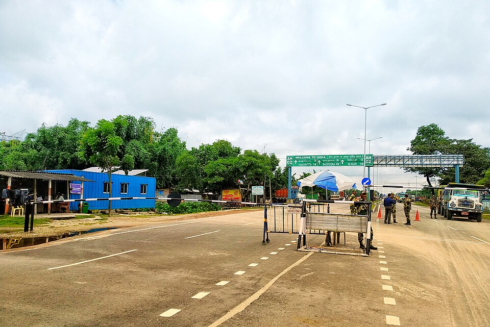 Banglabandha Zero PointNature & forests · Panchagarh, Rangpur
The northwestern tip of Bangladesh, where the Banglabandha land port was established to trade with India, Nepal and Bhutan. It sits 57 km north of Panchagarh town, near the Mahananda river bank with Himalayan foothills on the horizon — popular as the country's northernmost point.
Community-reported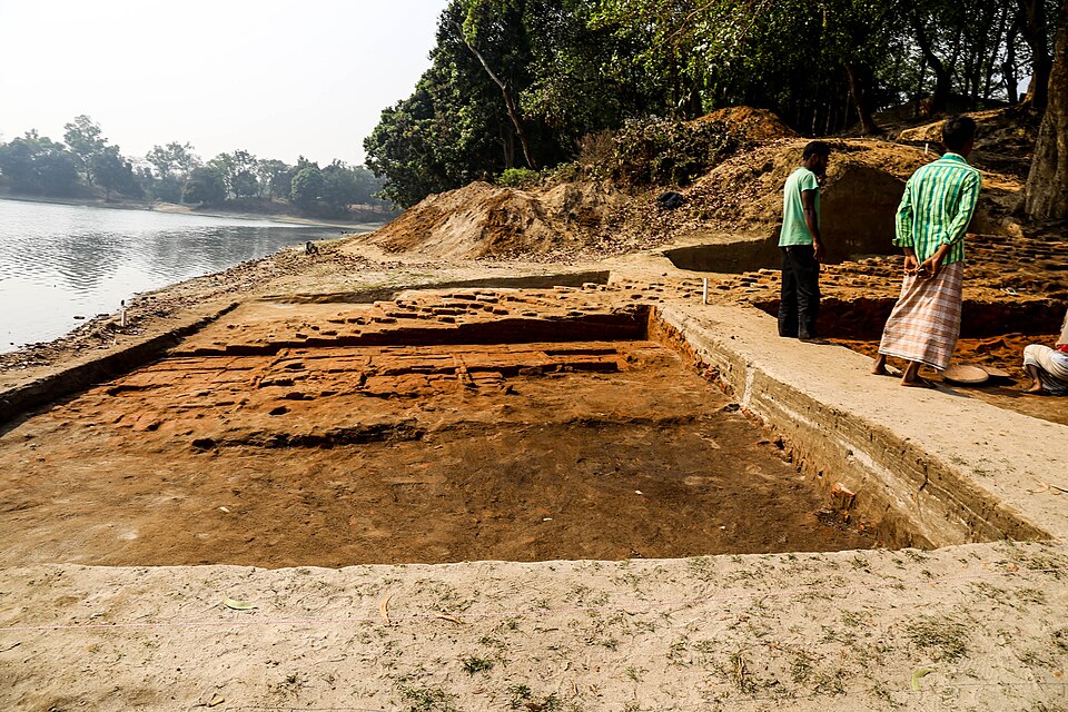 Bhitargarh Fort CityHistoric · Panchagarh, Rangpur
The remains of an ancient walled city built around the 5th century AD, spread over 25 sq km with four concentric quadrangles of ramparts. Described as the largest walled city-state of ancient northern South Asia — a significant stop for archaeology-minded travellers.
Community-reported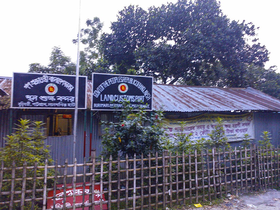 Burimari Land PortUrban / day trips · Lalmonirhat, Rangpur
A busy land port on the Bangladesh-India (West Bengal) border at Patgram, Lalmonirhat. The border gate, port infrastructure and the nearby Tin Bigha Corridor / Dahagram-Angarpota area draw curious visitors.
Official source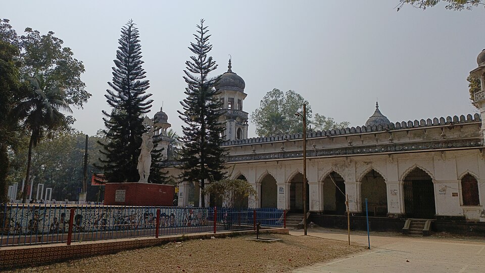 Carmichael College, RangpurUrban / day trips · Rangpur, Rangpur
A heritage public college in Rangpur, founded on 10 November 1916 and located about 4 km south of the town's zero point. Its 206-acre campus with old academic buildings, orchards and ponds is described as the biggest college in Bangladesh by area — a calm spot for an urban stroll.
Community-reported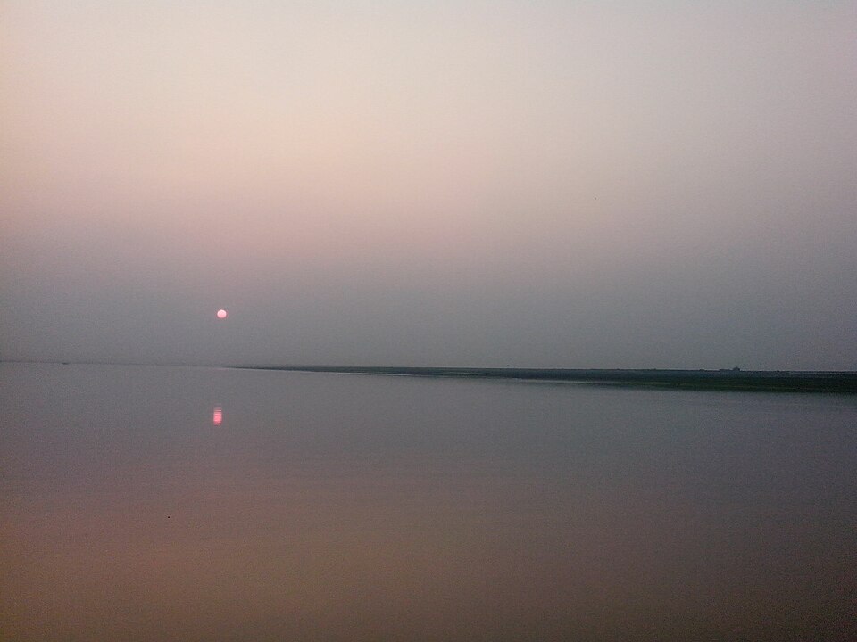 Char RajibpurNature & forests · Kurigram, Rangpur
A river-island upazila in the Brahmaputra-Jamuna floodplain where a third of the land is riverine, with scenic riverside villages and sandbars covered in kans grass. Bangladesh's first border haat at Bholarhat-Kalairchar is also here. Special for char exploration and river sunsets.
Community-reported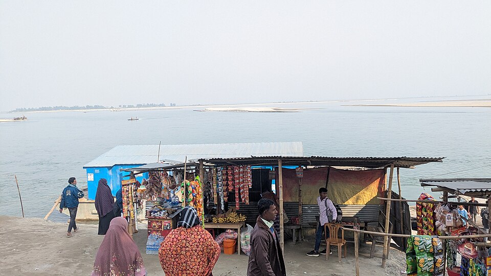 Chilmari River PortNature & forests · Kurigram, Rangpur
A historic river port on the Brahmaputra at Chilmari, included in the district administration's tourism list. Wide river vistas, launch traffic and sunsets make it the easiest gateway to Kurigram's Brahmaputra landscape.
Official source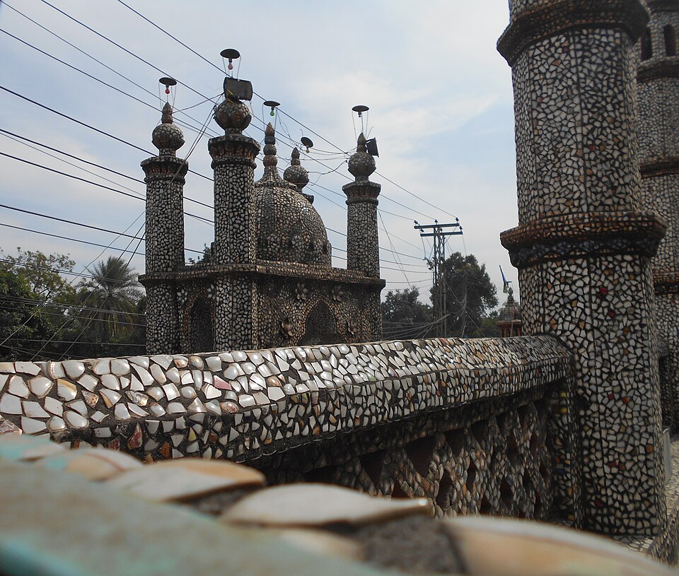 Chini Masjid (Glass Mosque), SaidpurHistoric · Nilphamari, Rangpur
A small, finely decorated mosque built in 1863 at Islambagh in Saidpur, known as the 'Chini (glass) Mosque' for its glass and coloured ornamentation. Easily combined with a walk through Saidpur's railway-heritage quarter.
Community-reportedDholar Hat TempleHistoric · Thakurgaon, RangpurTogether with Jamalpur Jame Mosque, one of the two archaeological structures in Thakurgaon district listed by the Department of Archaeology of Bangladesh — an ancient temple. Confirmed at district level by the cited source; verify the exact village location locally.
Community-reported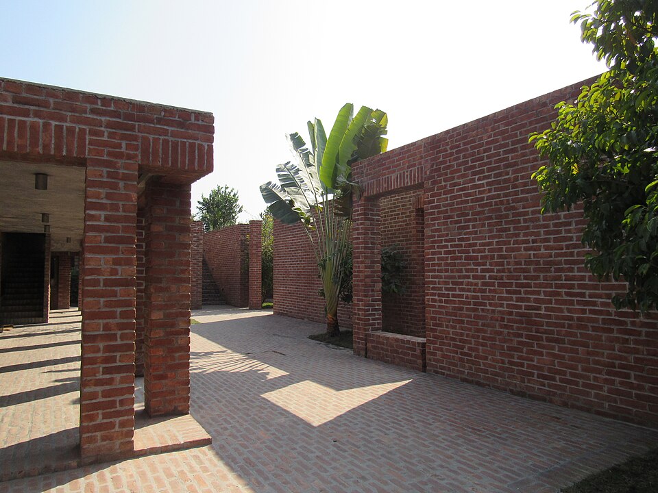 Friendship CentreHistoric · Gaibandha, Rangpur
A rural training and conference centre at Madanerpara, Kanchipara union, Fulchhari, internationally acclaimed for its architecture — architect Kashef Mahboob Chowdhury's design won the Aga Khan Award for Architecture in the 2014-16 cycle. It also appears on the district administration's tourism list.
Directly confirmed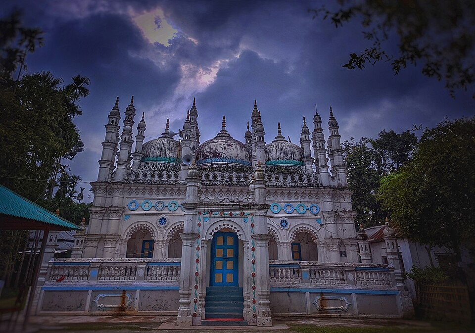 Jamalpur Jame MosqueHistoric · Thakurgaon, Rangpur
One of the two archaeological structures in Thakurgaon district listed by the Department of Archaeology of Bangladesh — an old heritage mosque. Its district-level listing is confirmed by the cited source, but the exact village location and coordinates should be verified locally before travel.
Community-reported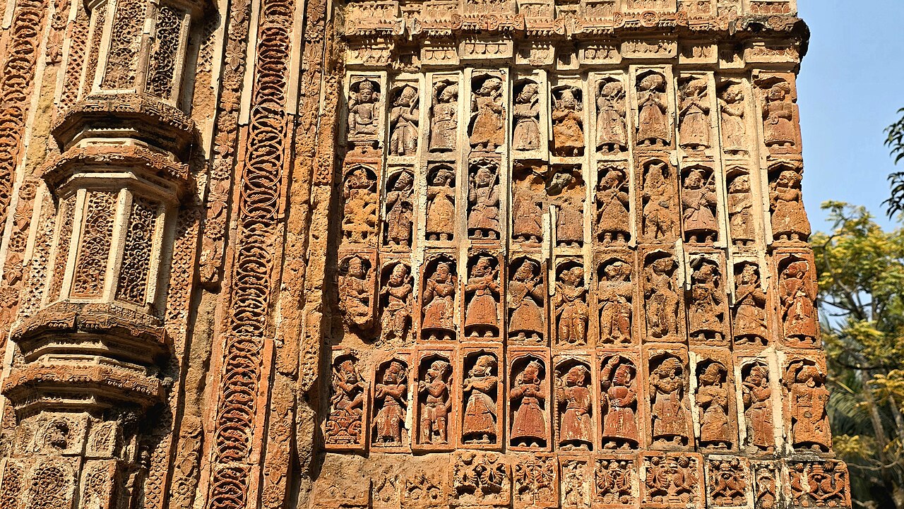 Kantajew TempleHistoric · Dinajpur, Rangpur
A navaratna Hindu temple built in the 18th century (during the reign of Nawab Alivardi Khan), famous for the most richly ornamented terracotta decoration in Bangladesh.
Community-reported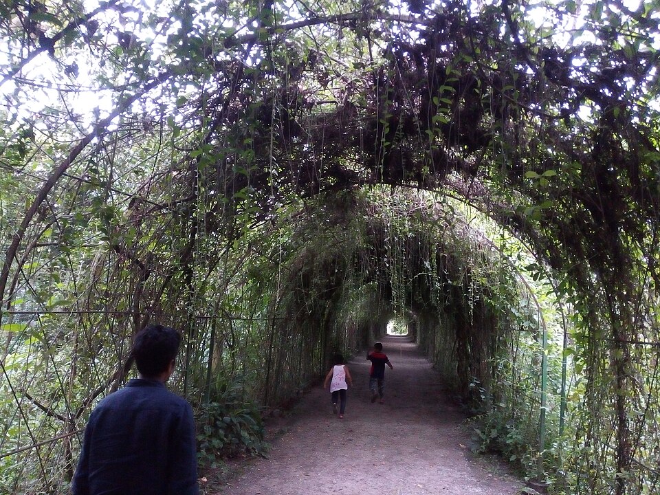 Kazi & Kazi Tea EstateNature & forests · Panchagarh, Rangpur
The celebrated organic tea garden spread across the flat green plains of Tetulia, about 45 km north of Panchagarh town and roughly 10 km south of Tetulia bazar — a symbol of Panchagarh's rise as a plains tea region. It is a working commercial estate and entry requires prior permission.
Community-reported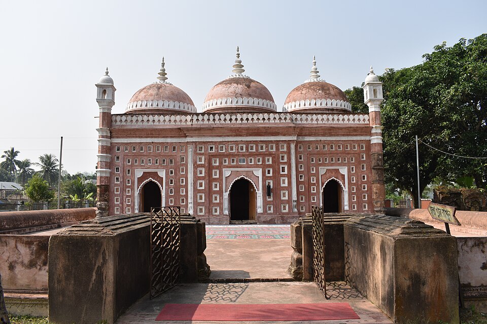 Nayabad MosqueHistoric · Dinajpur, Rangpur
A three-domed Mughal-era mosque (12.45 m x 5.5 m) built in 1793 CE beside the Dhepa River during the reign of Shah Alam II, with octagonal corner minarets and 1.1 m thick walls. It lies close to the Kantajew Temple route, so the two are easily combined in one trip.
Community-reported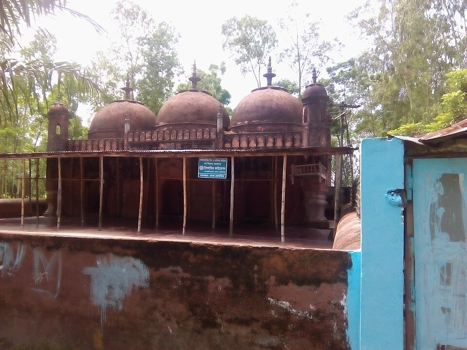 Nidaria MosqueHistoric · Lalmonirhat, Rangpur
A heritage mosque included in the Lalmonirhat district administration's tourism list, described as located in Kishamat Nagaibandh mouza, 2 km south of the Rangpur-Kurigram highway.
Official source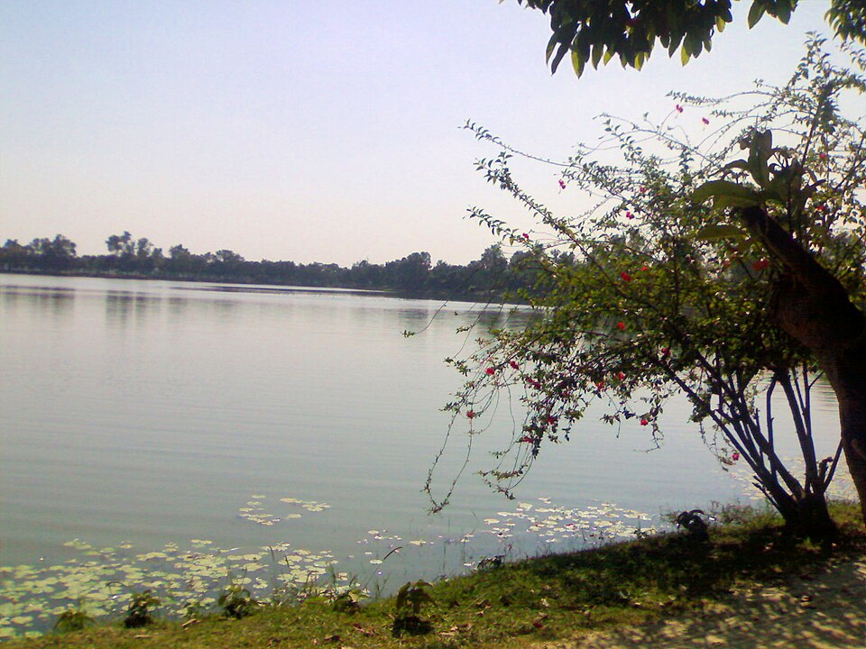 NilsagarNature & forests · Nilphamari, Rangpur
A large ancient pond of about 54 acres (32.70 acres water) at Gorgram union, 14 km north-west of Nilphamari district town, said to have been dug by the Vedic king Birat and renamed 'Nilsagar' in 1979 after the district. Popular in winter for birdwatching and picnics. (Note: contrary to common assumption, it lies in Nilphamari, not Dinajpur.)
Community-reported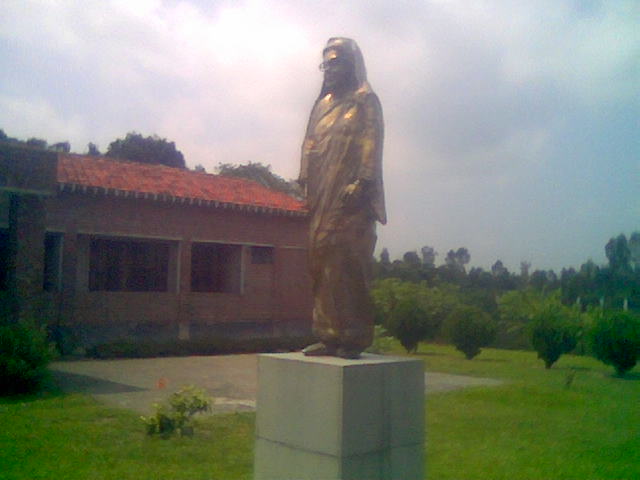 Begum Rokeya Memorial Centre, PairabandHistoric · Rangpur, Rangpur
Birthplace of Begum Rokeya (born 1880), pioneer of women's rights and education in South Asia, in Pairaband village, Mithapukur Upazila. A memorial centre here presents exhibits about her life, work and legacy, and hosts observances on Begum Rokeya Day (9 December).
Directly confirmedRamrai DighiNature & forests · Thakurgaon, RangpurA large historic pond in Ranisankail Upazila, listed among the sights of Thakurgaon district on the district's Wikipedia page. Known locally for winter birdlife and quiet rural waterside scenery (verify details locally).
Community-reported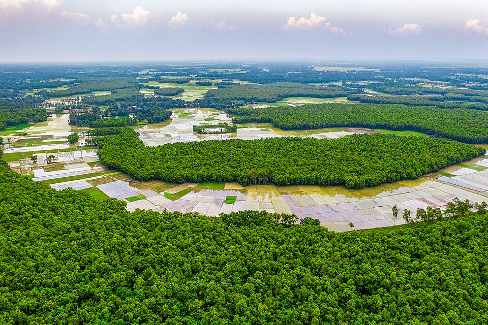 Ramsagar National ParkNature & forests · Dinajpur, Rangpur
A 27.75-hectare national park at Tajpur near Dinajpur town, centred on the historic Ramsagar reservoir, about 1,079 m long, excavated in the mid-18th century by Raja Ram Nath before the Battle of Plassey. Popular in winter for migratory birds and picnics.
Community-reported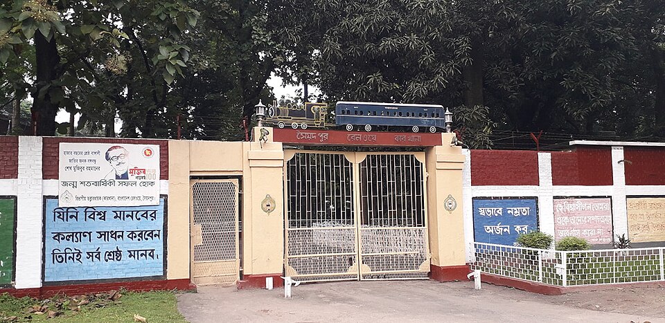 Saidpur Railway Workshop HeritageUrban / day trips · Nilphamari, Rangpur
The Syedpur Railway Workshop, established in 1870, is the largest in Bangladesh and was the major workshop of the Assam-Bengal railway; the town itself grew up around it. Old rail colonies, the workshop and colonial-era buildings draw railway-heritage visitors. Saidpur airport — the only airport in Rangpur Division — is in the same town.
Community-reported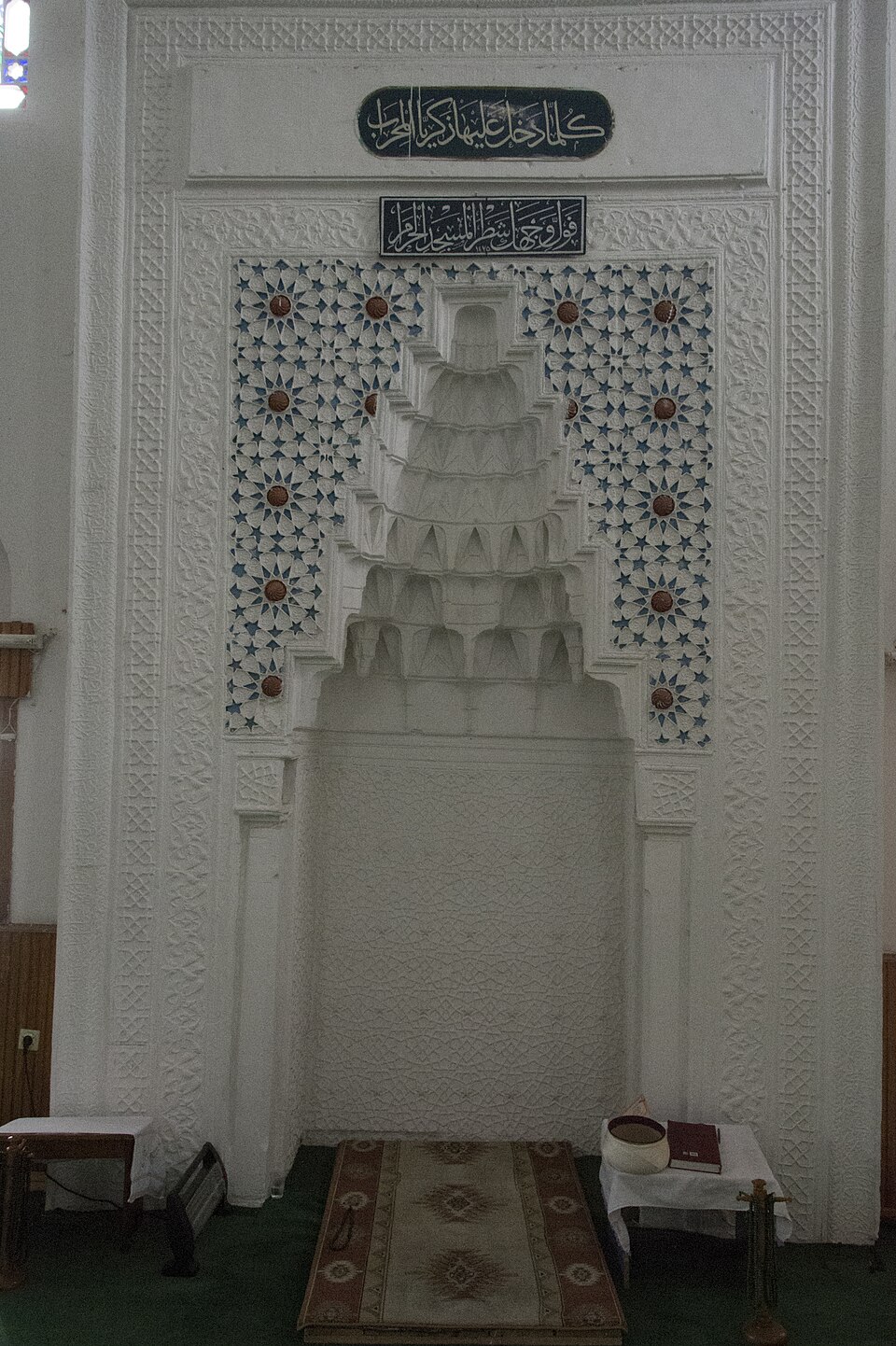 Shah Sultan Gazi Mosque, Mirer BaganHistoric · Gaibandha, Rangpur
A historic mosque at Mirer Bagan in Dariapur, Gaibandha Sadar, included in the district administration's list of tourist spots. Reachable from the district bus stand by auto, rickshaw or CNG.
Official source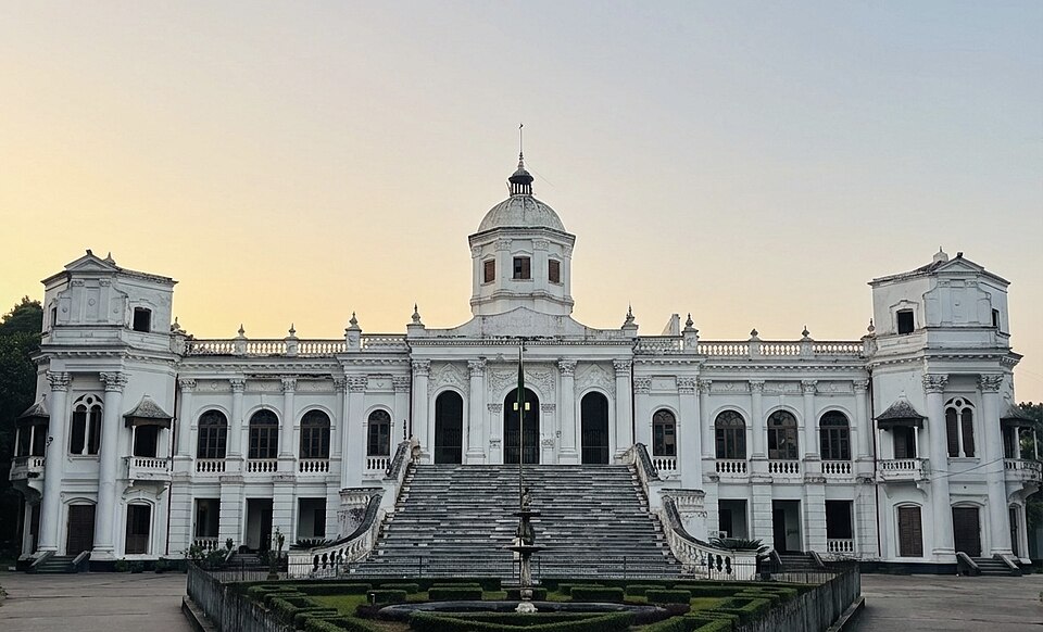 Tajhat PalaceHistoric · Rangpur, Rangpur
One of the finest zamindar mansions of northern Bangladesh, about 6 km south-east of Rangpur city. The two-storeyed palace, built of red brick, white stone and limestone, now houses an archaeology museum with roughly 2,100 objects including old manuscripts and carvings. It served as a High Court branch from 1984 to 1991 and was declared a protected monument in 1995.
Directly confirmed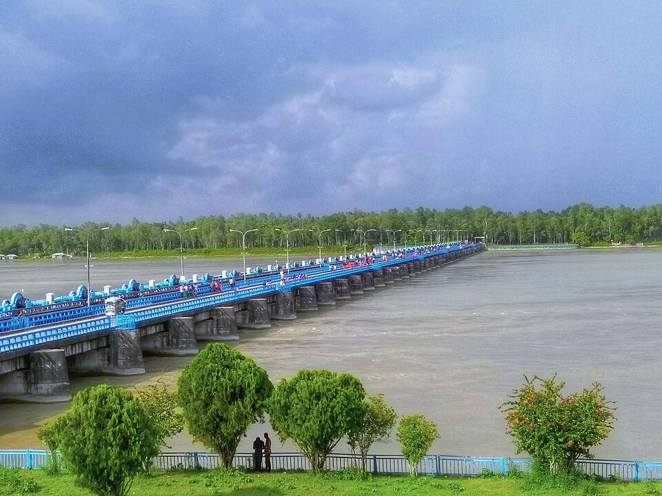 Teesta Barrage and Rest HouseNature & forests · Lalmonirhat, Rangpur
The barrage of Bangladesh's largest irrigation project across the Teesta river, listed by the district administration as 'Teesta Barrage and Rest House'. Near Duani in Hatibandha (Lalmonirhat) beside Dimla (Nilphamari), it offers wide river and embankment views, popular at sunset.
Official source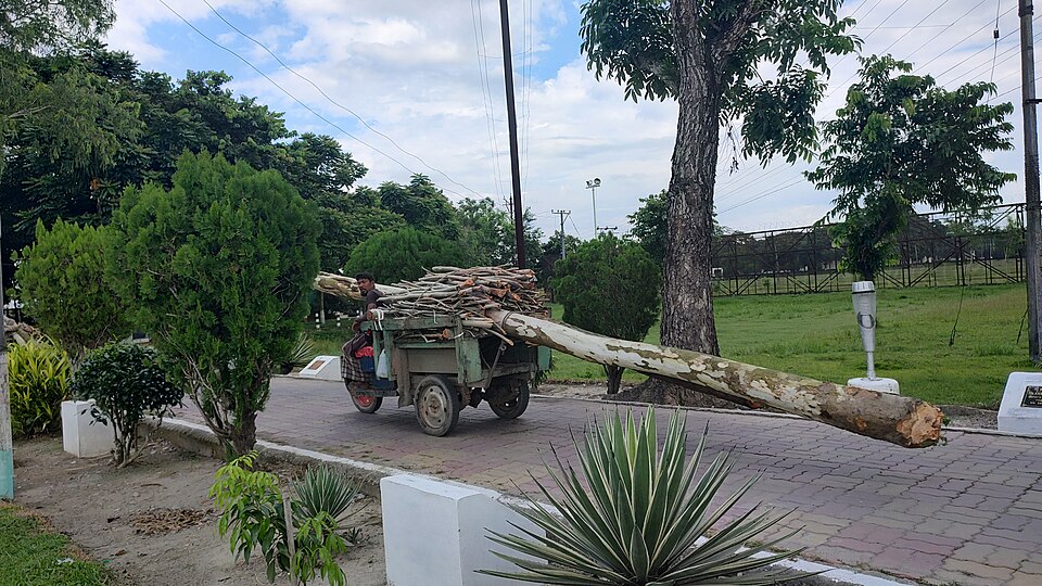 Tin Bigha Corridor and Dahagram-AngarpotaHistoric · Lalmonirhat, Rangpur
The historic Tin Bigha Corridor through Kuchlibari union, connecting the India-surrounded Dahagram-Angarpota enclave to mainland Bangladesh — a unique site of enclave history, listed on the district administration's tourism page.
Official sourceSylhet (সিলেট)
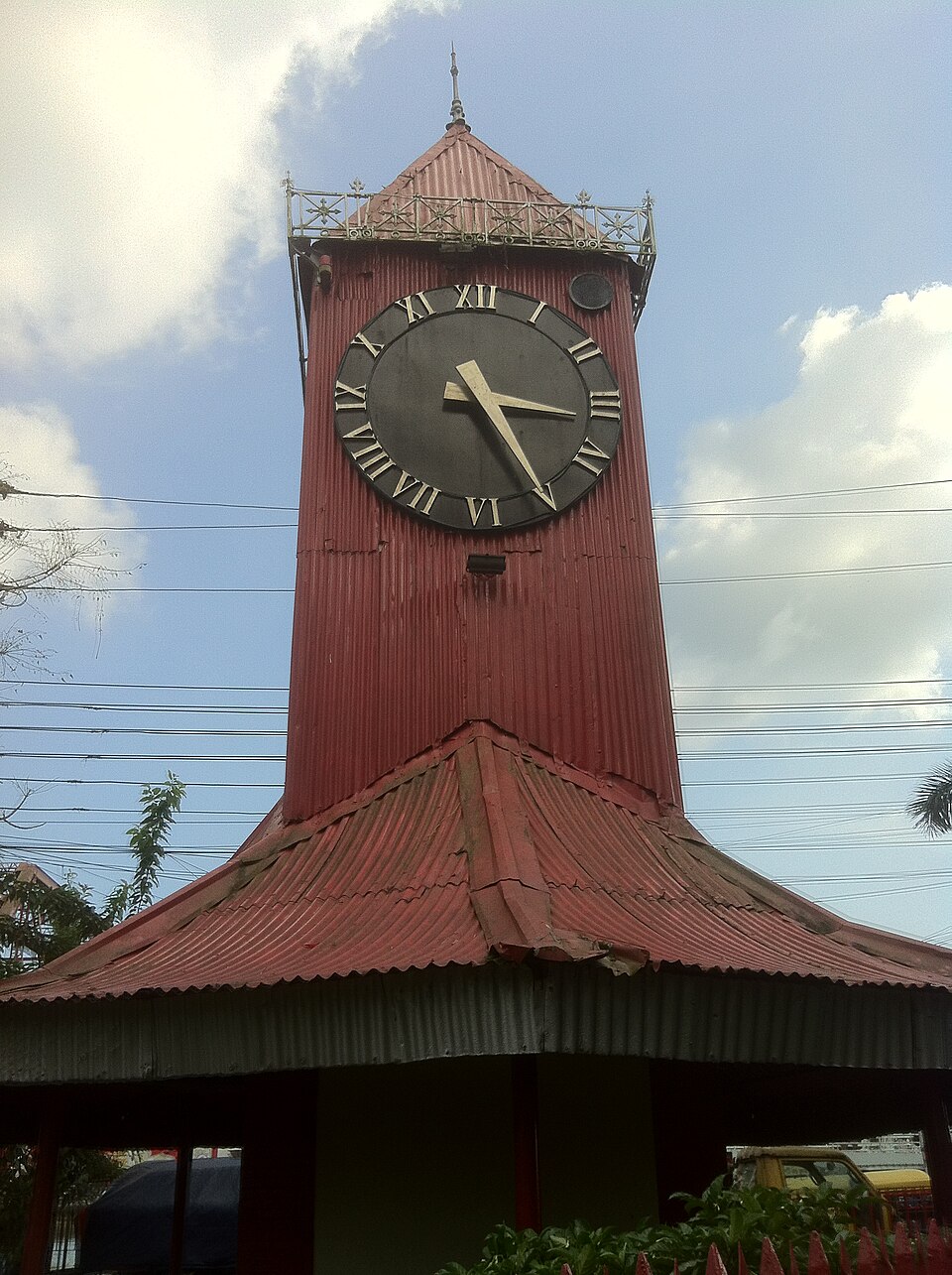 Ali Amjad's ClockUrban / day trips · Sylhet, Sylhet
Bangladesh's oldest clock tower, on the north bank of the Surma River beside the iron Keane Bridge; it was founded in 1872 by Nawab Ali Ahmad Khan of Prithimpassa and named after his son, Nawali Amjad Khan. Wikivoyage calls it "the Big Ben of Sylhet" (that page gives a differing construction date; Wikipedia's 1872 founding is adopted here). An evening riverside walk combining the tower and the bridge is a popular city activity.
Directly confirmed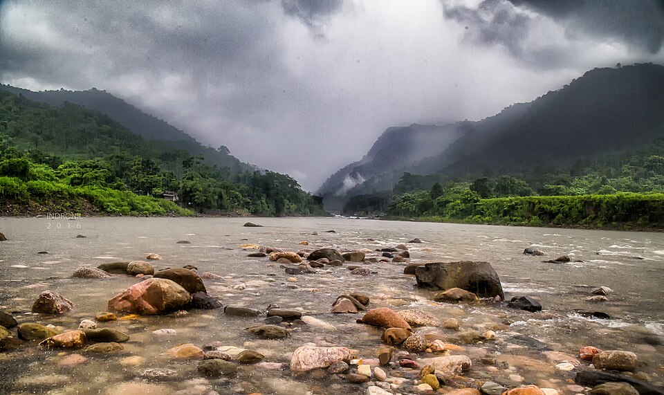 Bisnakandi (Bichnakandi)Nature & forests · Sylhet, Sylhet
A riverside stone-quarry village on the Piyain River in Gowainghat, near the Bangladesh-India border, where clear hill streams from the Khasi Hills run over layered piles of rock. The stacked-stone scenery is best in the dry season when water levels drop; in monsoon the river rises and travel is by boat, with flash-flood risk from hill catchments. It is one of the most popular day trips from Sylhet city.
Community-reported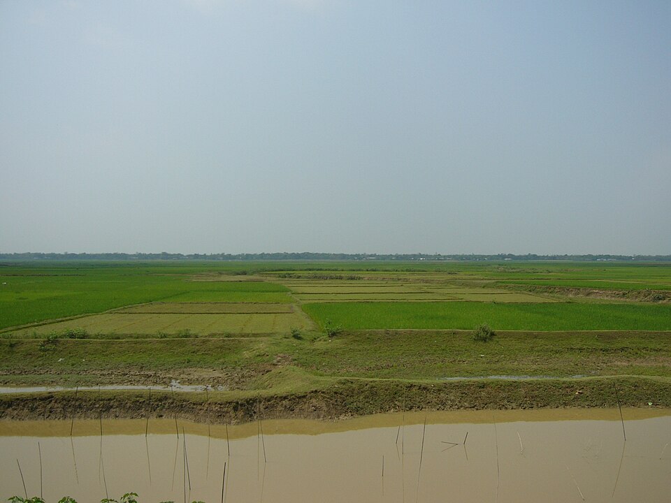 Hakaluki HaorNature & forests · Moulvibazar, Sylhet
One of Asia's larger marshes at about 181 sq km, spanning Kulaura, Juri and Barlekha (Moulvibazar) plus Golapganj-Fenchuganj (Sylhet), and declared an Ecologically Critical Area. Some 558 species of animals and birds have been identified here, with winter bringing migratory waterfowl. In the rains the entire haor floods to nearly four times its dry-season extent and stays underwater up to five months, when boat travel is the main access; in the dry season the beels shrink.
Directly confirmed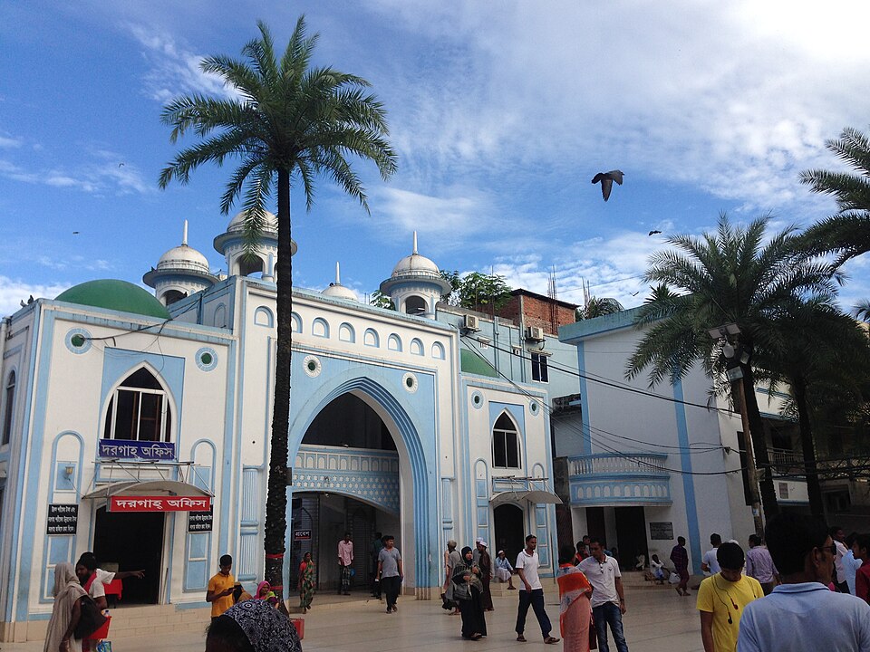 Hazrat Shah Jalal DargahHistoric · Sylhet, Sylhet
The shrine of the 14th-century Sufi saint Shah Jalal: an original shrine dates to a 1505 CE inscription on site, with the current shrine structure built in 1678 under Farhad Khan. The complex includes the Dargah Gate, four mosques (the Bara Gumbad is the largest), the Chashma well, a tank of sacred gozar fish, and a Langar Khana. Hundreds of devotees visit daily; the tomb chamber admits men only, with a dedicated women's section in the plaza. The annual Urs festival falls around 15 March.
Directly confirmed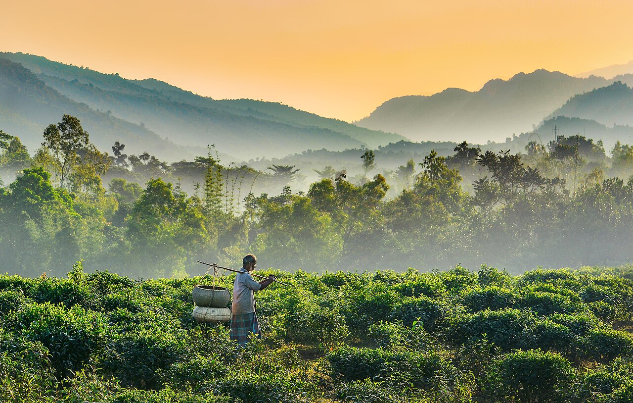 JaflongNature & forests · Sylhet, Sylhet
A border tourist spot at the foot of India's Khasi-Jaintia hills, on the Piain river in Gowainghat, Sylhet. Known for the river descending from the hills and the stone-collection scenes.
Community-reported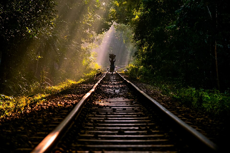 Lawachara National ParkNature & forests · Moulvibazar, Sylhet
A roughly 1,250-ha semi-evergreen national park (declared 7 July 1996) inside the West Bhanugach Reserved Forest, Kamalganj upazila. It holds 460 recorded species, including the western hoolock gibbon — a 2007 census found 62 individuals in 17 groups, the biggest surviving gibbon population in Bangladesh. Only 8 km from Sreemangal town, it combines easily with tea-garden trips; early-morning trails are the most rewarding.
Community-reported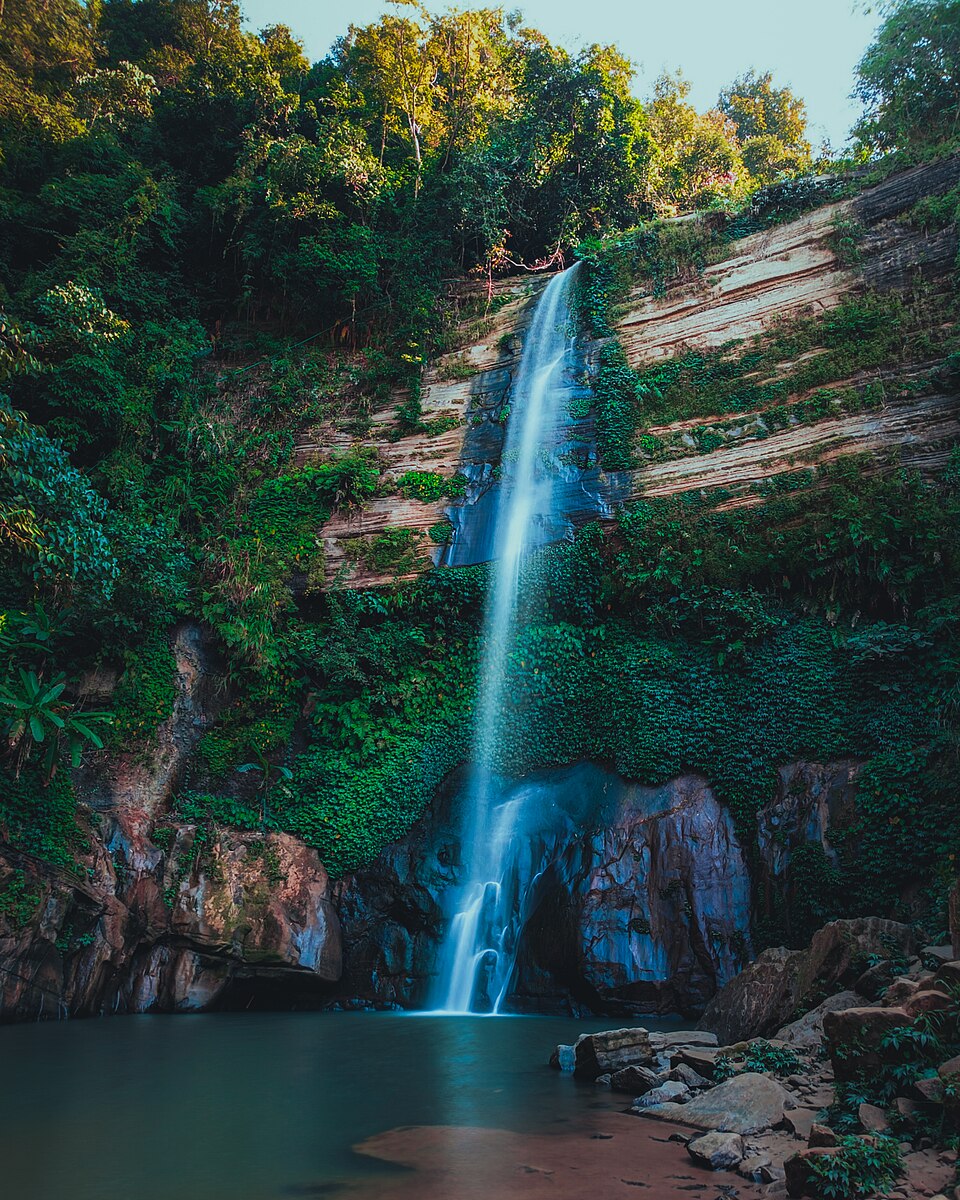 Madhabkunda WaterfallNature & forests · Moulvibazar, Sylhet
The Gangamara stream drops about 200 feet (61 m) from rocky Patharia Hill, making this one of Bangladesh's tallest waterfalls — a distinct site from the Srimangal tea-garden record, located in Barlekha upazila. The surrounding forest, streams and a roughly 500-acre eco park draw large picnic and day-trip crowds. The site also has Hindu significance, with a temple and an annual fair nearby.
Community-reported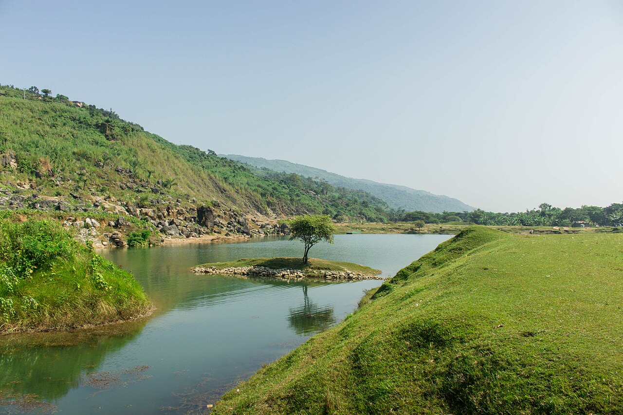 Niladri Lake (Tekerghat)Nature & forests · Sunamganj, Sylhet
A reservoir formed in an abandoned limestone quarry, whose minerals give the deep-blue water its famous hue against the Meghalaya hills — a highlight of Tanguar Haor trips. October to March is the best window, when water is calm and skies clear. Small engine boats from the Tekerghat shore are the way to explore the lake.
Community-reported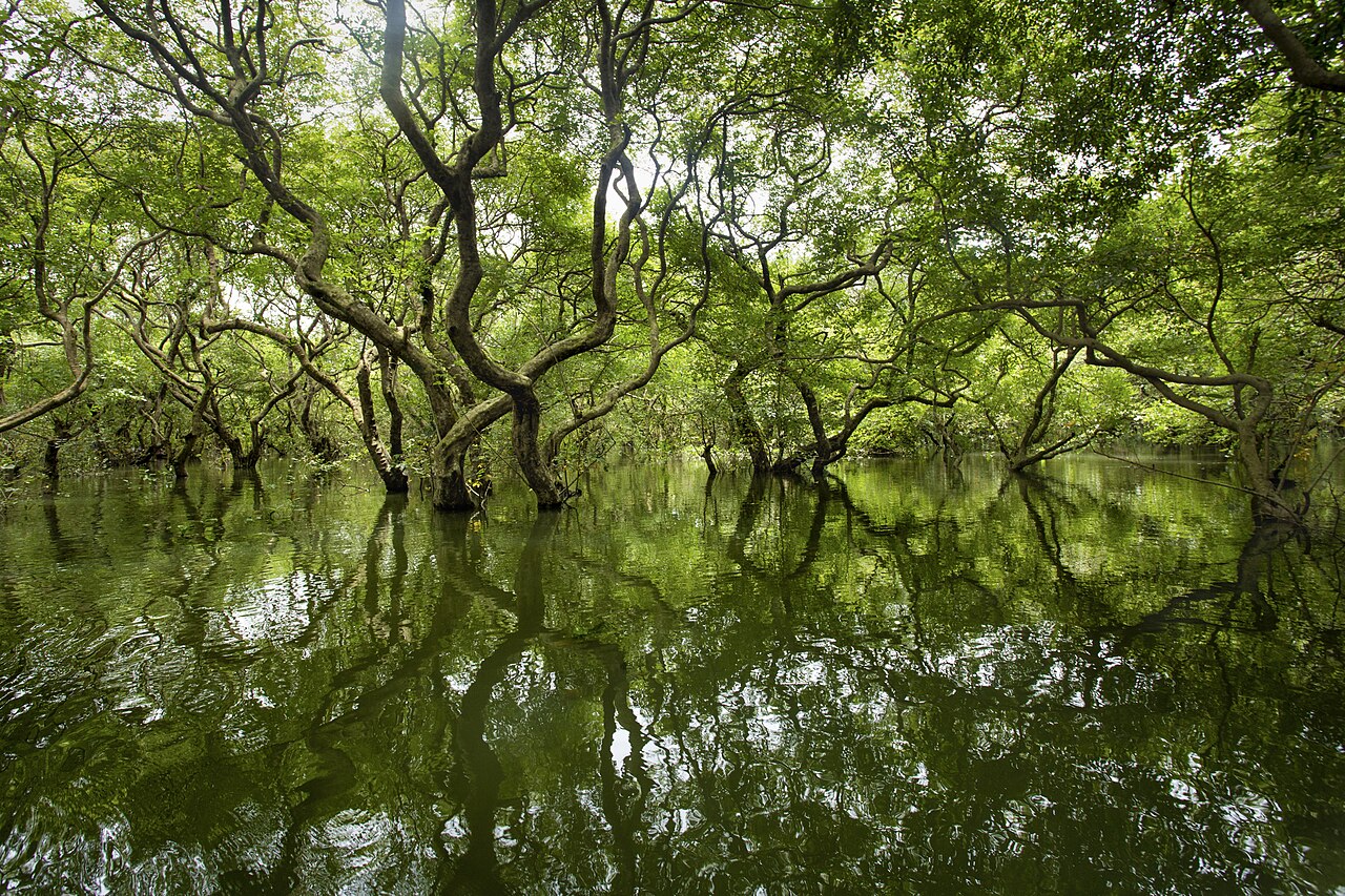 Ratargul Swamp ForestNature & forests · Sylhet, Sylhet
Bangladesh's only freshwater swamp forest, on the banks of the Goain river in Fatehpur union. In the wet (monsoon) season the water rises to the tops of the koroch trees and the forest is explored by boat.
Community-reported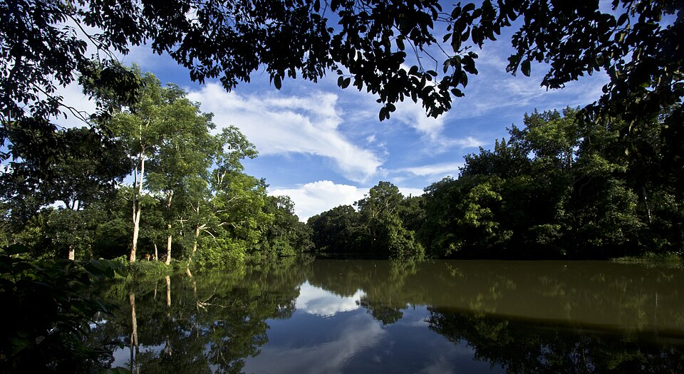 Rema-Kalenga Wildlife SanctuaryNature & forests · Habiganj, Sylhet
Established in 1982 and expanded in 1996 to about 1,795 hectares, this sanctuary near the Indian Tripura border in Chunarughat holds 37 mammal species, 167 bird species and 638 plant species — including capped langur, hoolock gibbon and hill myna. It comprises four beats of the Kalenga Forest Range: Kalenga, Rema, Chanbari and Rashidpur.
Community-reported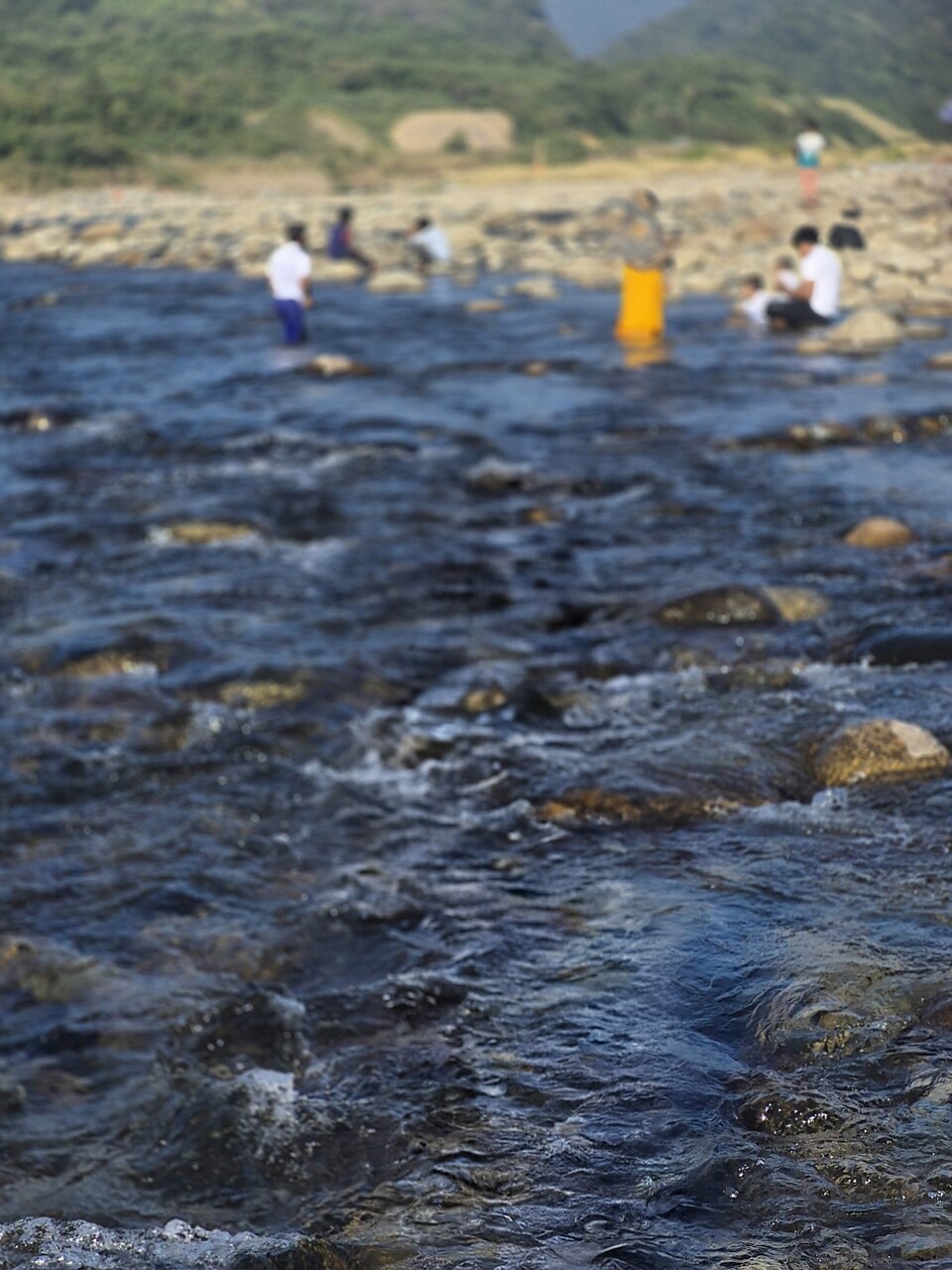 Sada Pathor (Bholaganj)Nature & forests · Sylhet, Sylhet
A scenic white-stone quarry area along the Dhalai river in border-area Bholaganj, Companiganj upazila, which rapidly became a tourist spot in recent years. However, The Daily Star reported that the 15-acre tourist site was stripped bare within a year by large-scale stone extraction that spread after August 2024; there have also been reports of temporary closure and reopening. Verify the site's current condition and accessibility before travelling.
Community-reported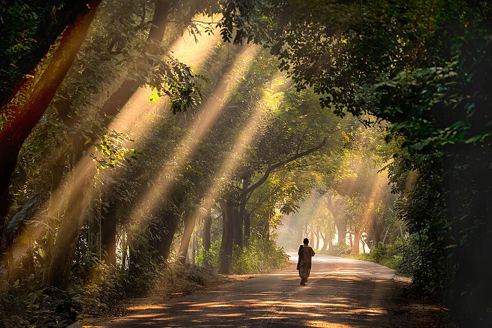 Satchari National ParkNature & forests · Habiganj, Sylhet
A 243-hectare national park established in 2005 on the Raghunandan hill near the Indian border in Chunarughat upazila. Wildlife includes the critically endangered western hoolock gibbon along with Phayre's leaf monkey, capped langur, and birds such as the red-headed trogon. Nine tea gardens surround the park, which sits about 130 km from Dhaka.
Community-reported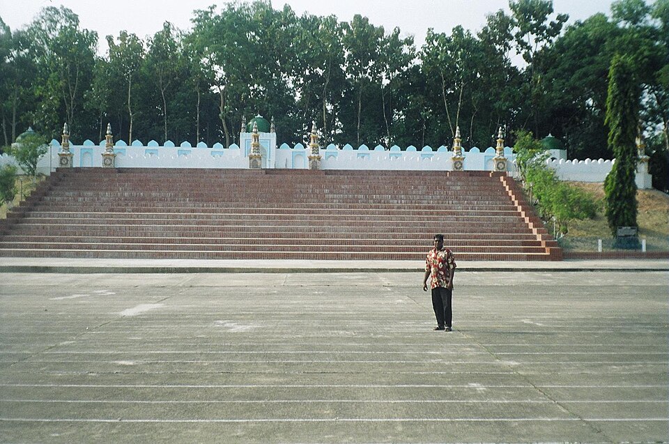 Sylhet Shahi EidgahHistoric · Sylhet, Sylhet
A Mughal-era open Eid prayer ground built in the 17th century under faujdar Farhad Khan, on a hill during the reign of Emperor Aurangzeb. It is laid out like a grand Mughal fort, with three gates, 15 domes and half-domed minars along its walls. It hosts the city's largest Eid congregations and can be visited as a historic monument the rest of the year.
Community-reported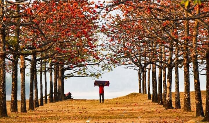 Shimul Bagan (Tahirpur)Nature & forests · Sunamganj, Sylhet
A garden of about 3,500 shimul (cotton) trees across some 30 acres on the west bank of the Jadukata River in Tahirpur. Per BSS, the red blossoms open from 10 February and last at least until 28 February, with fallen petals forming a red carpet on the grass; the garden draws an average 500-700 visitors daily in season. Out of bloom the scenery is ordinary — late February is the sweet spot — with the Jadukata River and Meghalaya hills alongside.
Community-reported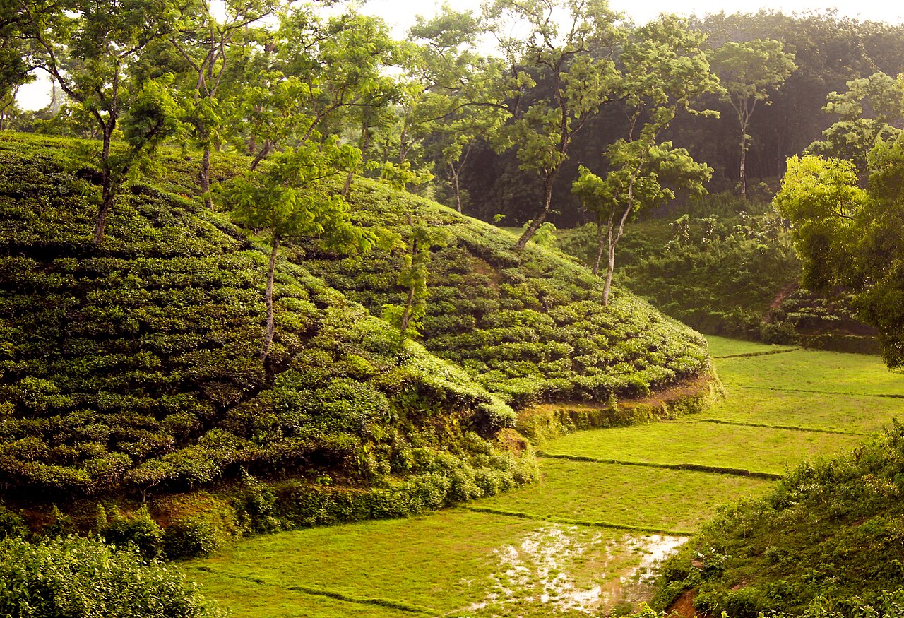 Srimangal Tea GardensNature & forests · Moulvibazar, Sylhet
Bangladesh's 'tea capital'. Vast tea gardens, Laskarpur bamboo groves, Madhabpur Lake and the famous seven-layer tea. Lawachara National Park and Madhabkunda waterfall are close by.
Community-reported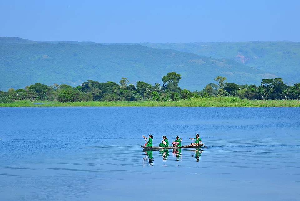 Tanguar HaorNature & forests · Sunamganj, Sylhet
The 'mother of all haors' — about 100 sq km across Dharmapasha and Tahirpur in Sunamganj, designated a Ramsar wetland of international importance on 10 June 2000 (reference 1031). Every winter roughly 200 types of migratory birds arrive, and the haor holds over 140 freshwater fish species. It has grown popular for houseboat trips; in monsoon the basin fills and boats are the only access, with water receding in winter.
Directly confirmed